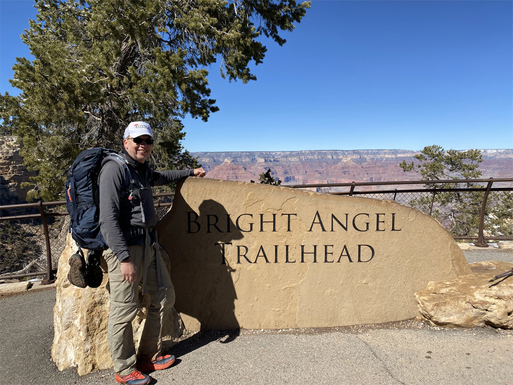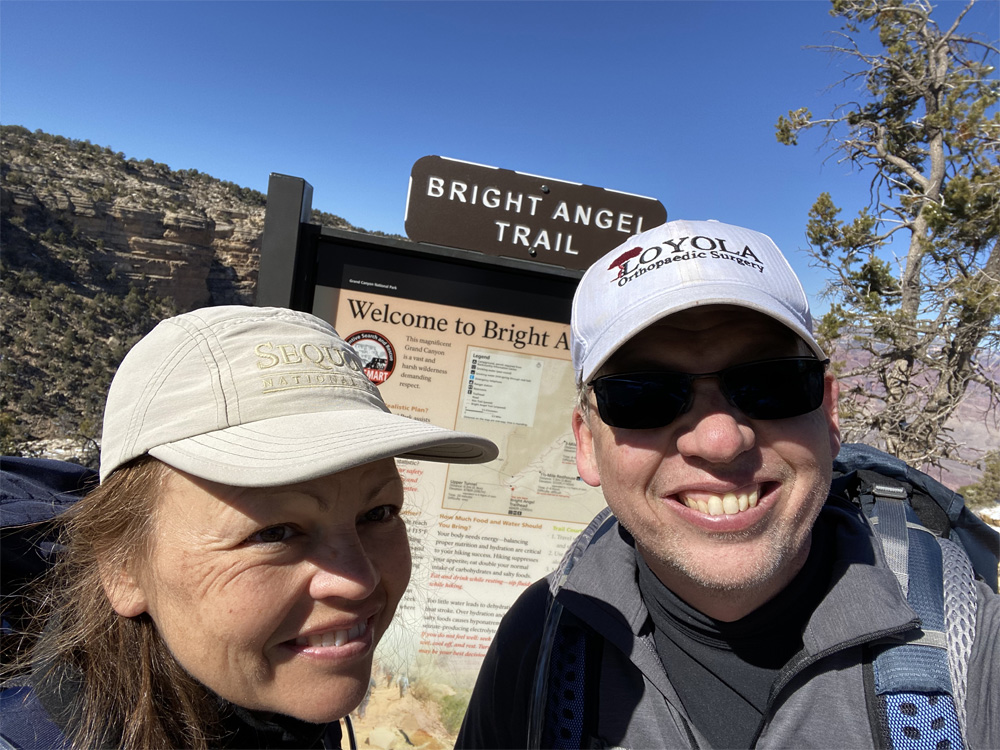
Ascending the BRIGHT ANGEL TRAIL
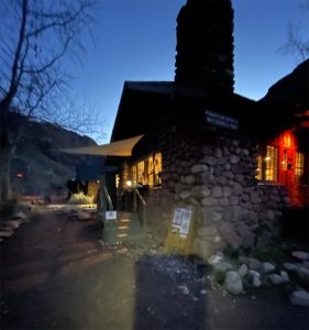
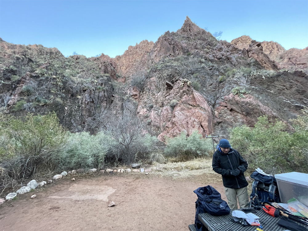
After a restless cold night sleep in our tent, we started to arouse a little after 4:30am (7:30 back home). But with the frigid weather we stayed bundled in our sleeping bags until almost 5am when we unzipped the tent. Our eyes were dazzled by the abundance of stars that filled the skies all around us. Looking up at the 360 degree view of dark clear starry skies was mesmerizing and stimulating. As we gazed at the skies, we walked over to the Canteen for breakfast to prepare us for our journey back up to the South Rim. We sat at a picnic table outside the Canteen and ate an early deliciously warm breakfast of pancakes, scrambled eggs, sausage and hot maple syrup with a hot coffee and tea to warm up from the 32 degree night.
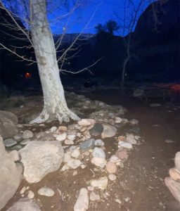
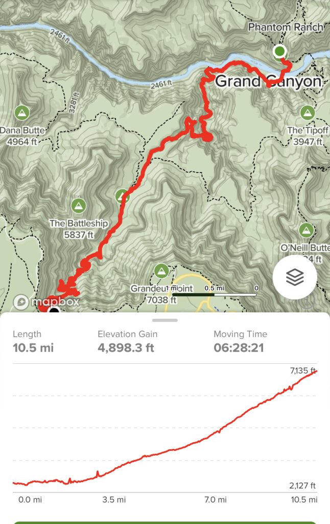
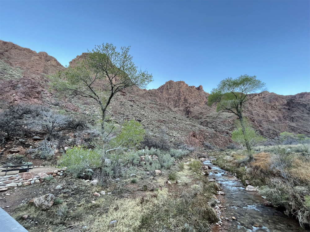
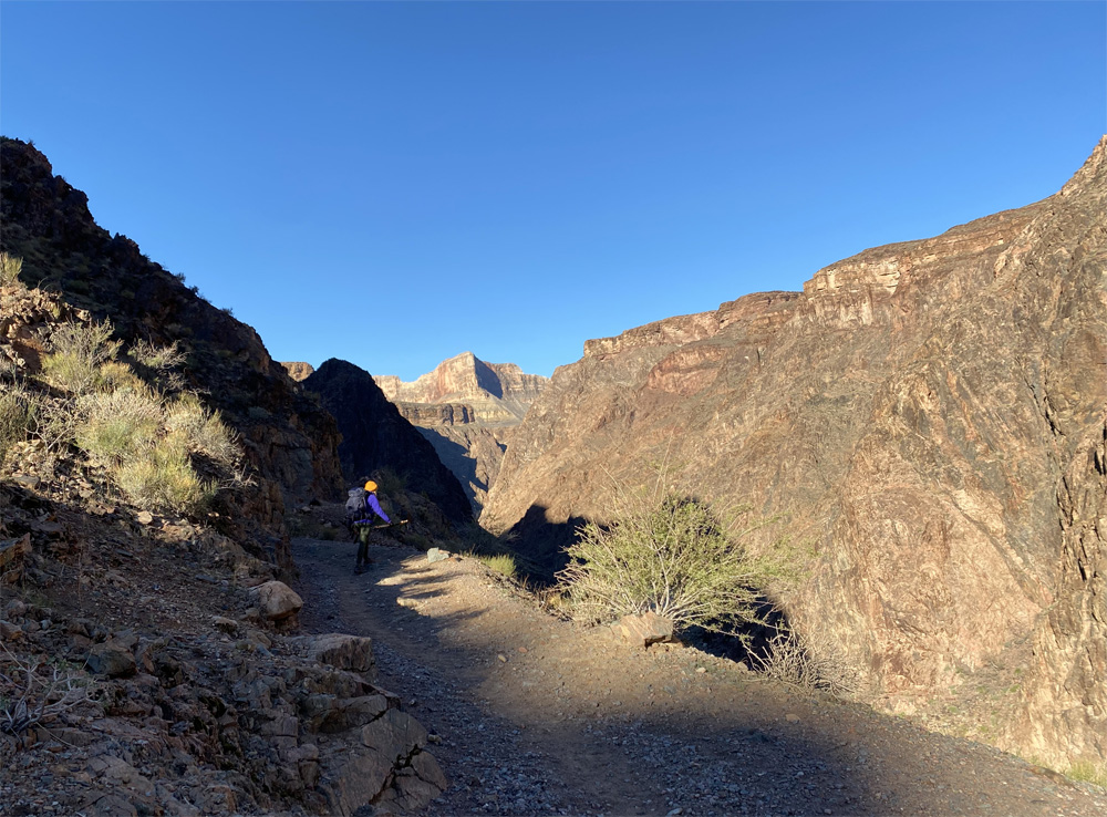
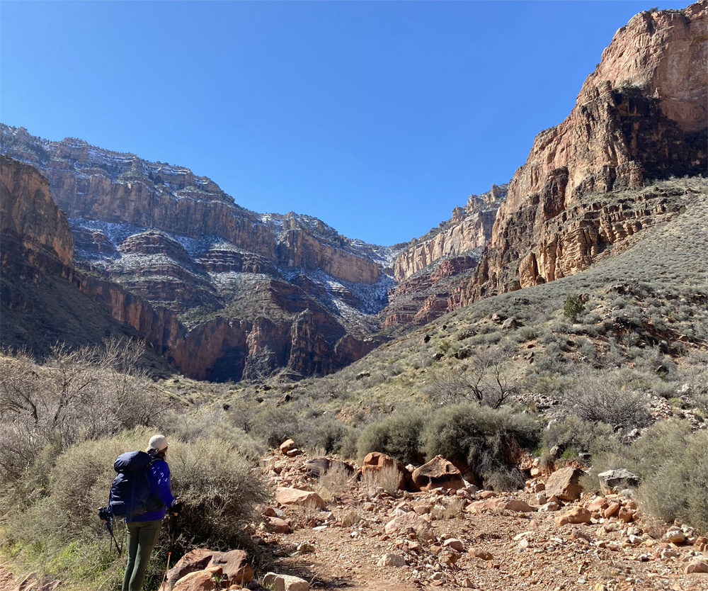
We enjoyed the walk back to campsite with a peaceful awakening of our day. The gentle sound of the creek water flowing, campers waking up, nature stirring with clear blue sunny skies. No sign of a cloud in the sky but 32 degrees is chilly for us southerners. Now was time to take down our campsite and compress our gear back into our backpacks. About 90 minutes later we were packed up, took a few photos of the campground, loaded backpacks on our backs and set out for the Bright Angel Trail, our 10.5 mile ascending hike, a 4,400 feet elevation climb to the top of the South Rim. Our legs and bodies were feeling good after the over 8 mile hike down the canyon from the day before and spending the chilly night in a tent.
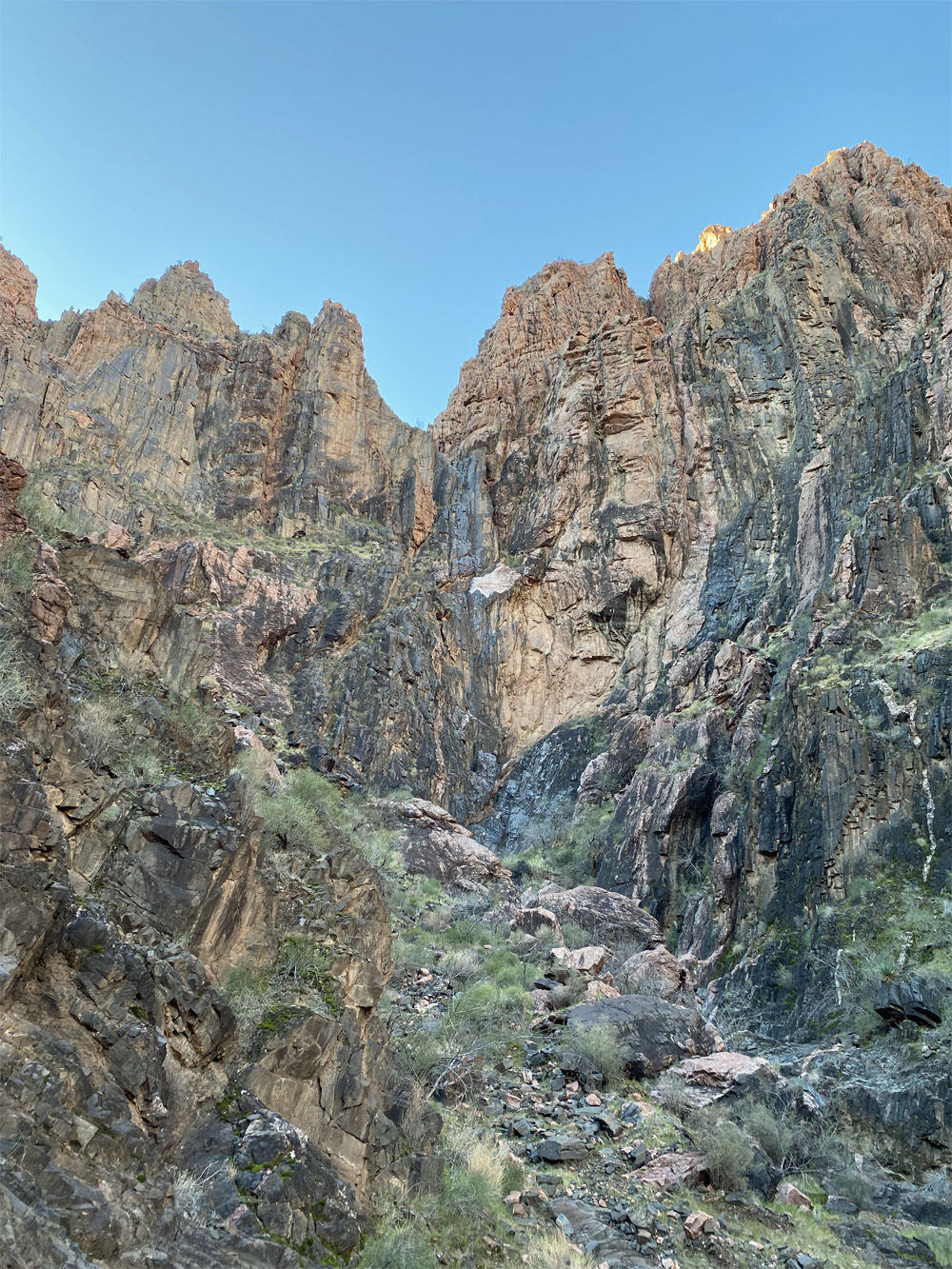
The walk to the Colorado River took about 10 minutes, we were taking in the views of the inner depths of the canyon along the way. The bright blue clear skies were shining on the walls of the canyon creating interesting shadows and colors along the trail. The rock formations, colors and geology of the canyon are really amazing to ponder and research further like John Wesley Powell and his explorers ventured down the Colorado River in 1869. How did they manage to maneuver themselves down this river so long ago? We were reading the book called the “Down the Great Unknown” on this adventure and wow what a journey to think about.

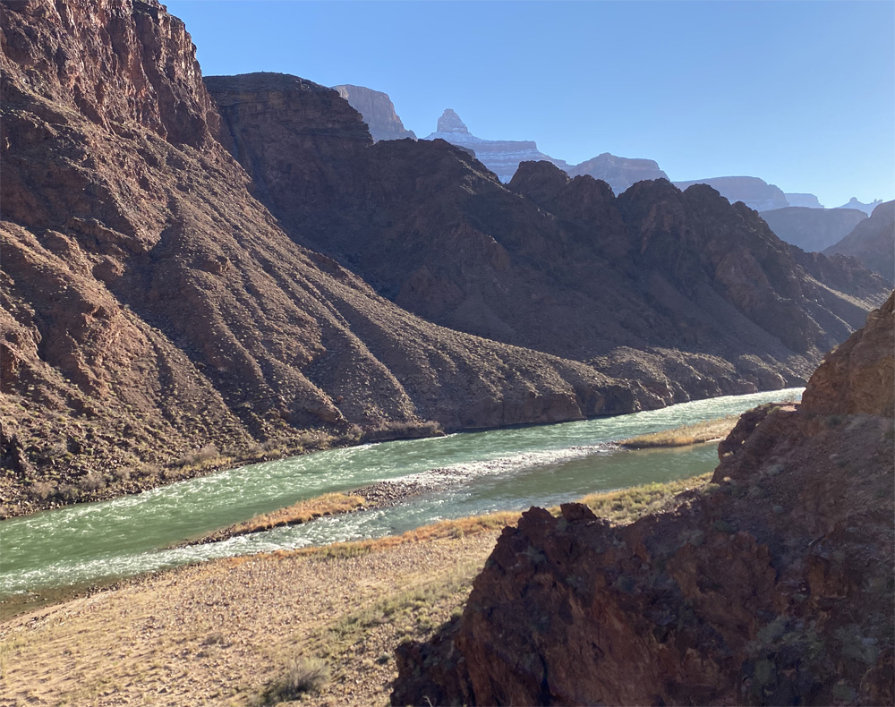
As we approached the Silver Metal Suspension Bridge (at 2,415 feet elevation) I recalled the length is just over 500 feet across with a metal mesh bottom so the river waters are visible thru the openings not like the sturdy Black Suspension bridge made of solid wood just 2,300 feet upstream. We were told the Mules are not fans of walking over this metal bridge, they prefer the wood bridge which blocks the view of the river below. I focused on our views as we got closer to the bridge, we had eye capturing views of the Colorado River which was a glistening emerald green, the water flowing with currents and beautiful ripple lines visible on the surface. The sun really allowed us to capture the rivers essence and beauty. Hearing the river currents flowing made me respect it even more from above…..a body of natural water filled with energy and life. I will let someone else explore the river waters as John Wesley Powell and his team did so long ago.
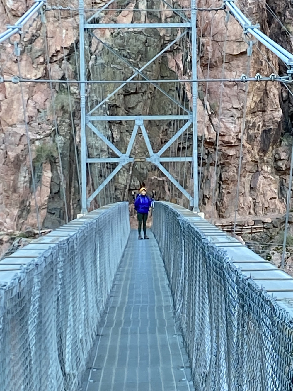
Walking across the bridge I could feel the movement and hear the clanging of the metal and see the water currents flowing below me. As I walked across I could understand the mules hesitation on crossing this bridge but power and energy kept me going. I stopped half way to take in the beauty, sounds and magic of the river and canyon itself. I thought about the name the “Inverted Mountain” and I could barely see in the distance where our 10.5 mile hike will lead us out of the inner canyon and back to south rim.
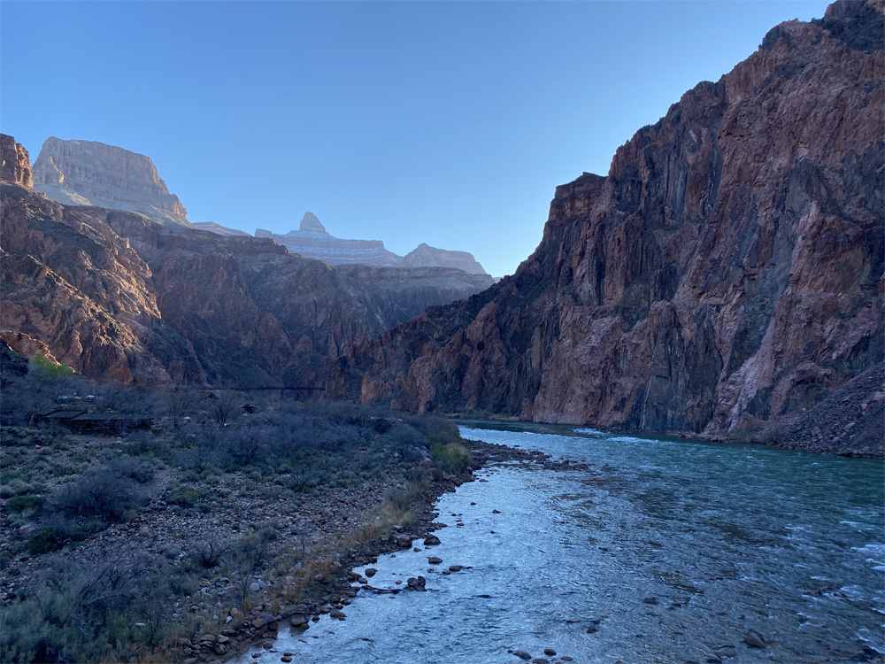

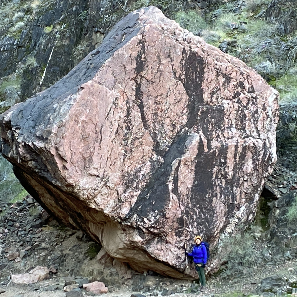
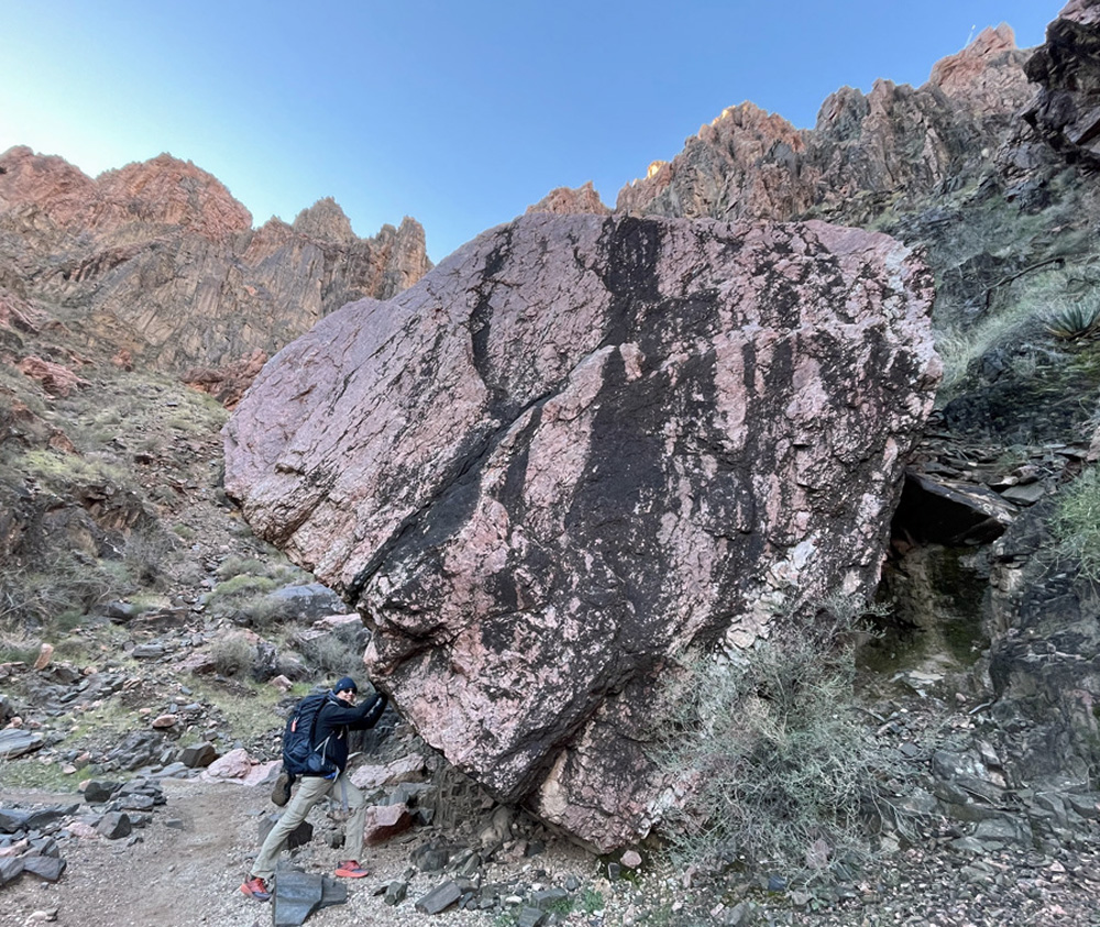
As we reached the south side of the river, the giant rock beach filled with different colors and sizes of polished rocks! I wonder how long ago did the rocks land here and how much tumbling they had sustained. And then I saw the ENORMOUS BOULDER I had seen on the IFIT series, looks even bigger in real life and the colors of the granite were glowing different shades of pink, black and mixed colors, as I stood next to the boulder I appeared to be a miniature person. And the rock formations behind the boulder were also glowing, bright colors and formations just amazing!
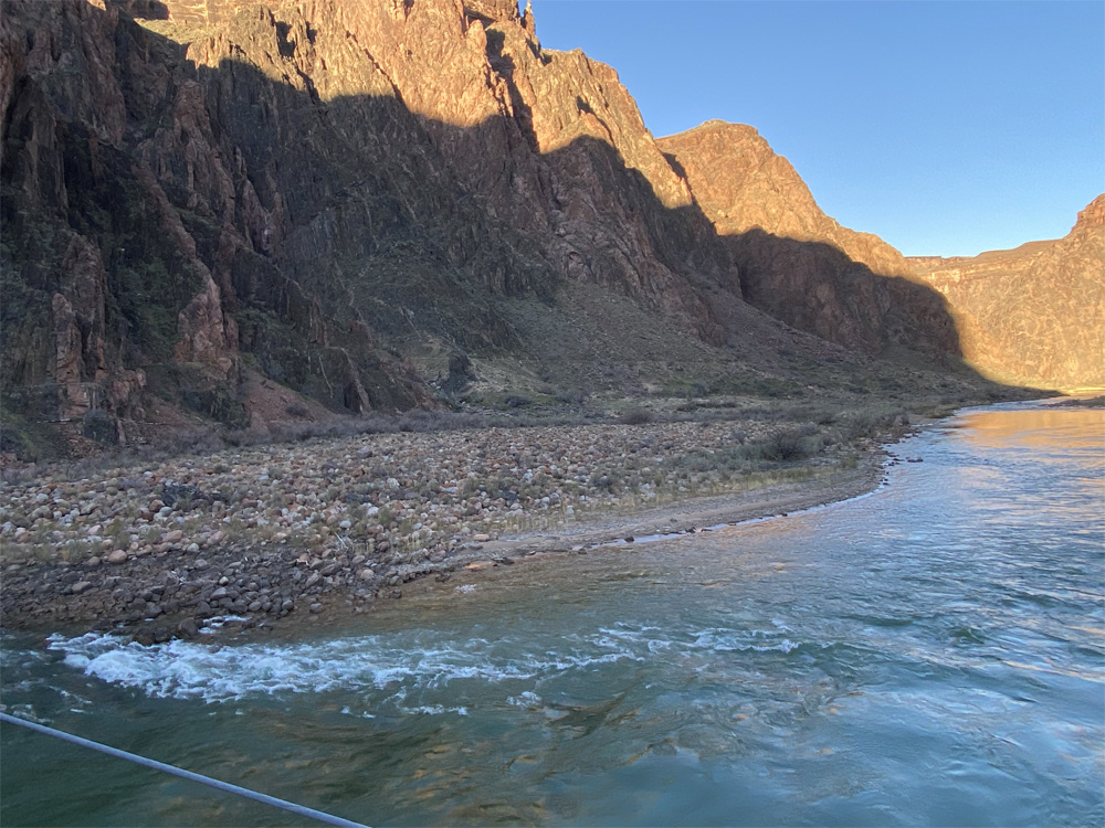
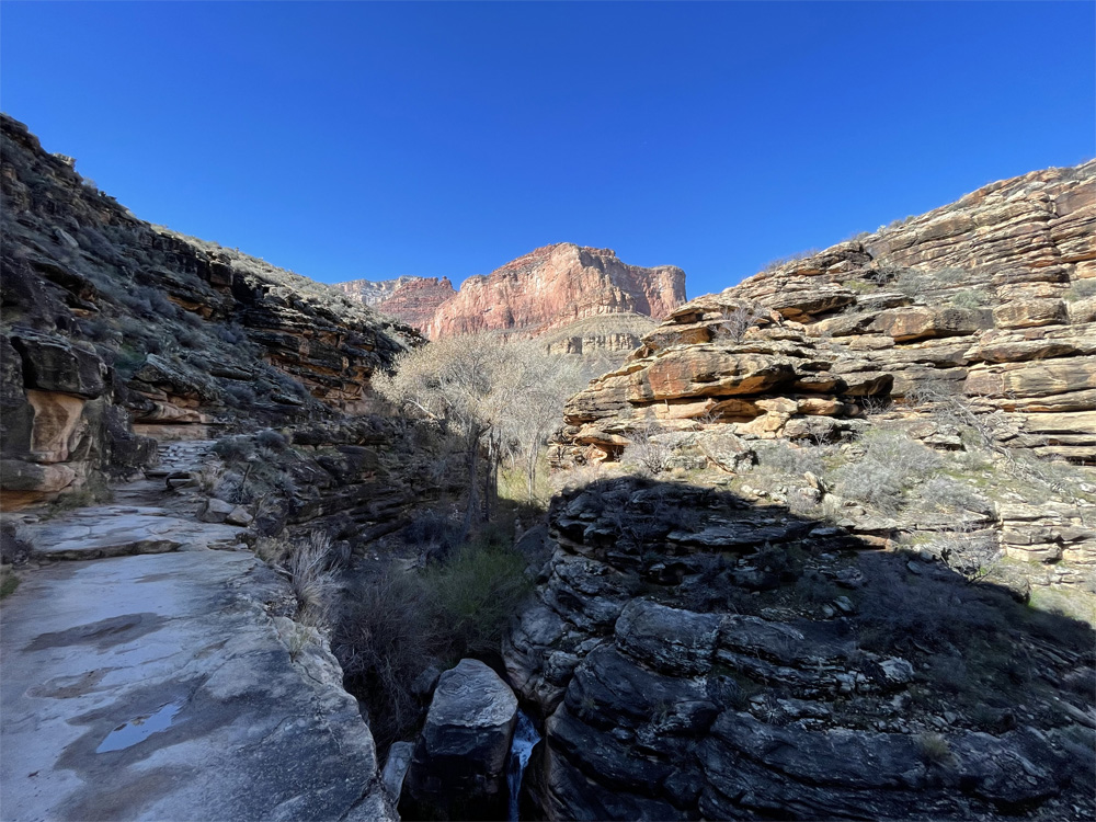
Exploring the River Trail along the south river gorge banks the trail gets quite sandy for a distance then turns back into a beautiful reddish dirt trail the along the river. We took in the sites of such an expanse of the canyon walls along the river trail. The beauty is just breathtaking and amazing.
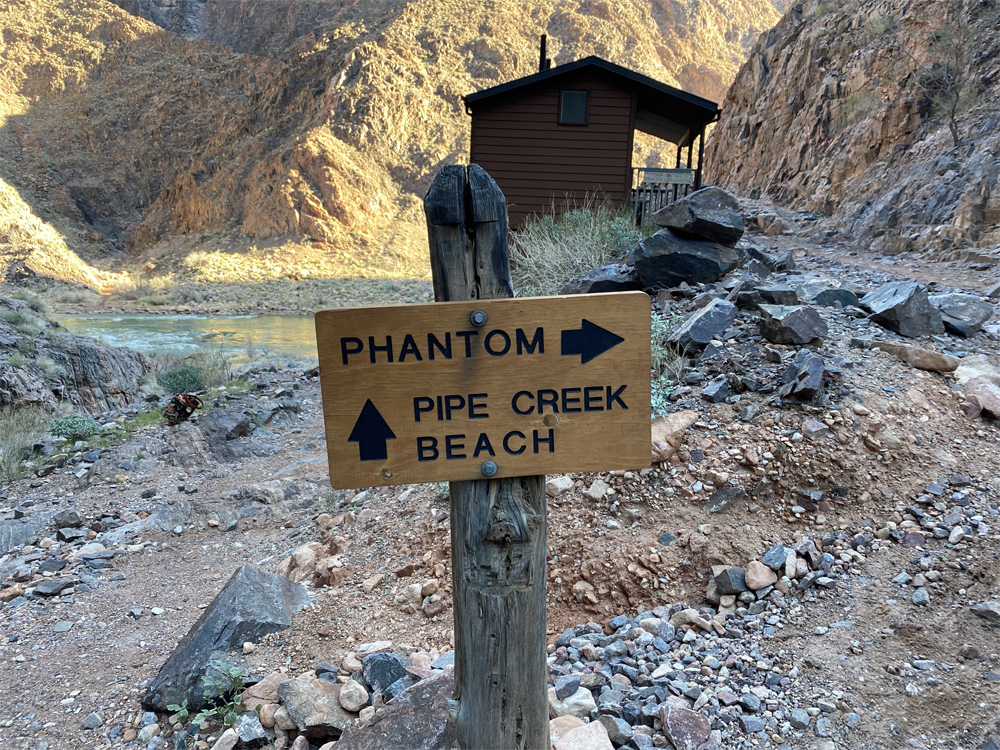
After about mile and a half we reached the mouth of Pipe Creek where is flows into the Colorado River. The elevation had minimal chance at 2,445 feet at this area. There is a sharp left 90 degree turn on the trail to switch to the Bright Angel Trail. To the right is a rocky pipe creek beach area next to the river. You can see the creek flowing gently into the strong river.
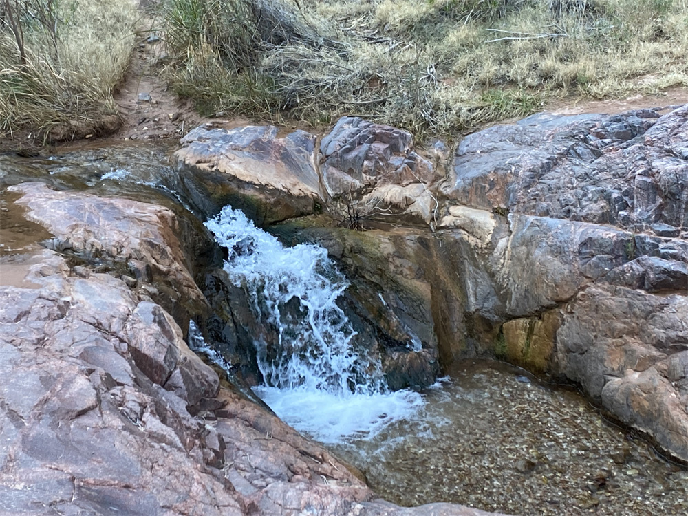
We turn left and and enjoy pipe creek at its best with flowing water and small waterfalls along with the beautifully polished granite brightly glowing. The rain and snow from the previous day had enhanced the sounds and views of our hike along this part of the trail. This is the gentlest part of the trail as the terrain begins to change with more with plant, grasses and vegetation life appearing. We make a couple gentle creek crossings across the rocks and pebbles.
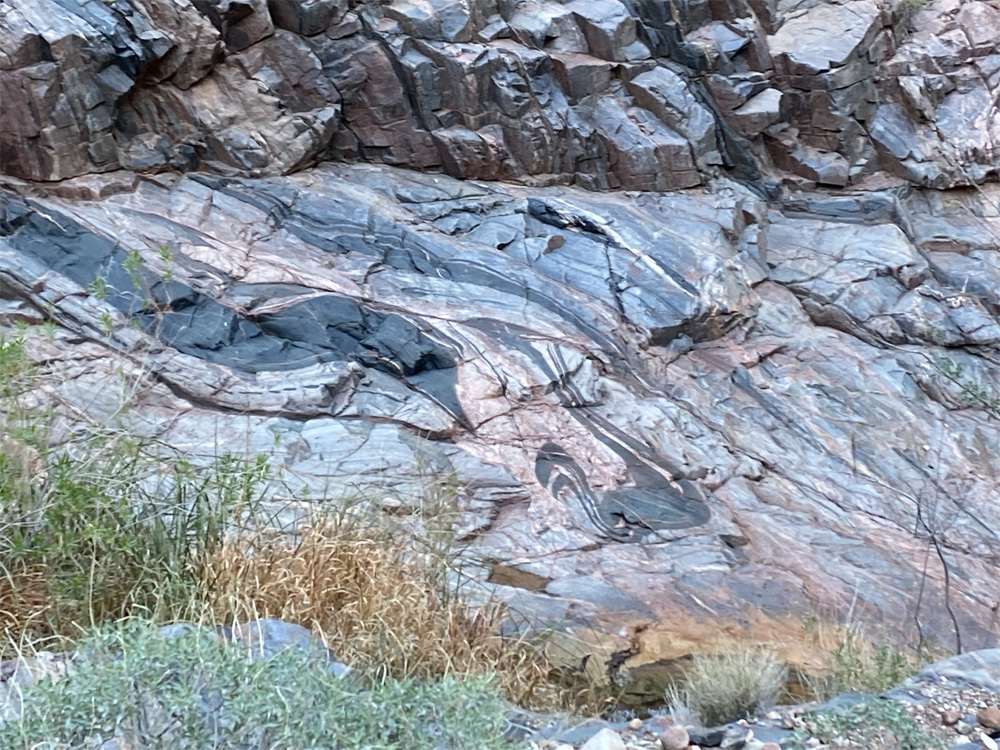
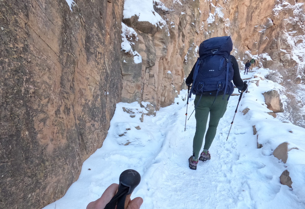
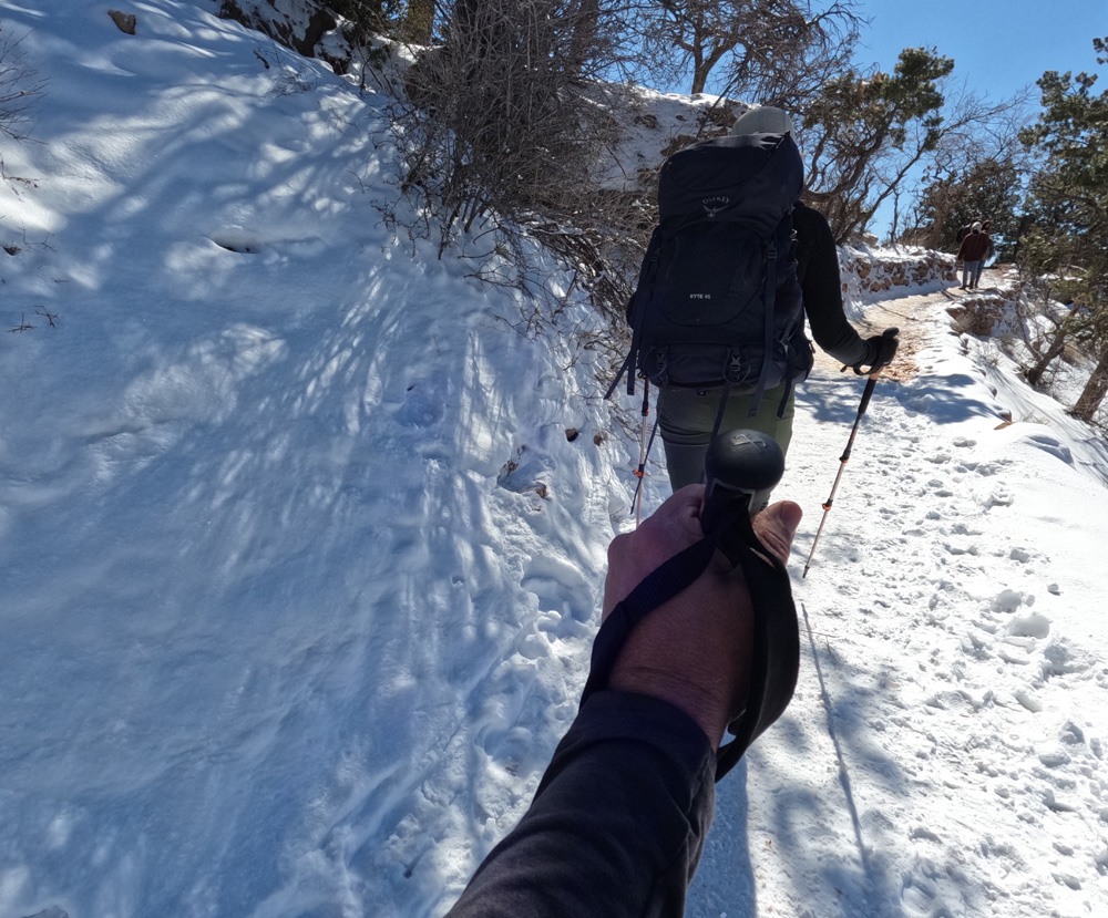
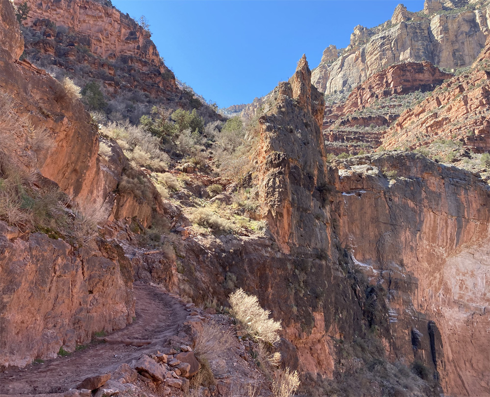
As we leave Pipe Creek we are on Bright Angel Trail, 2,936 feet elevation we hike on about 2 more miles where the trail begins to intensify a bit with switchbacks known as Devil’s Corkscrew. We hike thru changing rock formations from shale, sandstone, limestone. A mule trains comes from behind and passes us, the mules are big and can carry a lot of weight. They appear ever so gentle but move with a fast pace as they pass by. We catch up to them again as they take a stop. The vegetation changes again into plants, thickets, trees and whitish yellow sandstone walls of the canyon are immense.
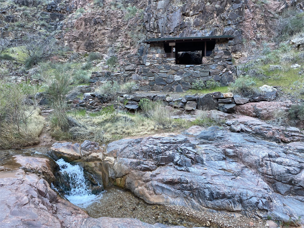
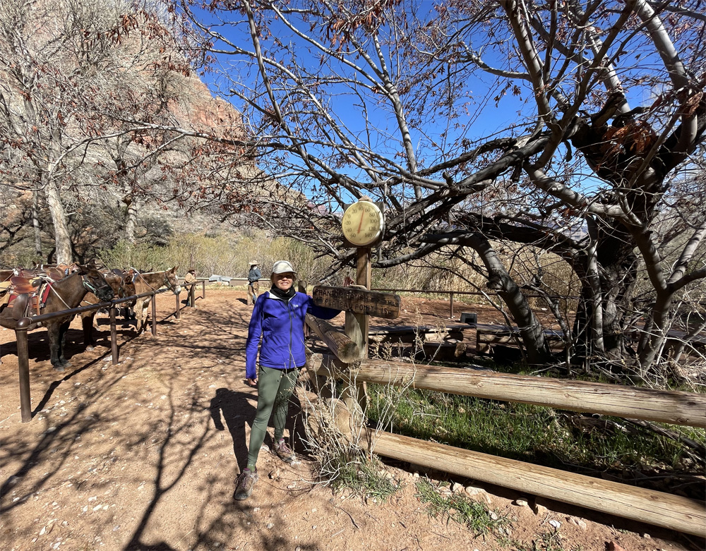
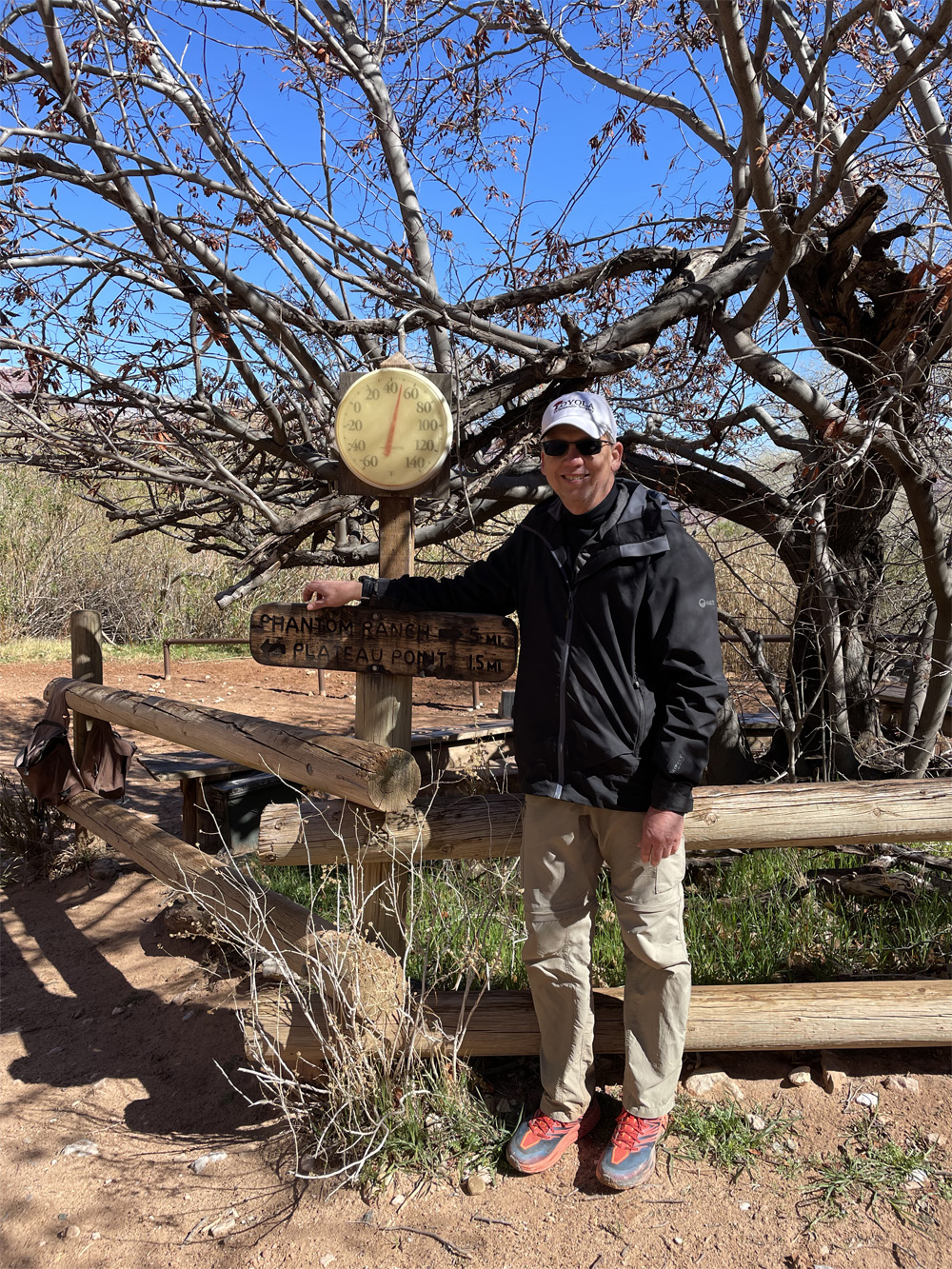
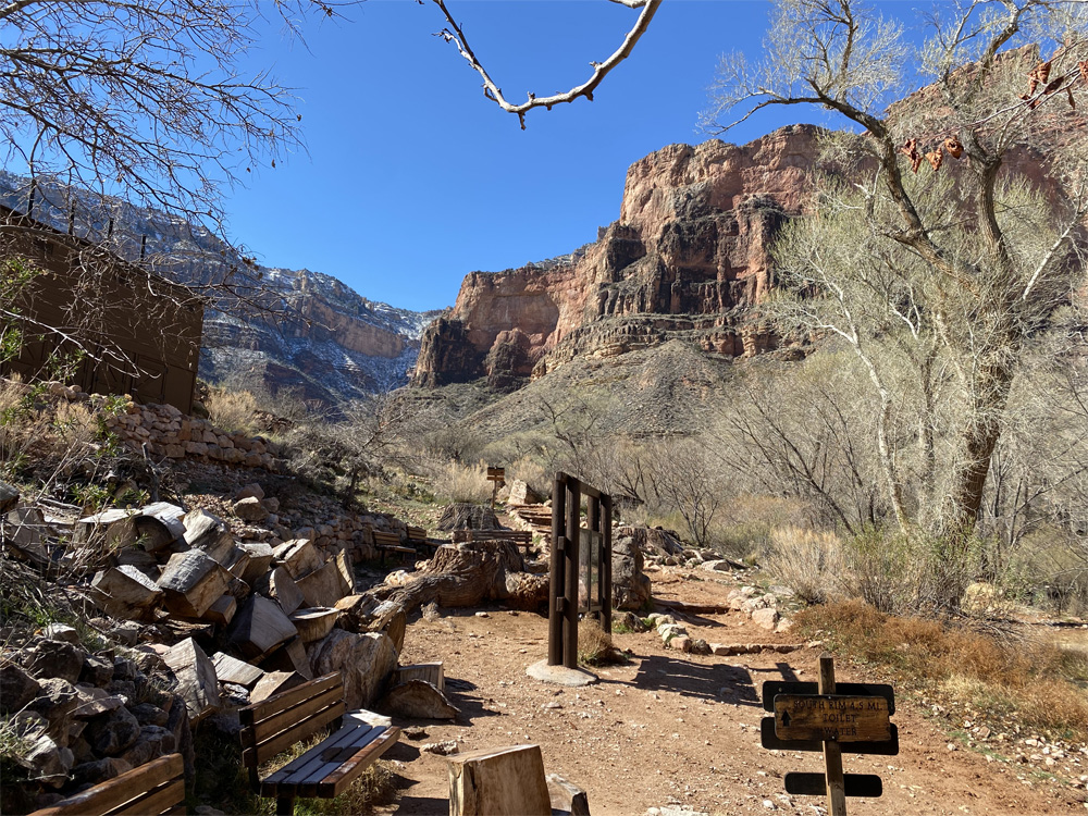
We reach Indian Gardens at 3,820 feet elevation, about 1500 feet of elevation gain and nearly 3000 feet more to go. The mules are drinking and resting under the beautiful tree site. The thermometer reads 40 degrees, sunny blue skies. We take an extended break (a whole 20 minutes) and enjoy the relaxing time with other hikers around, the views and a rock squirrel joins us too! There are benches, the rest house, the water pump house at this area. There is also a campground here for tenting. Temperature has increased 5 degrees since we arrived in Indian Gardens 20 minutes ago.
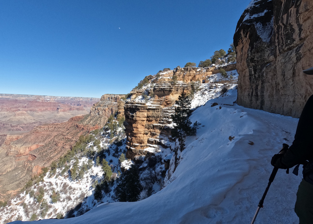
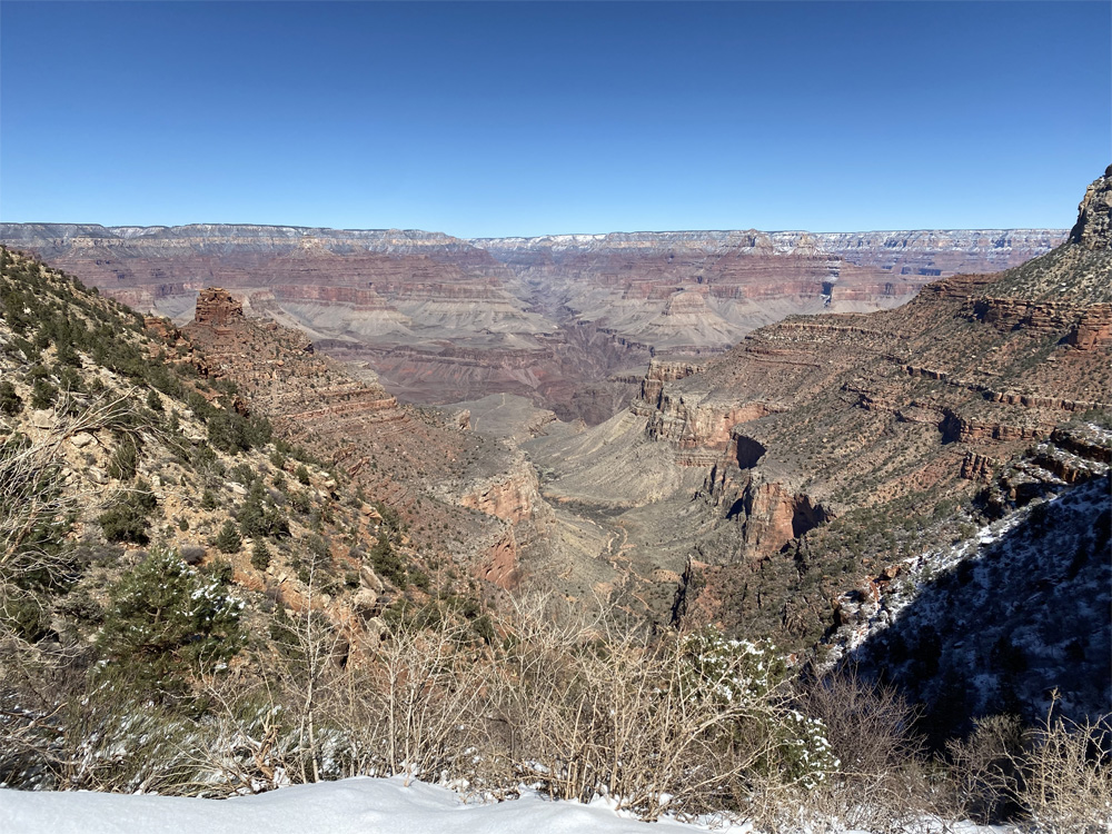
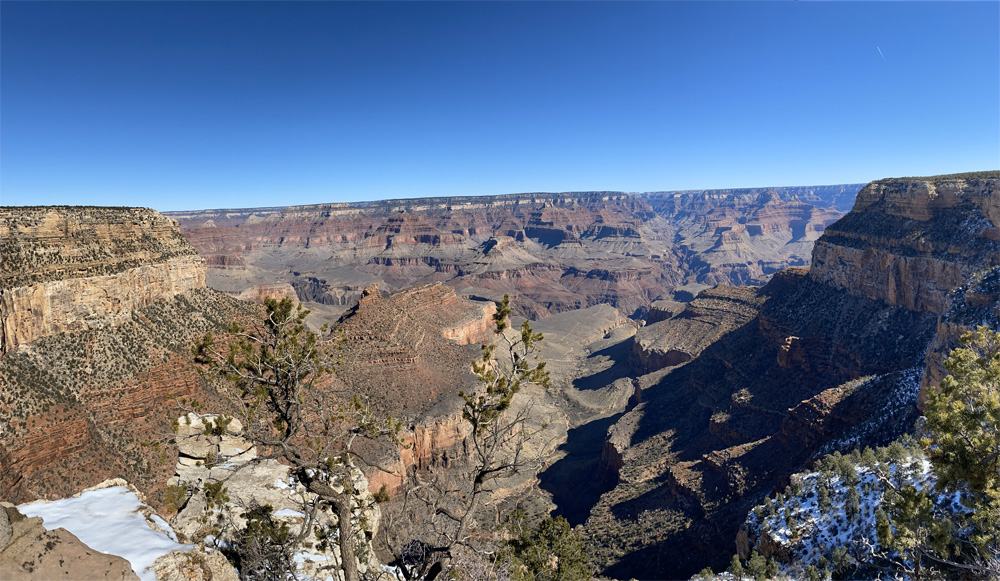
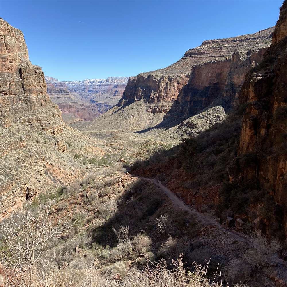
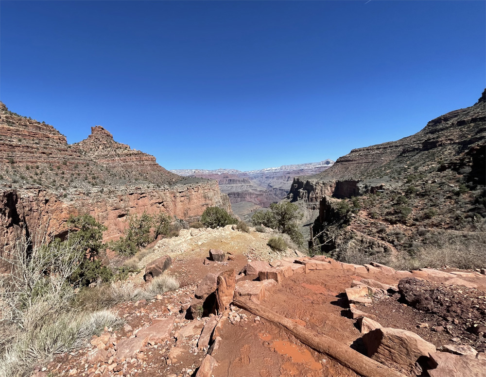
As we hike out of Indian Gardens, we see the sign that says 4.5 miles to go! Don’t let that sign tease you, we have over 3,000 feet of elevation to climb. Soon we will reach the steepest part of the Bright Angel Trail. But for now the 1.5 miles out of Indian Gardens is a gradual climb. We see distant views the top of the South Rim. As can be seen in the photos, our goal is the top of the rim where the left and right walls meet in the middle of the photo.
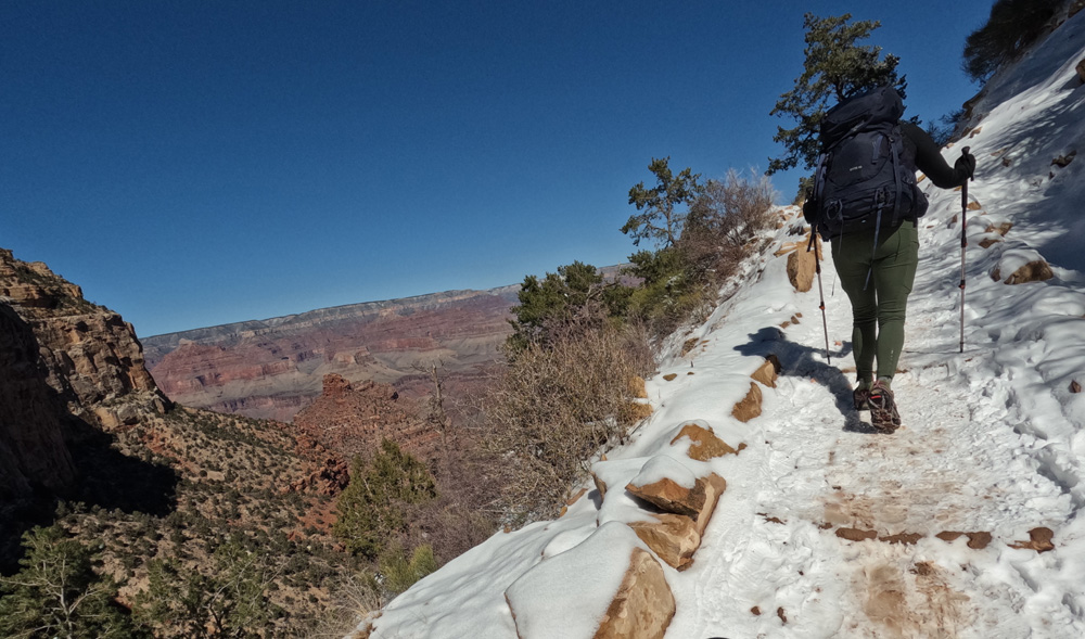
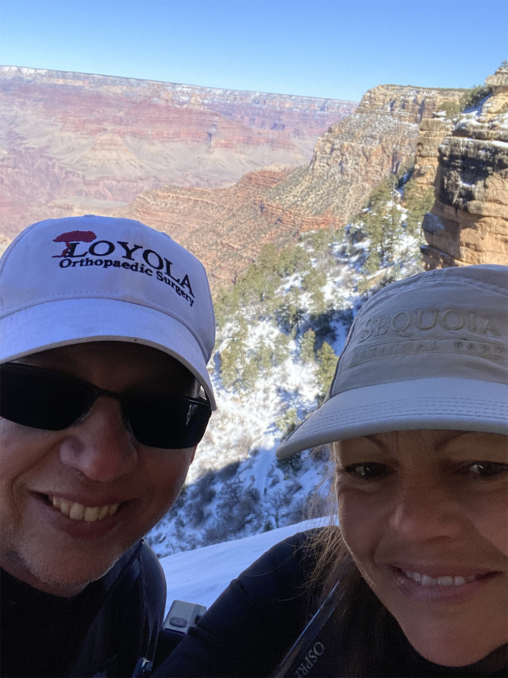
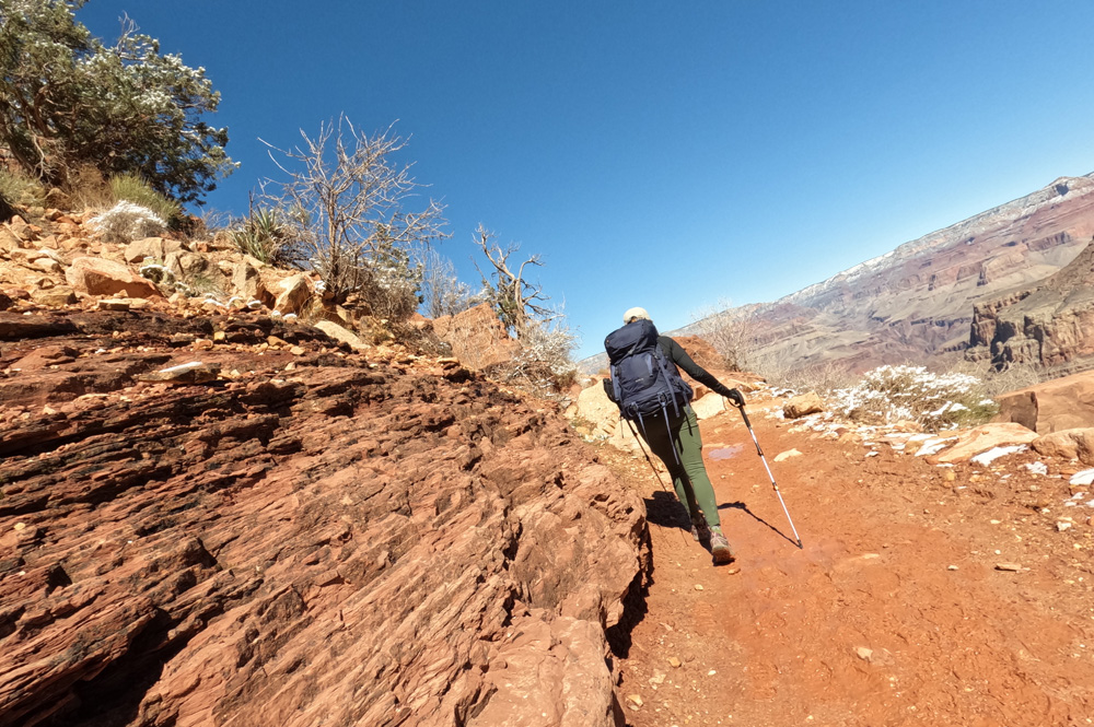
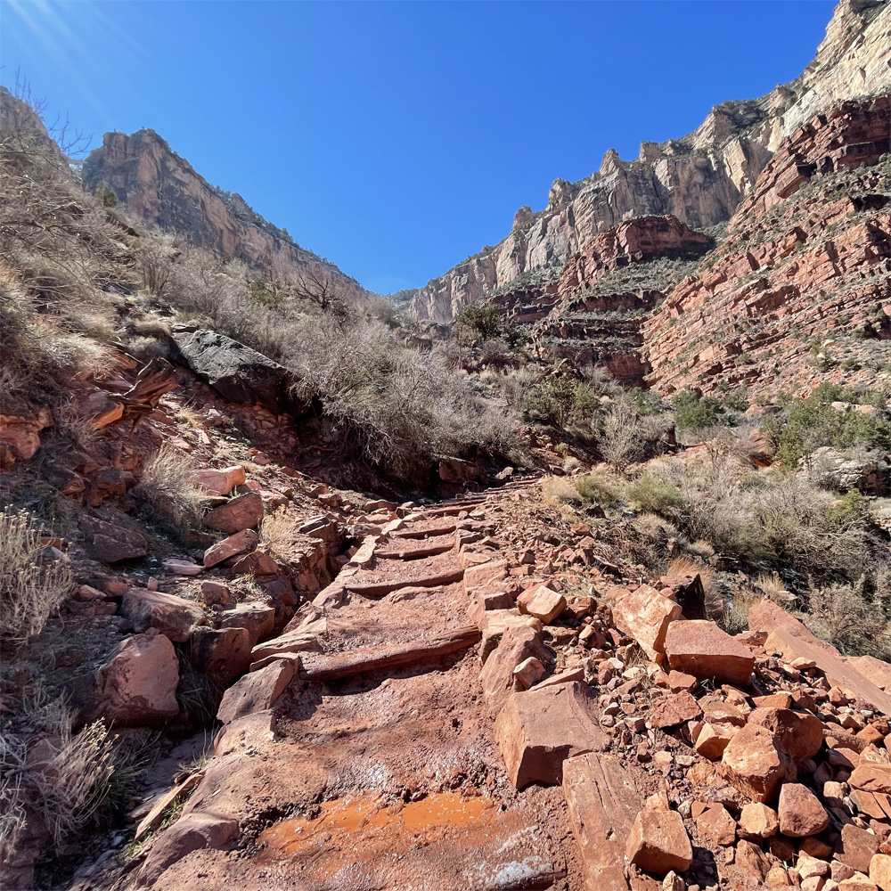
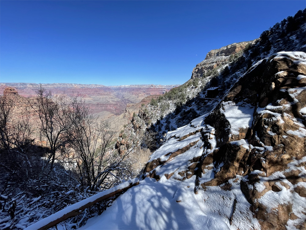
After this gentler part of the trail, we meet the switchbacks with grand views of where we had hiked. Just amazing to reflect on the beauty of the canyon and feel its majesty.
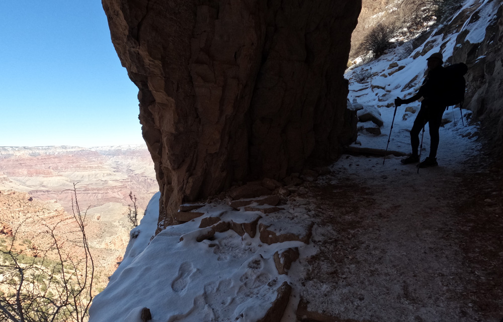
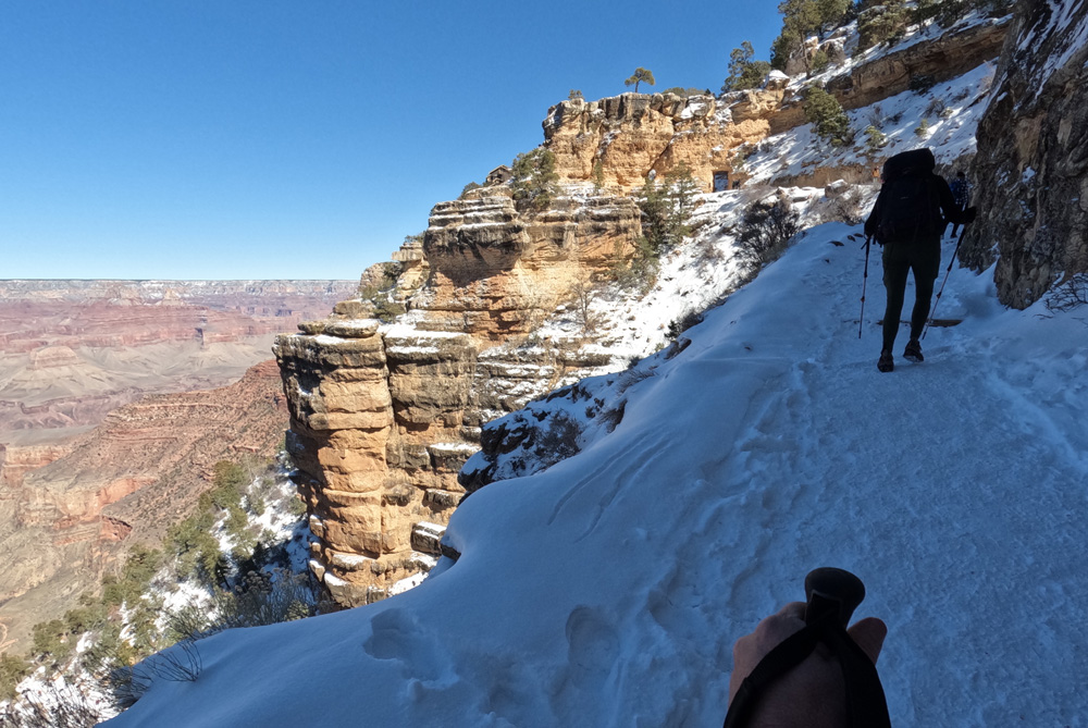
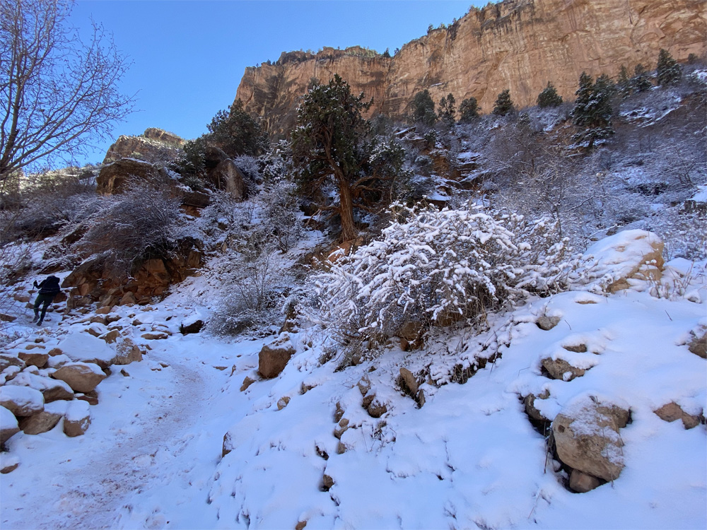
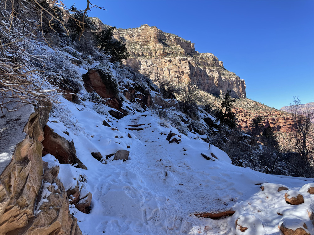
And the trail gets steeper and steeper with muddy switchbacks and puddles covered with ice. We can see the remaining snow covering the upper part of the canyon as we climb further to 3 mile Rest House, 4,732 feet elevation, just over 2,000 feet to climb!
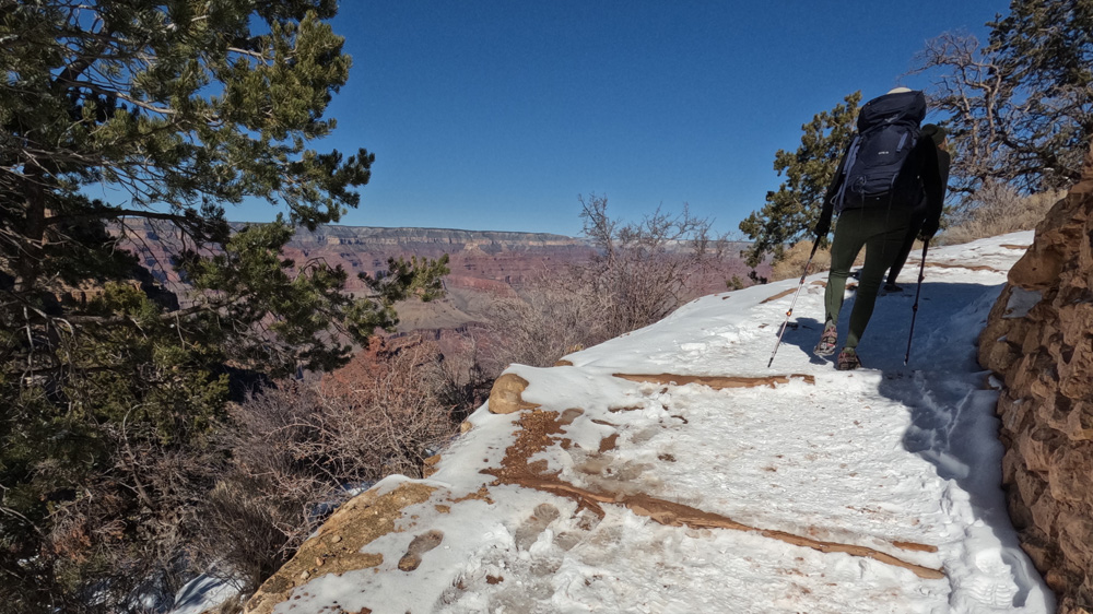
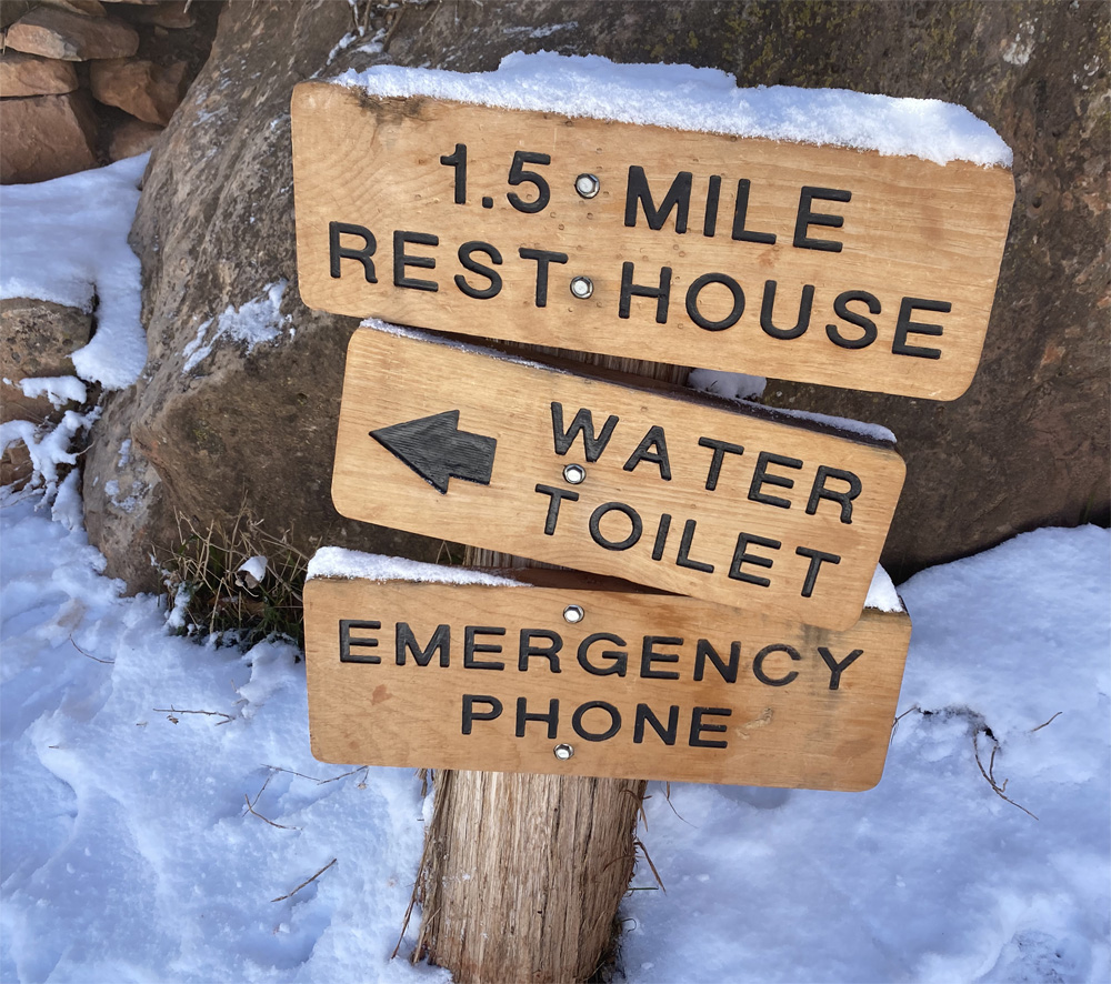
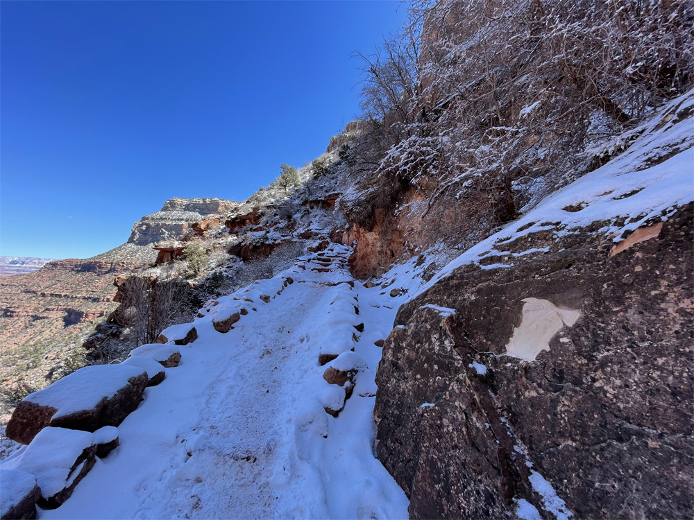
Time to get those micro-cleats on our hiking shoes as the trail turns to snow packed and icy nearing the 1.5 mile rest house at 5,695 feet elevation. Kyle’s happy as that gets rid of 2 pounds out of his backpack. Its a winter wonderland, the trees and ground are covered from yesterdays fresh snow but getting colder and colder as we climb higher. The most intense part of the trail is the last 1.5 miles, steep and elevation gain of 1,246 feet, the micro cleats make the trail safer along with our trekking poles.
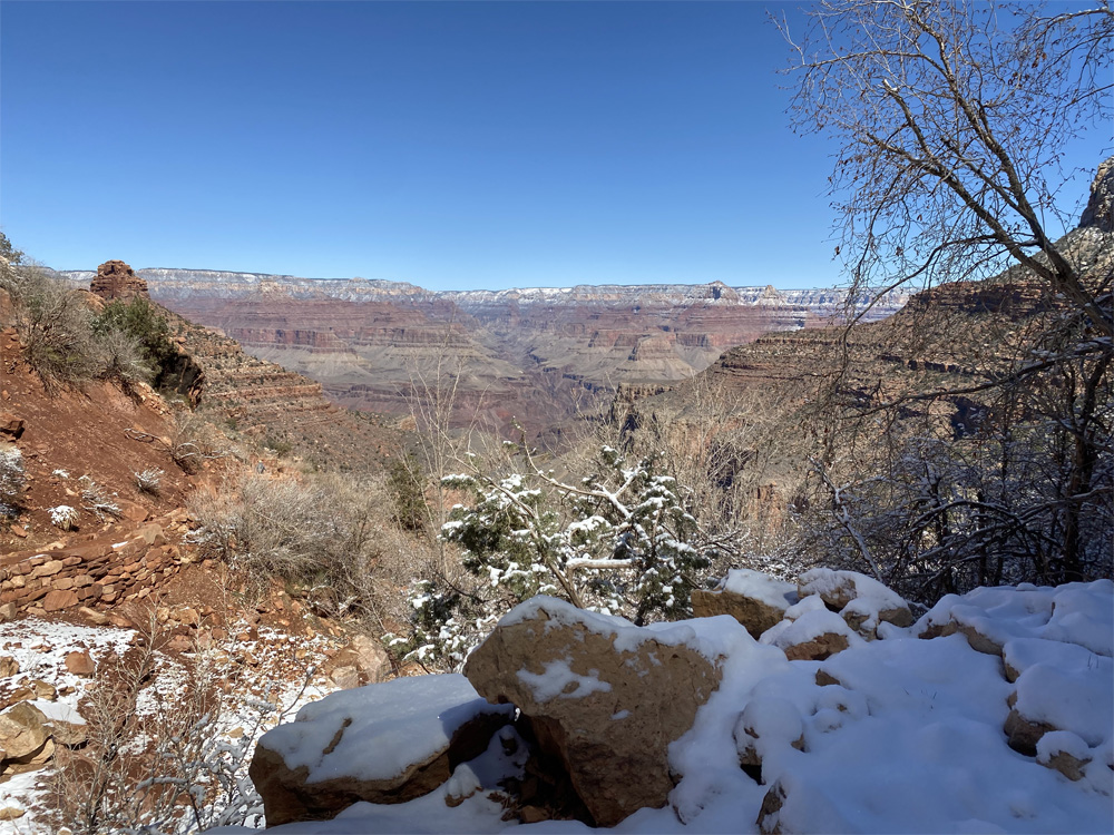
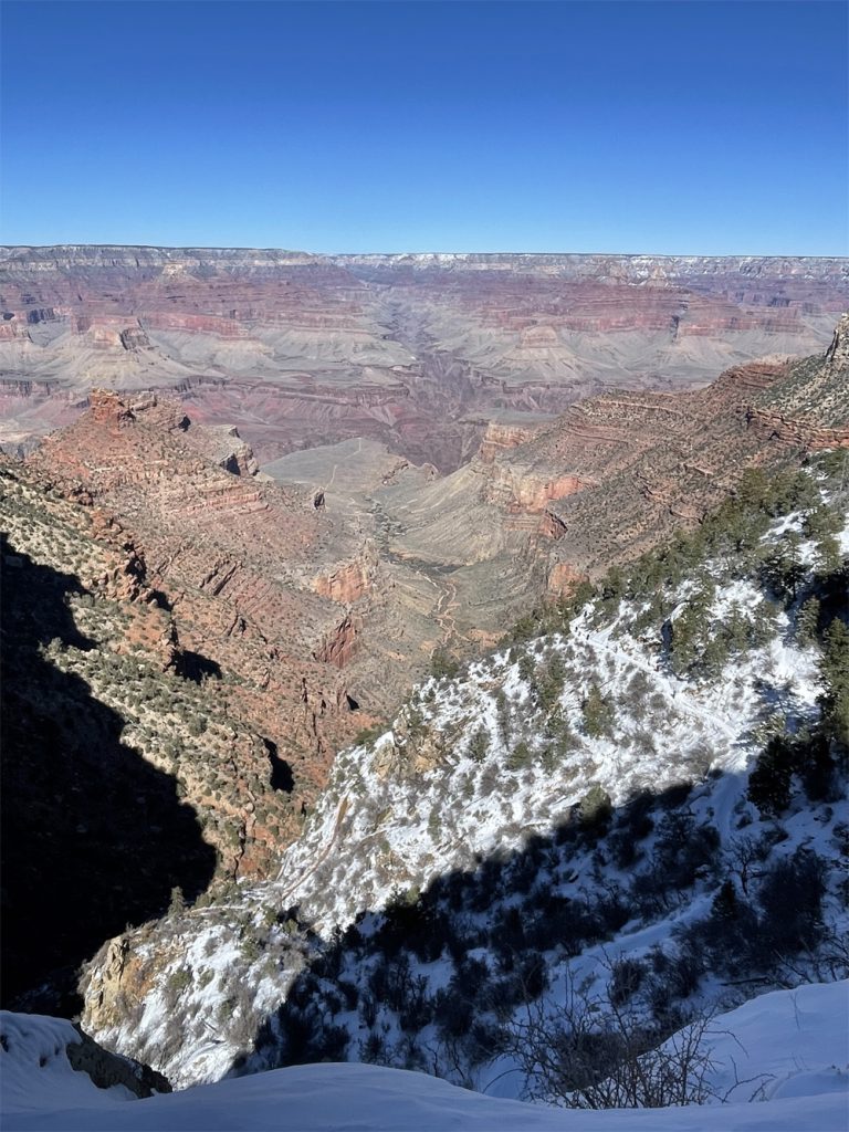
The views of to the North rim and where we have been are stunning. You can see in the photo the trail all the way to Indian Gardens and then the “drop off” that leads to the Colorado River and the Bright Angel Campground. It is amazing that we have traversed this far. We keep climbing keeping our momentum going with our backpacks we hike on. At this point in the trail it was a balance of rest and keeping the body moving as we didn’t want to tighten up or get cold, but it was impossible to not pause and soak in the beauty of the Grand Canyon.
This part of the trail is more congested with tourist hikers not as respectful of other hikers so we keep eyes on the trail. One down hiker slipped on the ice by Kyle’s feet landing flat on his back. Fortunately he didn’t take out Kyle on his fall.
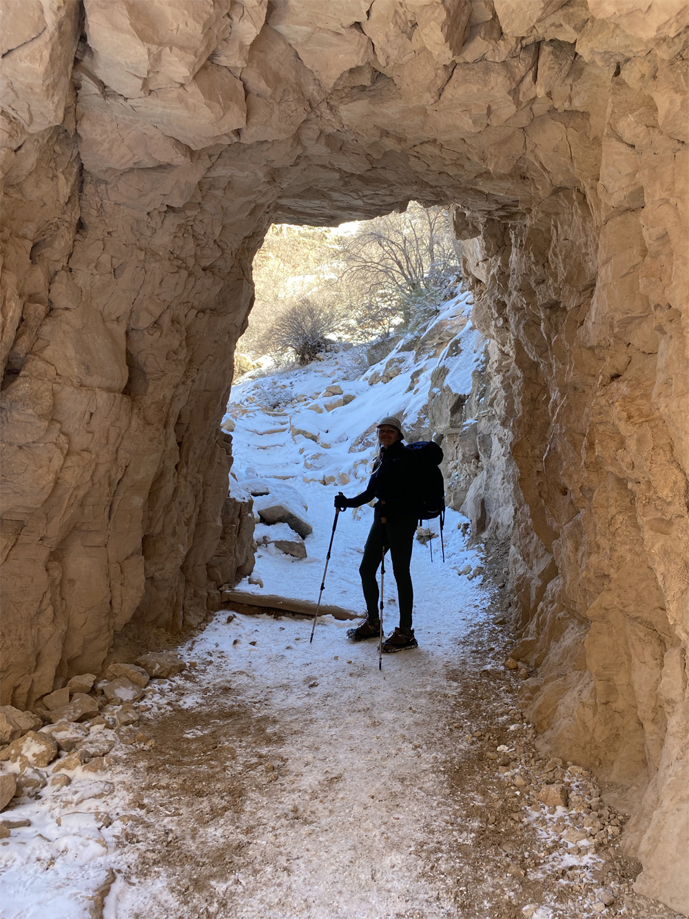
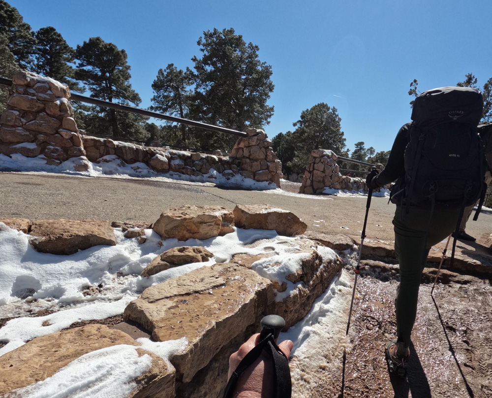
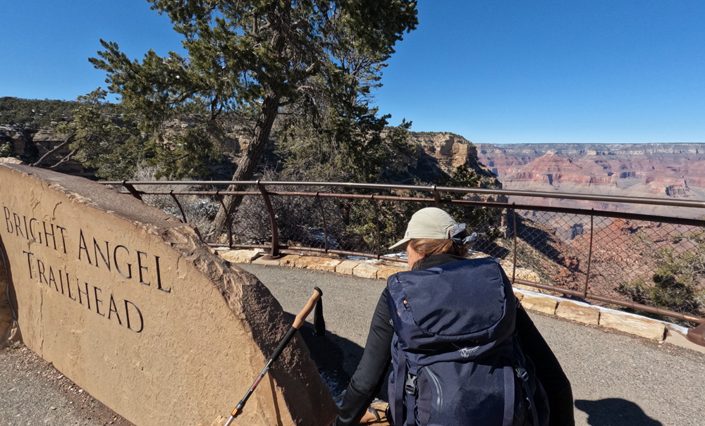
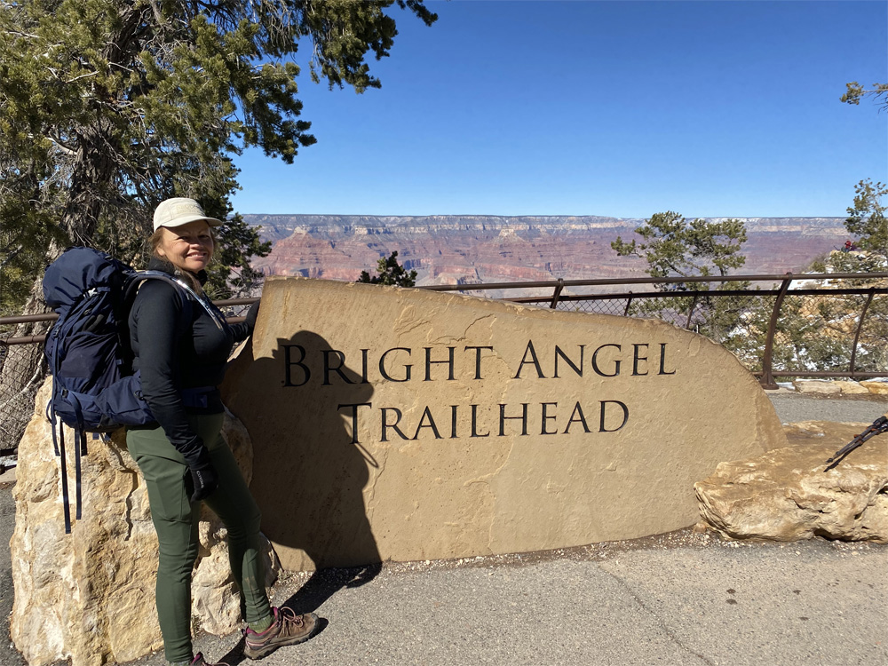
We hike thru the 2 tunnels near the top of the trail and reach the South Rim. We did it. The elevation at the top is 6,841 feet! Over 10 miles of hiking and 4,400 feet of elevation gain.
Other Links:
Video of our climb out the canyon
Video of our climb into the canyon
Blog Posts: Our Decent, Our Equipment, Preparation Part 1, and Preparation Part 2
Kyle’s Google Earth Videos: Decent, Ascent