
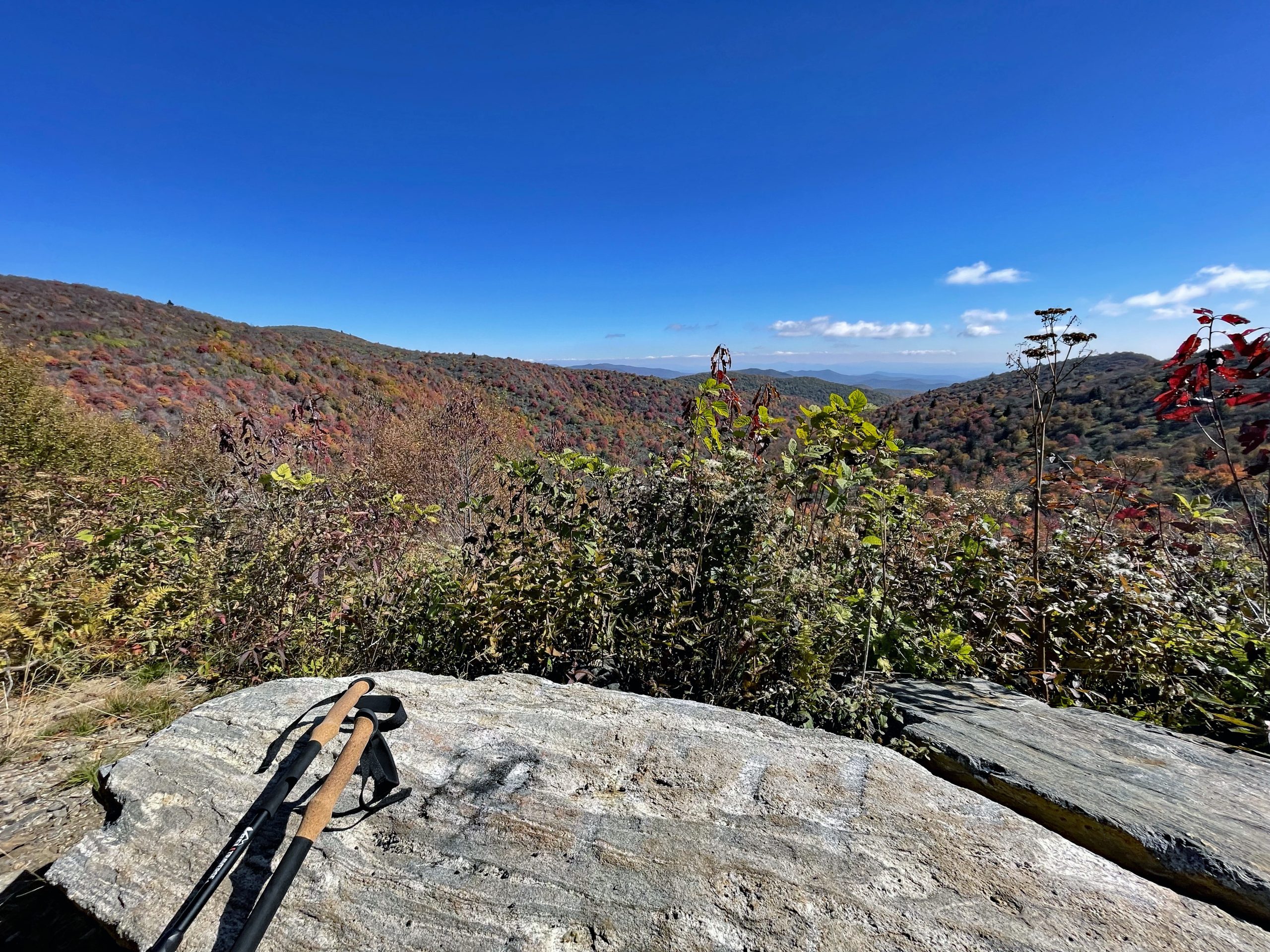
First Backpacking Group Hike
After our adventure in the Grand Canyon, we were excited about future overnight backpacking experiences. Now back country hiking meant learning how to prepare meals in the forest, sleeping in the forest, going potty in the forest… What no bathroom! So, Kyle and I did our research …and more research….and ultimately…
We came together with both of our interests and research. We decided on Western North Carolina as our focus location. We had previously purchased our hiking equipment from REI so we knew they offered group REI adventures with experienced guides to lead the hiking, backpacking and overnight adventures!
Reviewing the trip availability I knew Autumn was the time of year to take a group hike. I’d love to see the autumn leaves turning colors and feel the cool air in the forest. We read the group trip overview and itinerary. The group size was 10 hikers plus 2 experienced guides. Hiking 6-8 hours daily with possible elevation gain of 1,750 feet, 3 nights sleeping in tents. Definitely a learning adventure for us that we were looking for since we have only tented twice. Once at Disney Campground 20+ years ago with the unusual drop of temperature in the 30’s and our Grand Canyon night of which dropped in 30’s also! But never in the “Back Country” so to speak for multiple nights! So we signed up! Next to prepare!
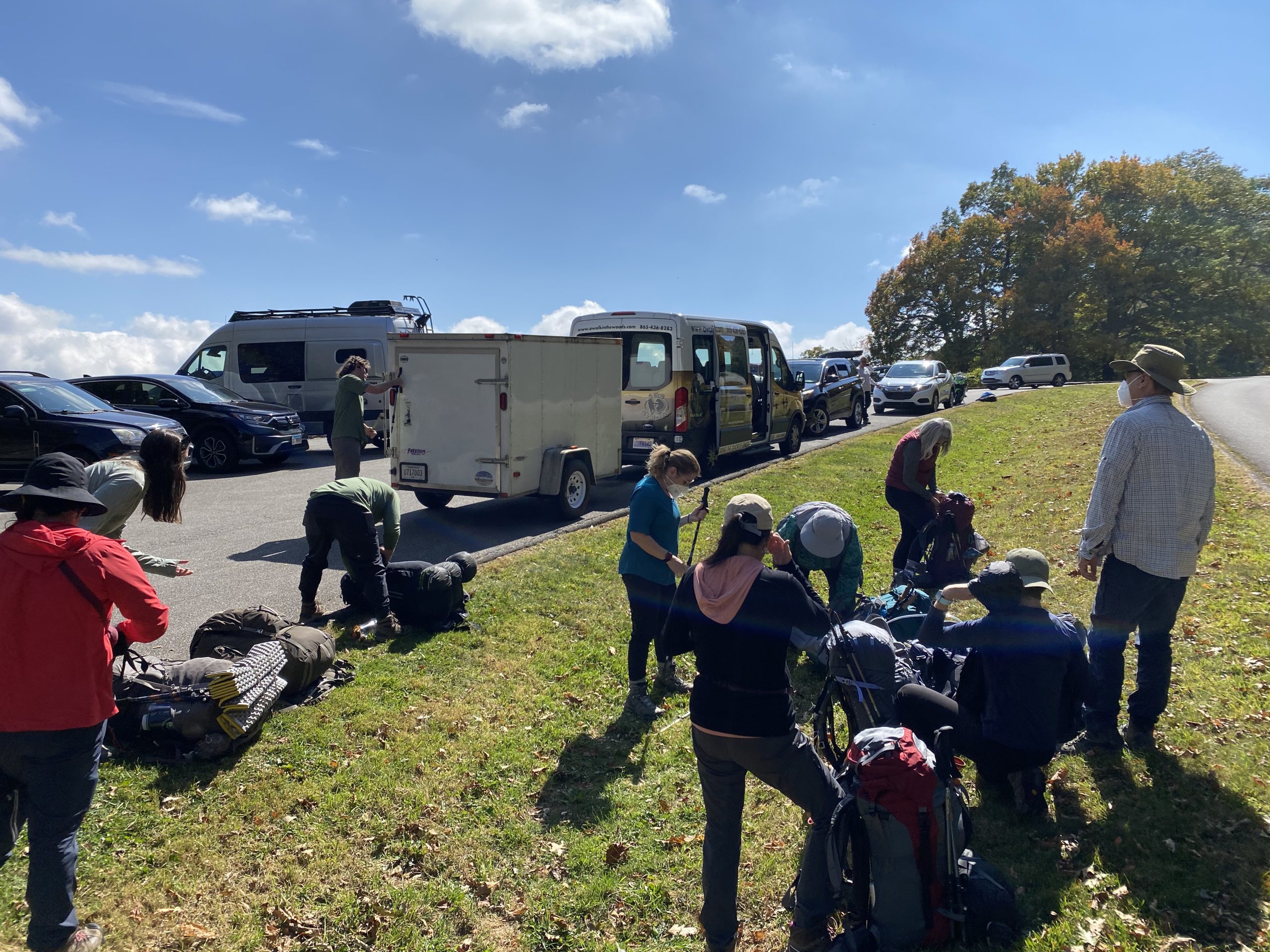
First item on the gear list was a Bear Canister! What is a Bear Canister I said….after research we discovered the importance of a bear canisters especially near the Smokey Mountains where Black Bears have a sizable population and enjoy people food. We reviewed the gear list and checked off what we had and what we needed to purchase.
The experienced guides taught us the ropes of backpacking, tenting, cooking, filtering water, campfire, how to go potty in the forest, preparing for cold rainy weather in back country. We learned detailed information about the area, landscape, plants, trees, history and more from the guides.
Beginning of Hiking Adventure 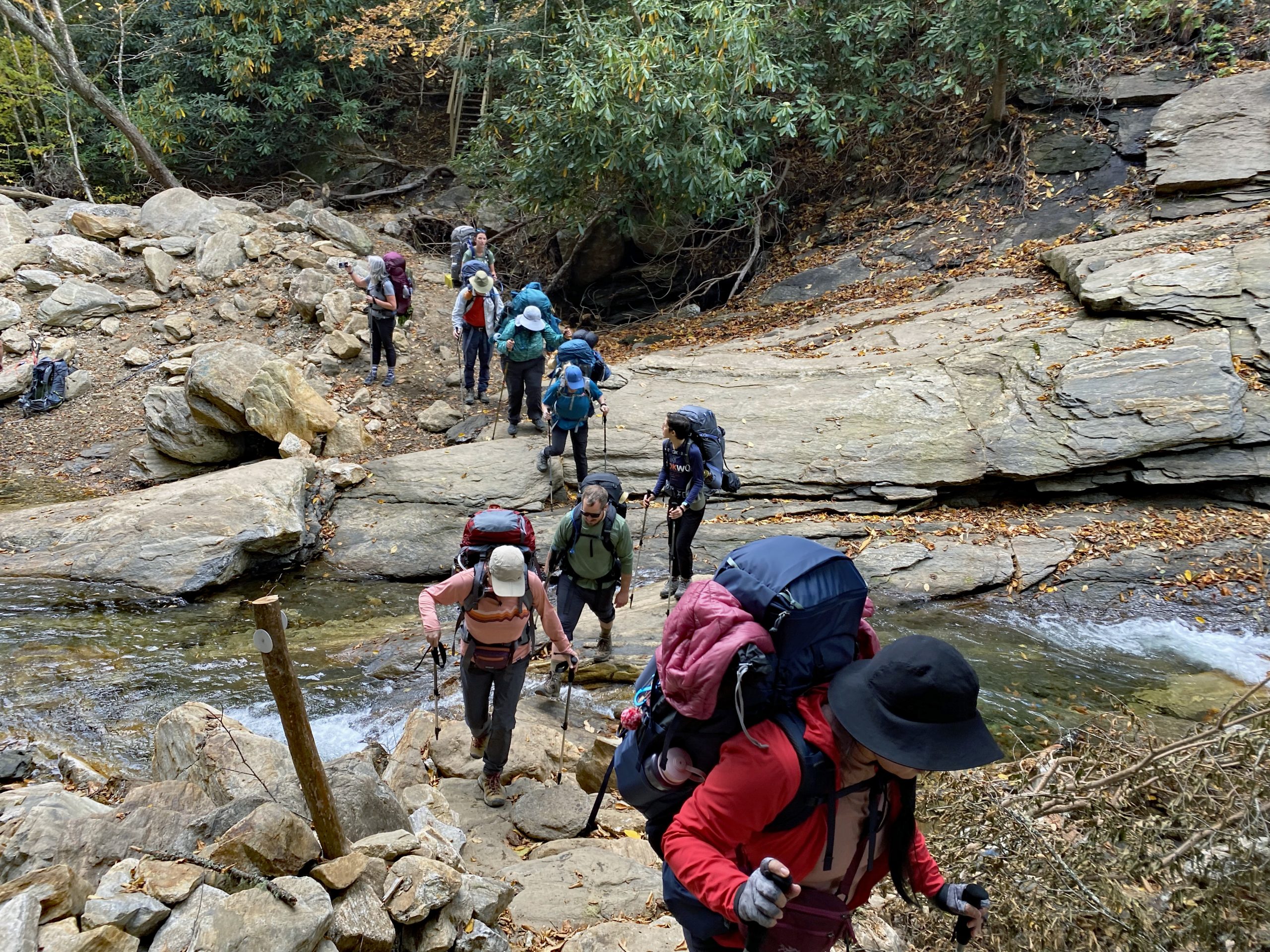
Into the Forest we go 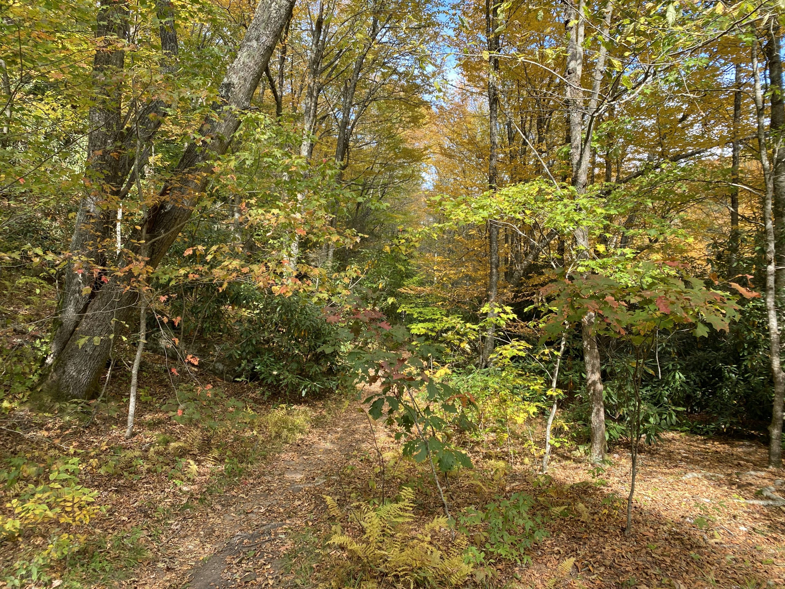
Autumn Trees 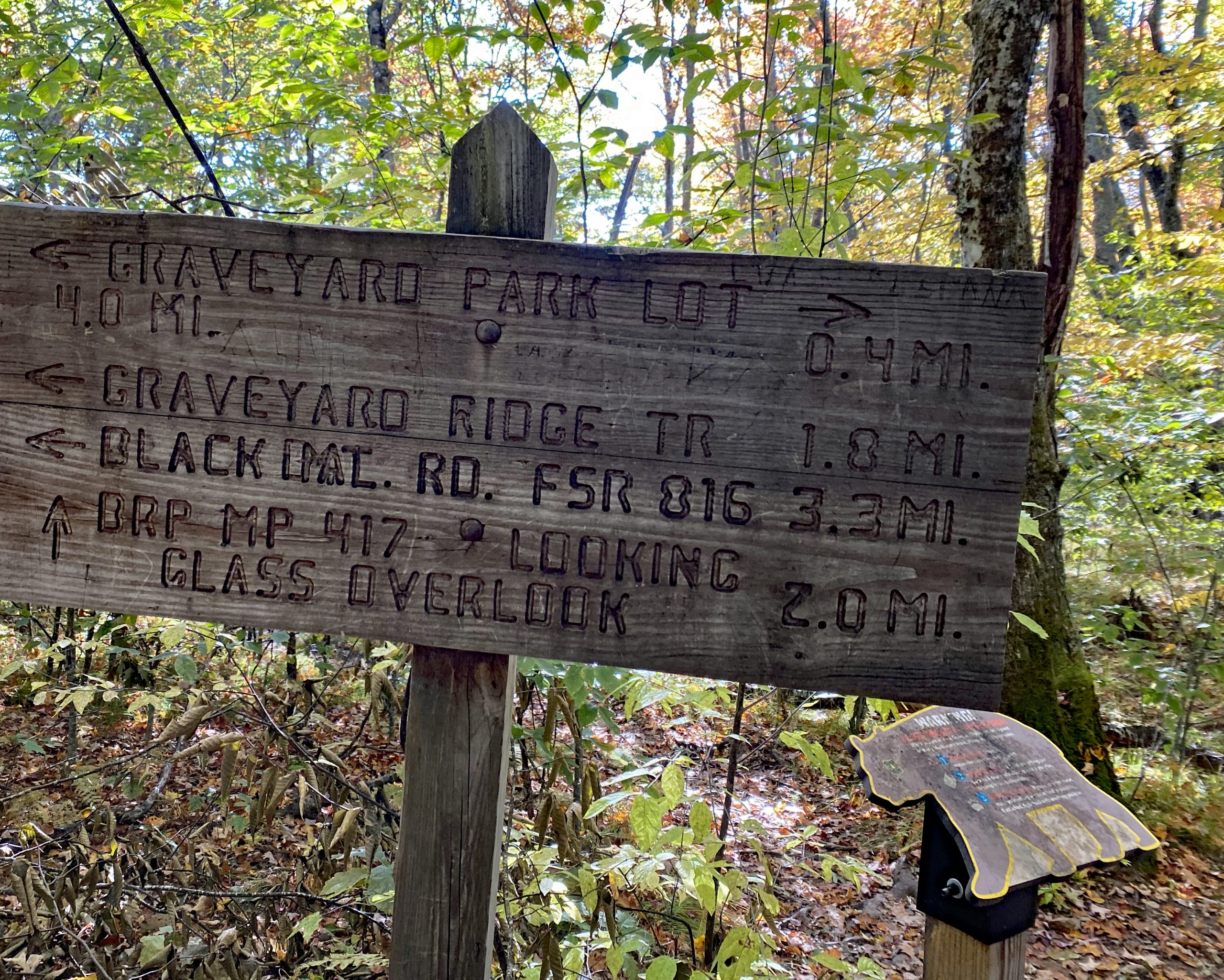
Hike Trail Sign 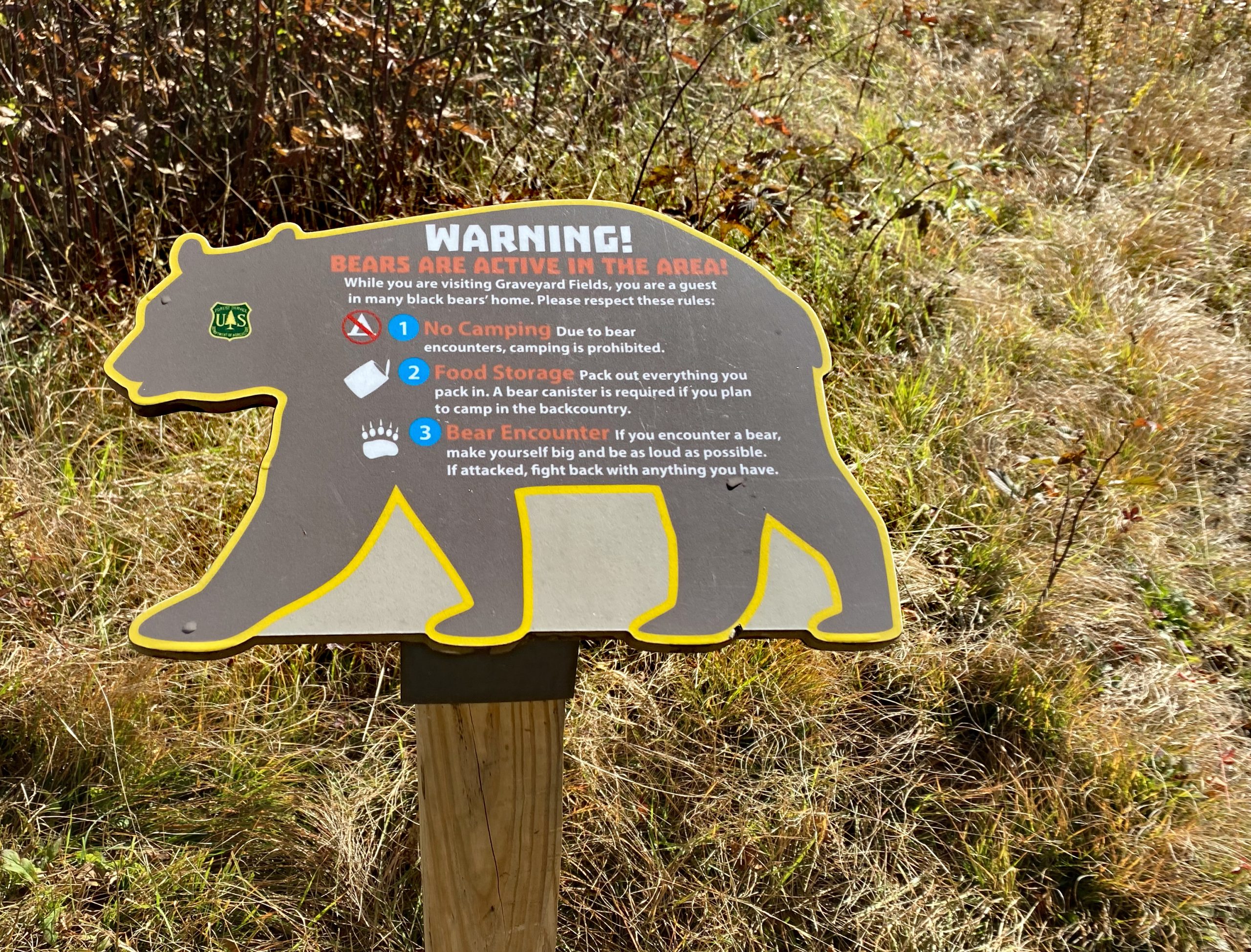
Bear Warning 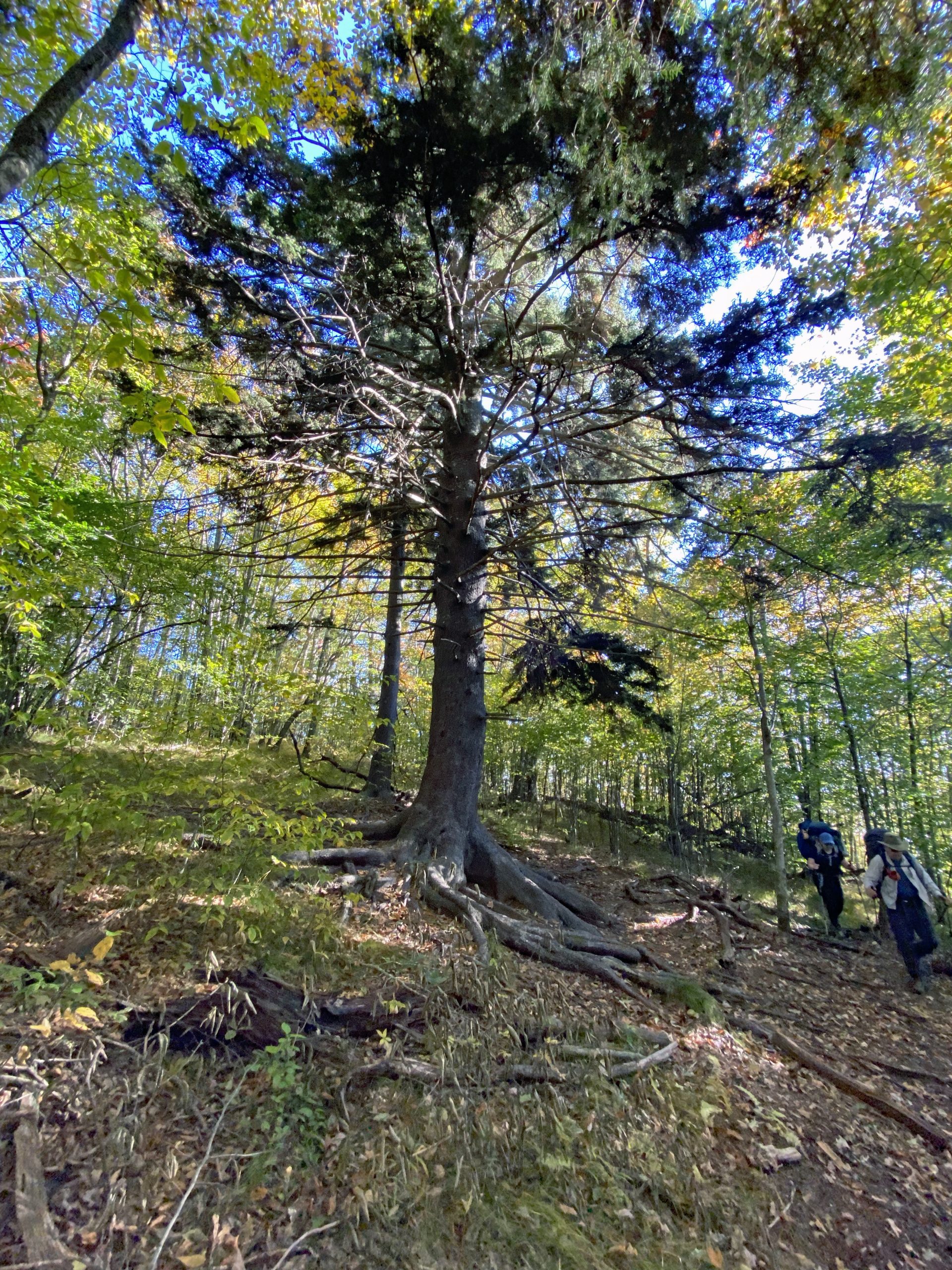
Hiking 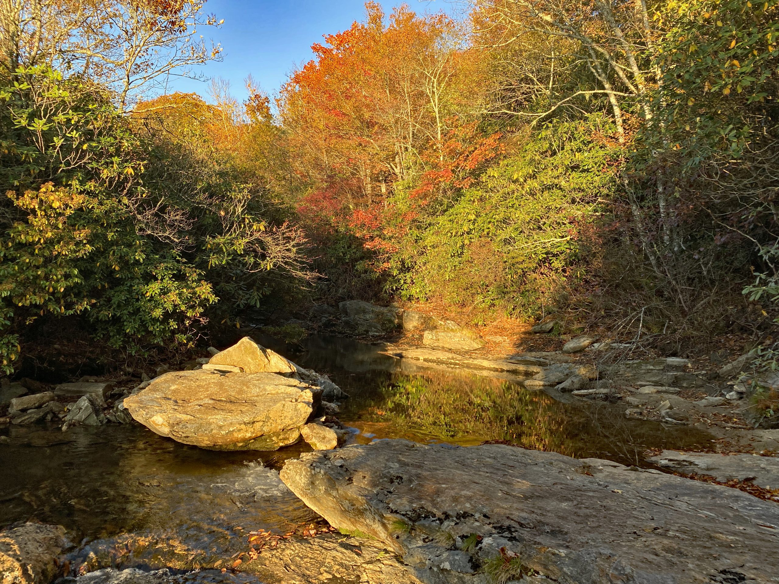
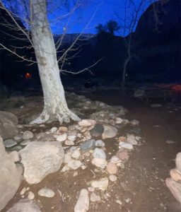
Campsite near Creek 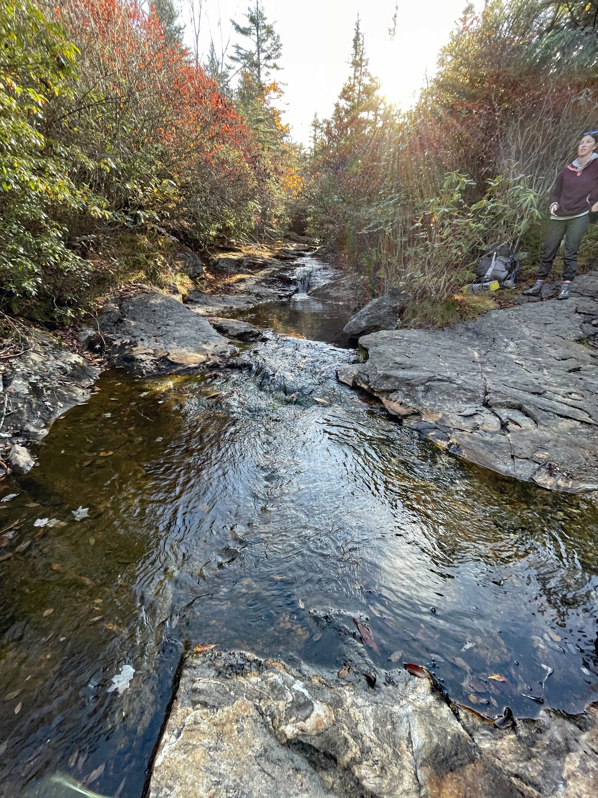
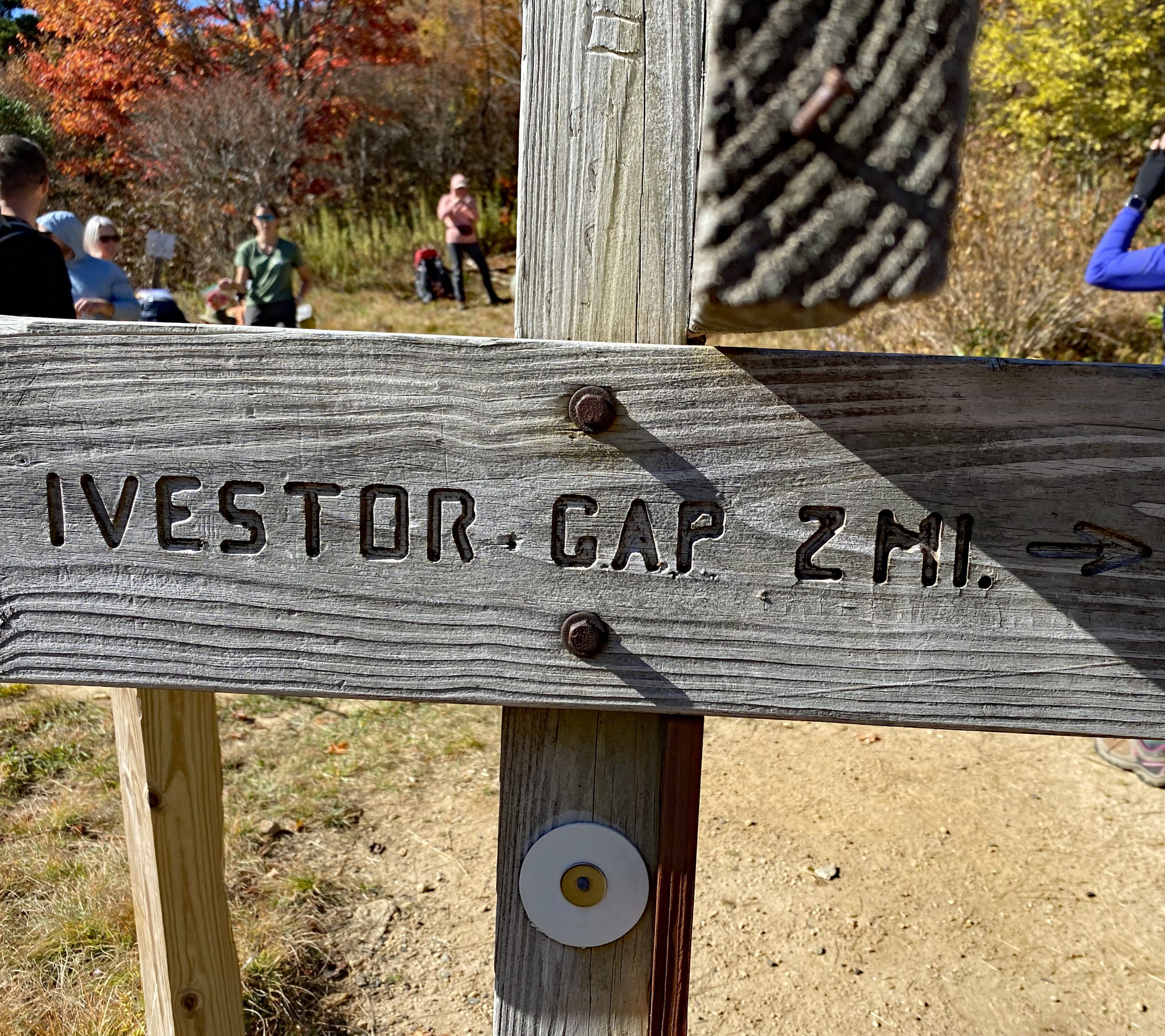
Hiking Trail Sign 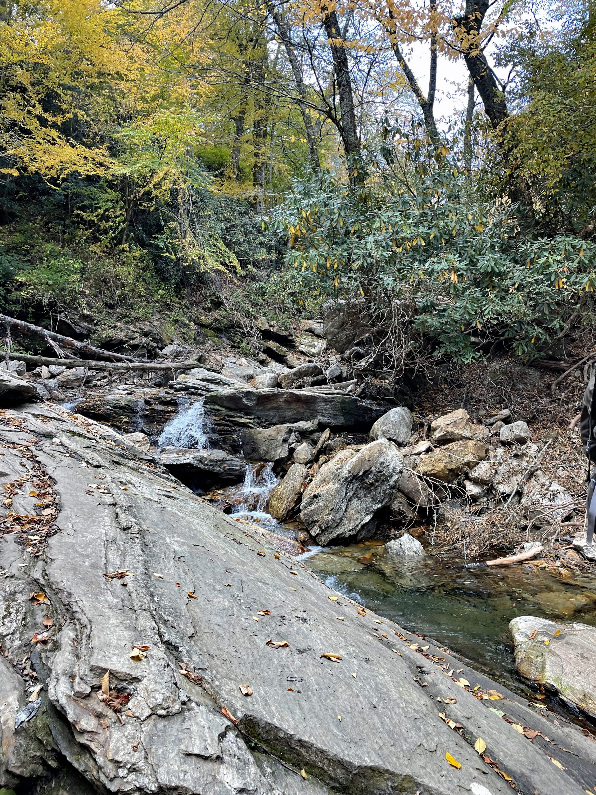
Beautiful rocks 
Campsite #1 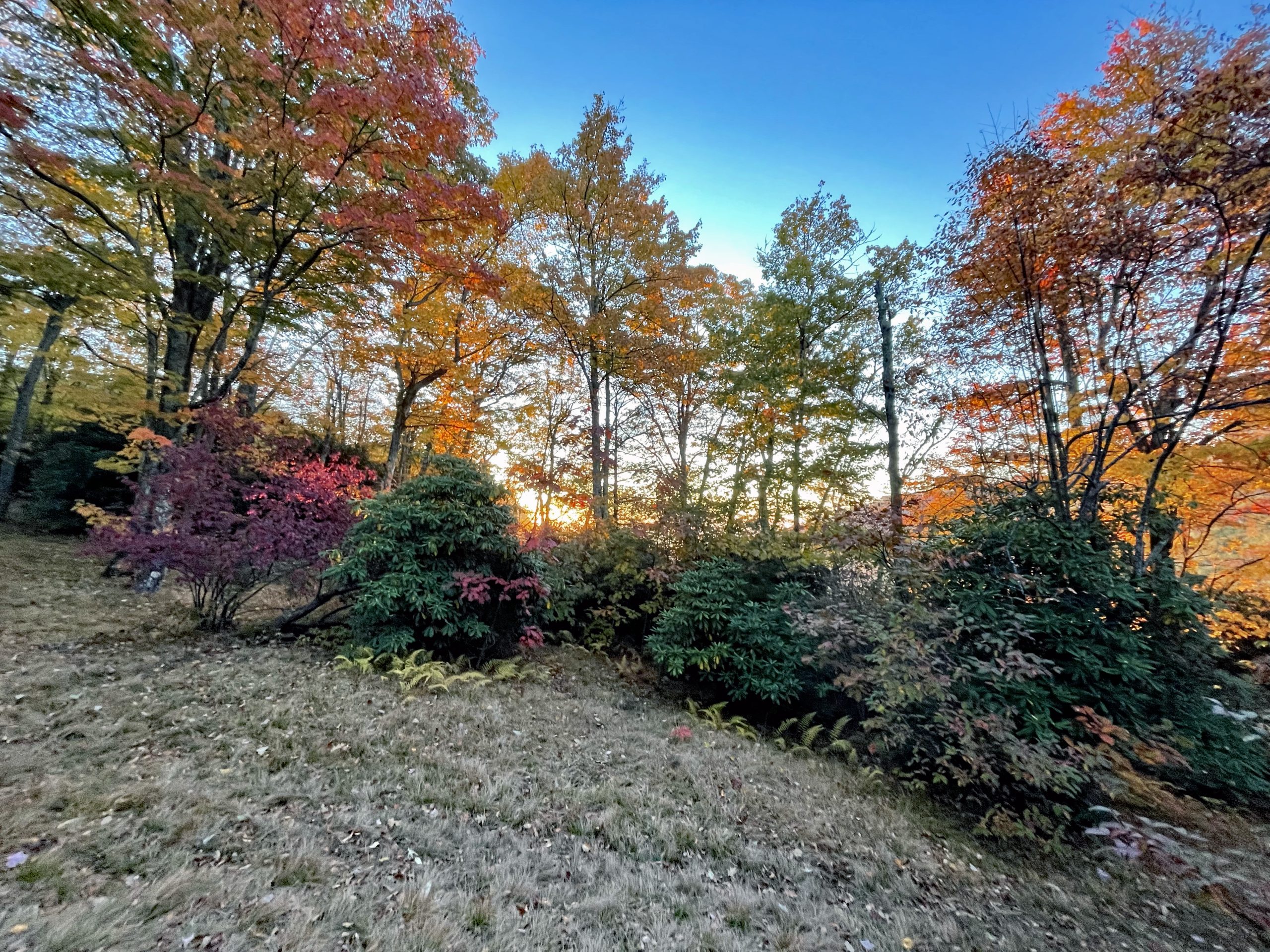
Sunrise at Campsite 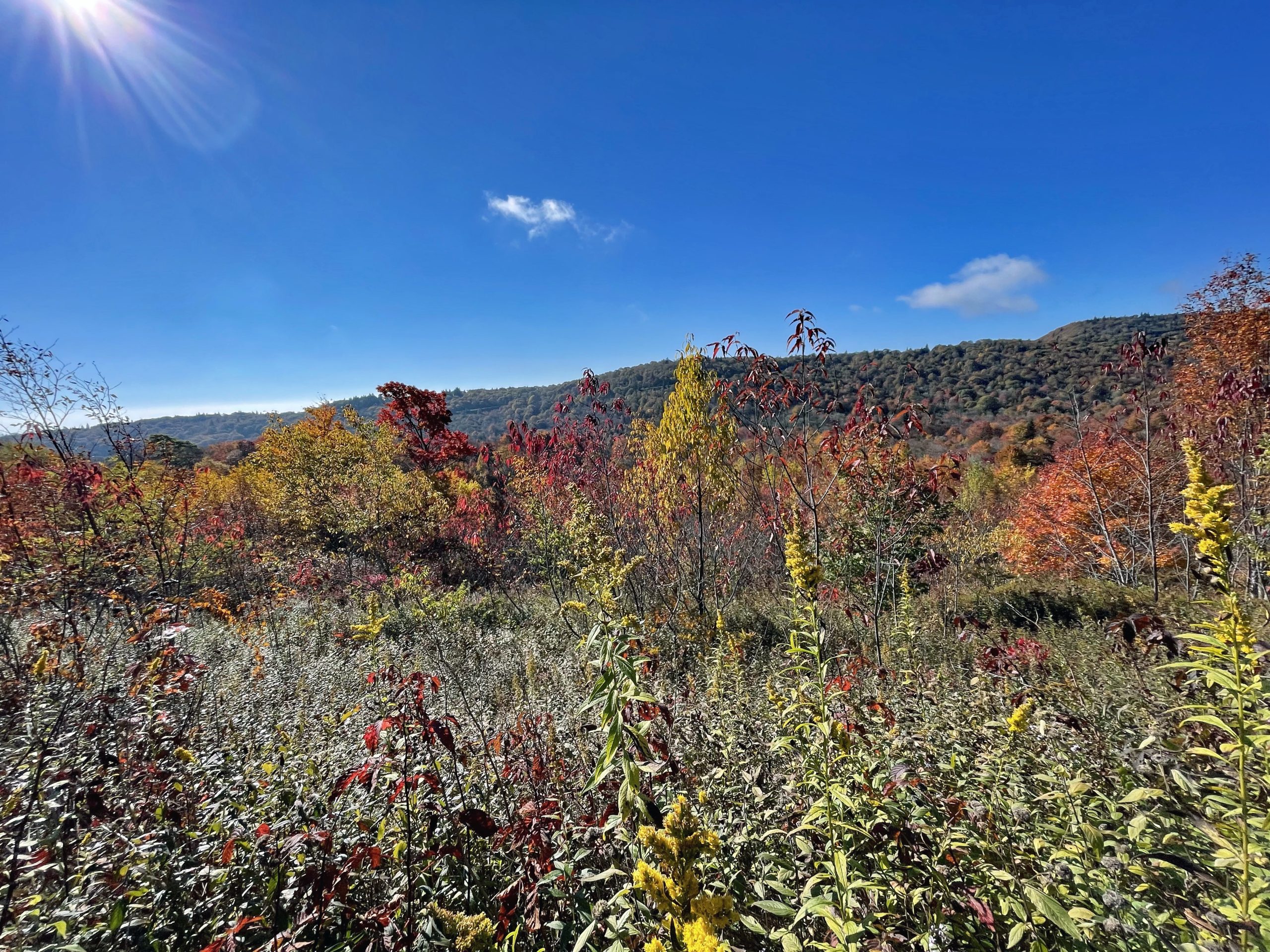
Ridge Line 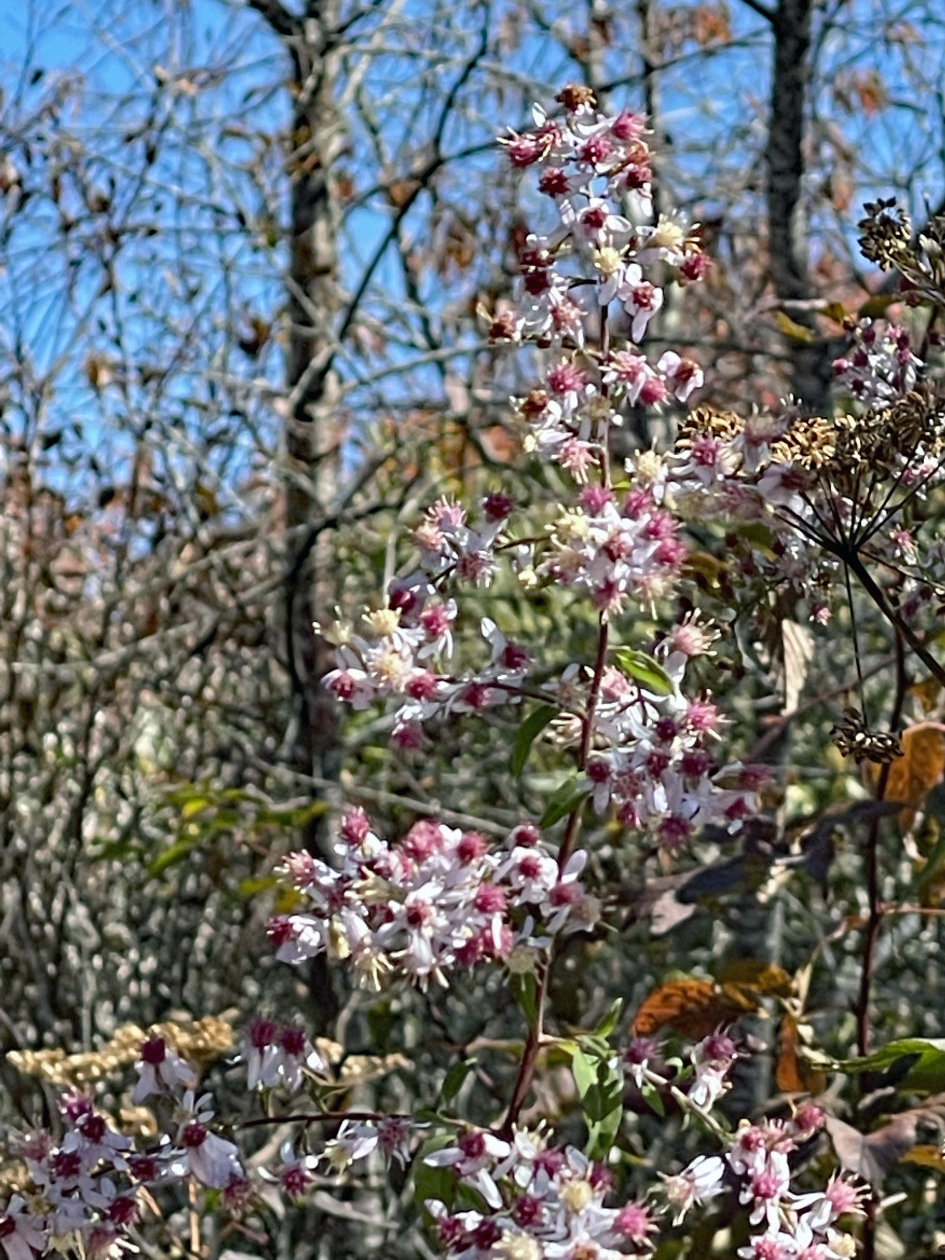
Wildflowers 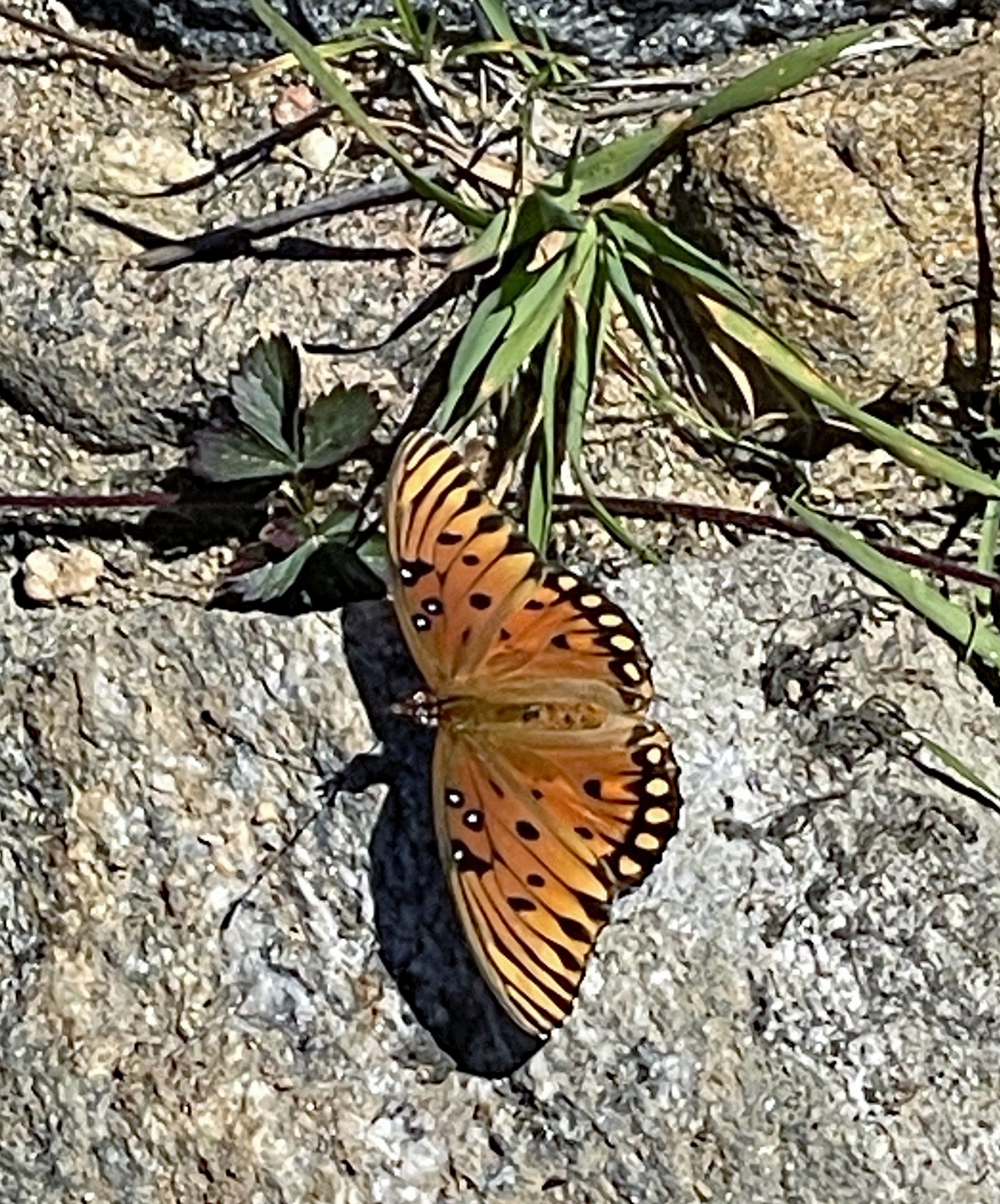
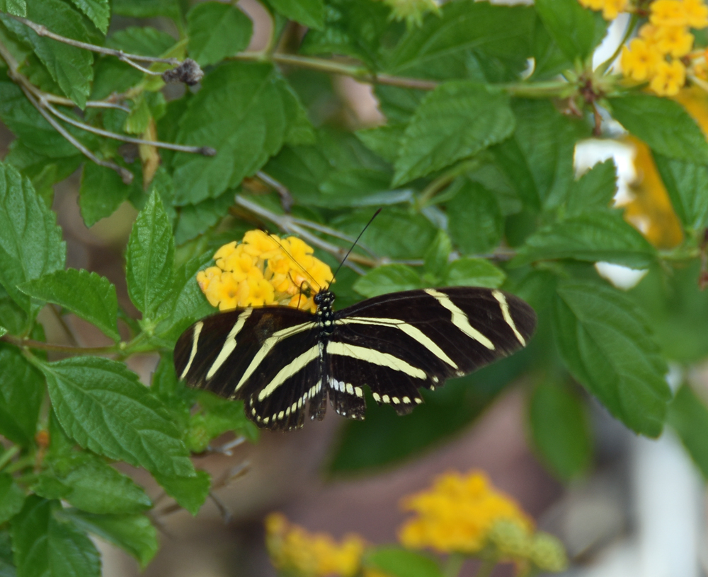
Gulf Fritillary Butterfly 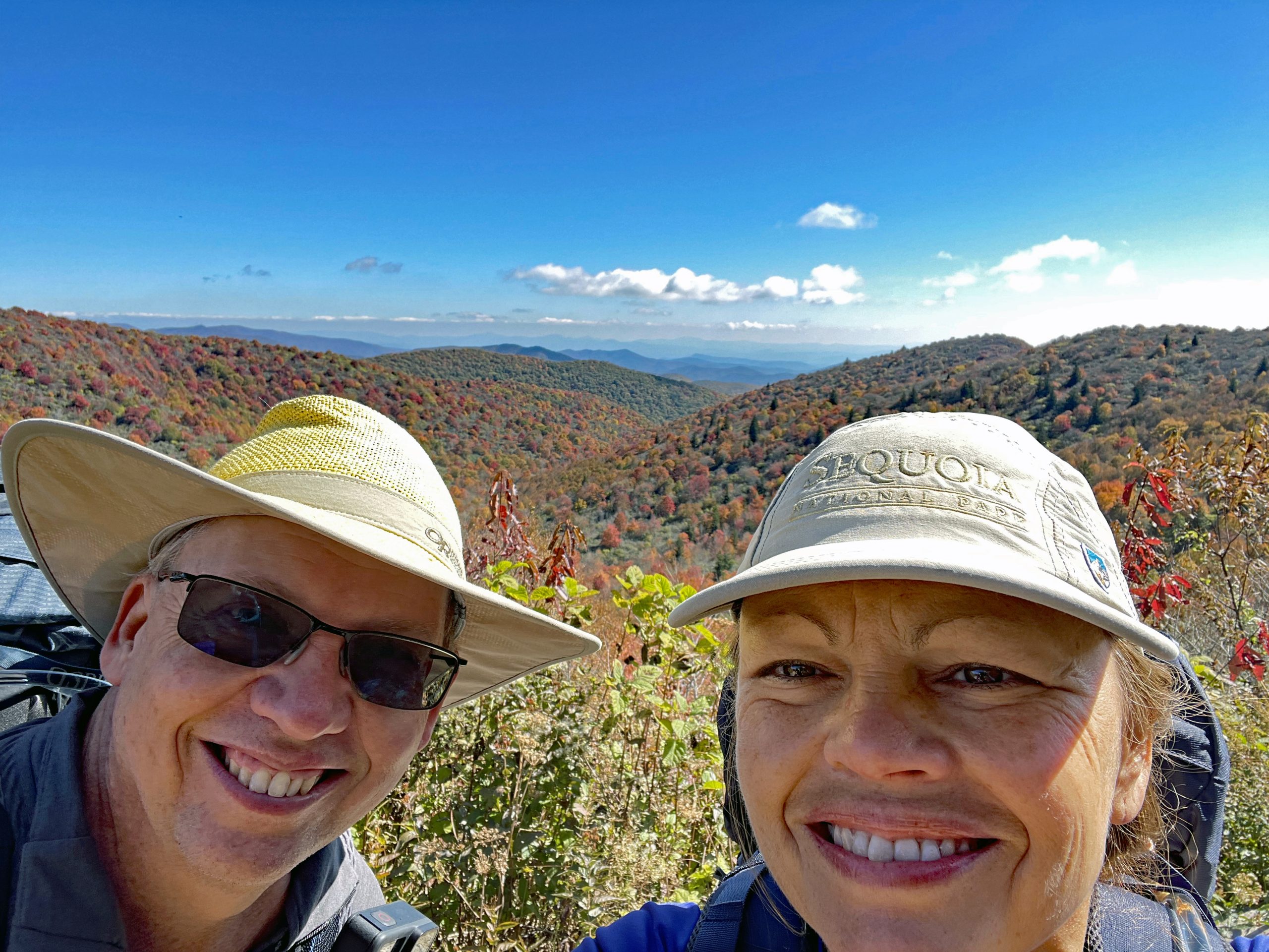
Beautiful Hike 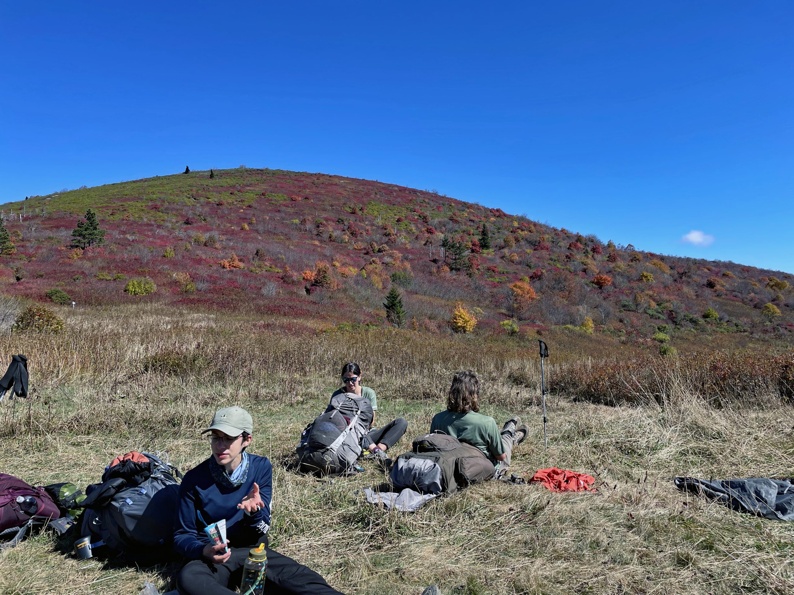
Breaktime 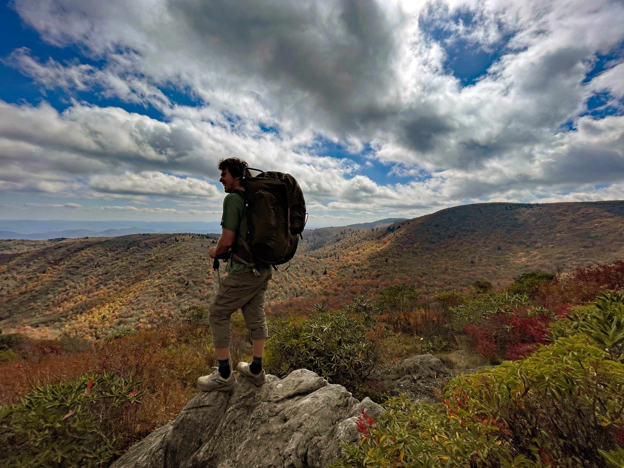
Guide on rock edge 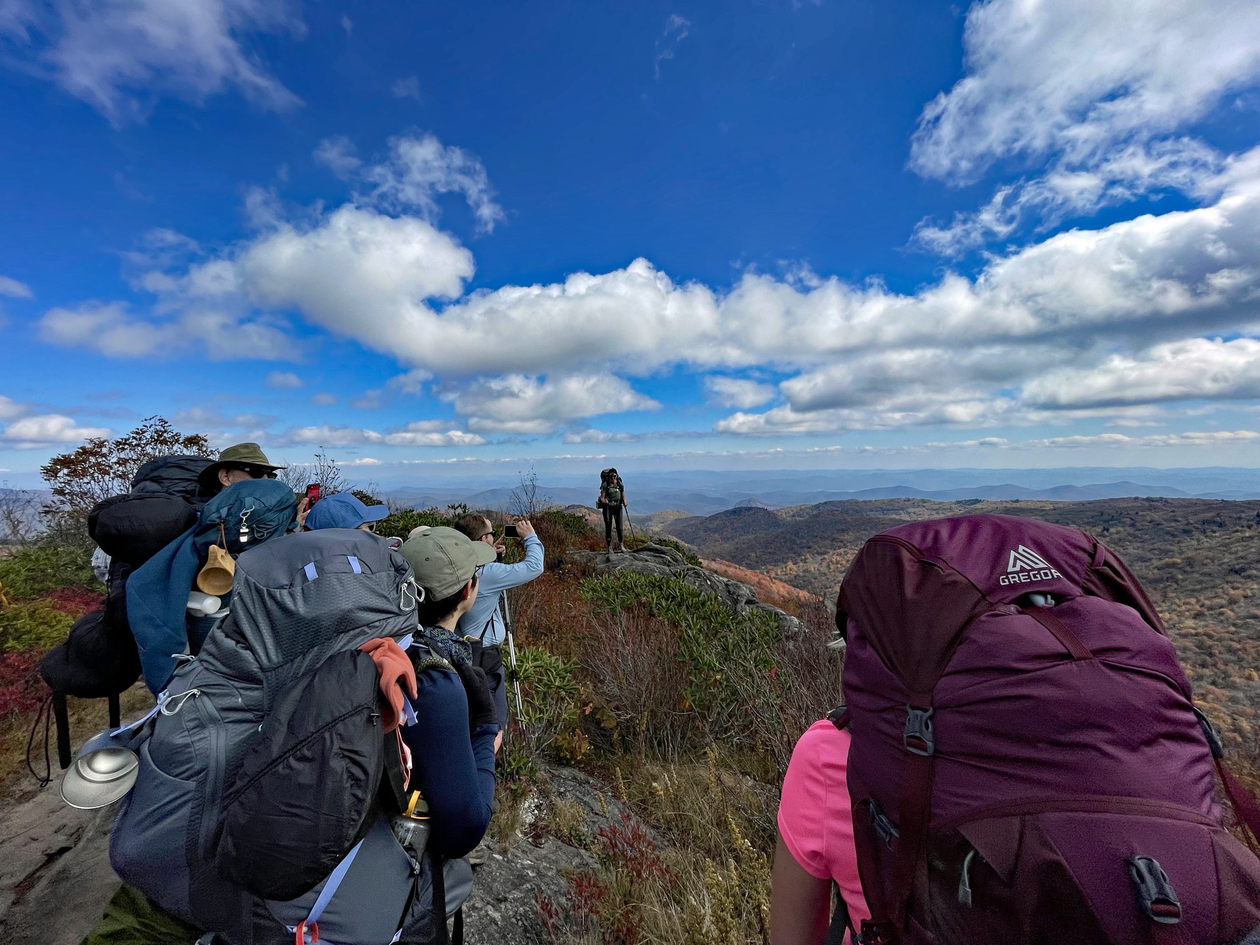
Beautiful Views 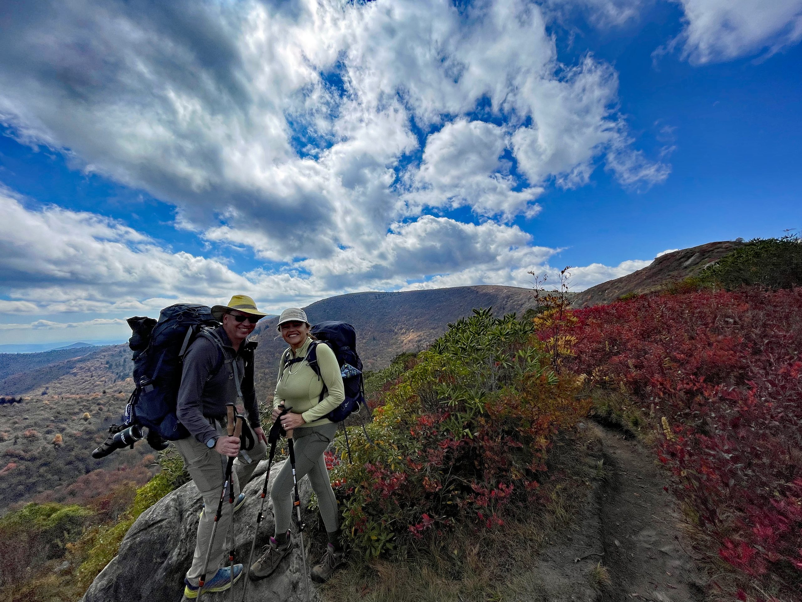
Beautiful ridgeline and colors 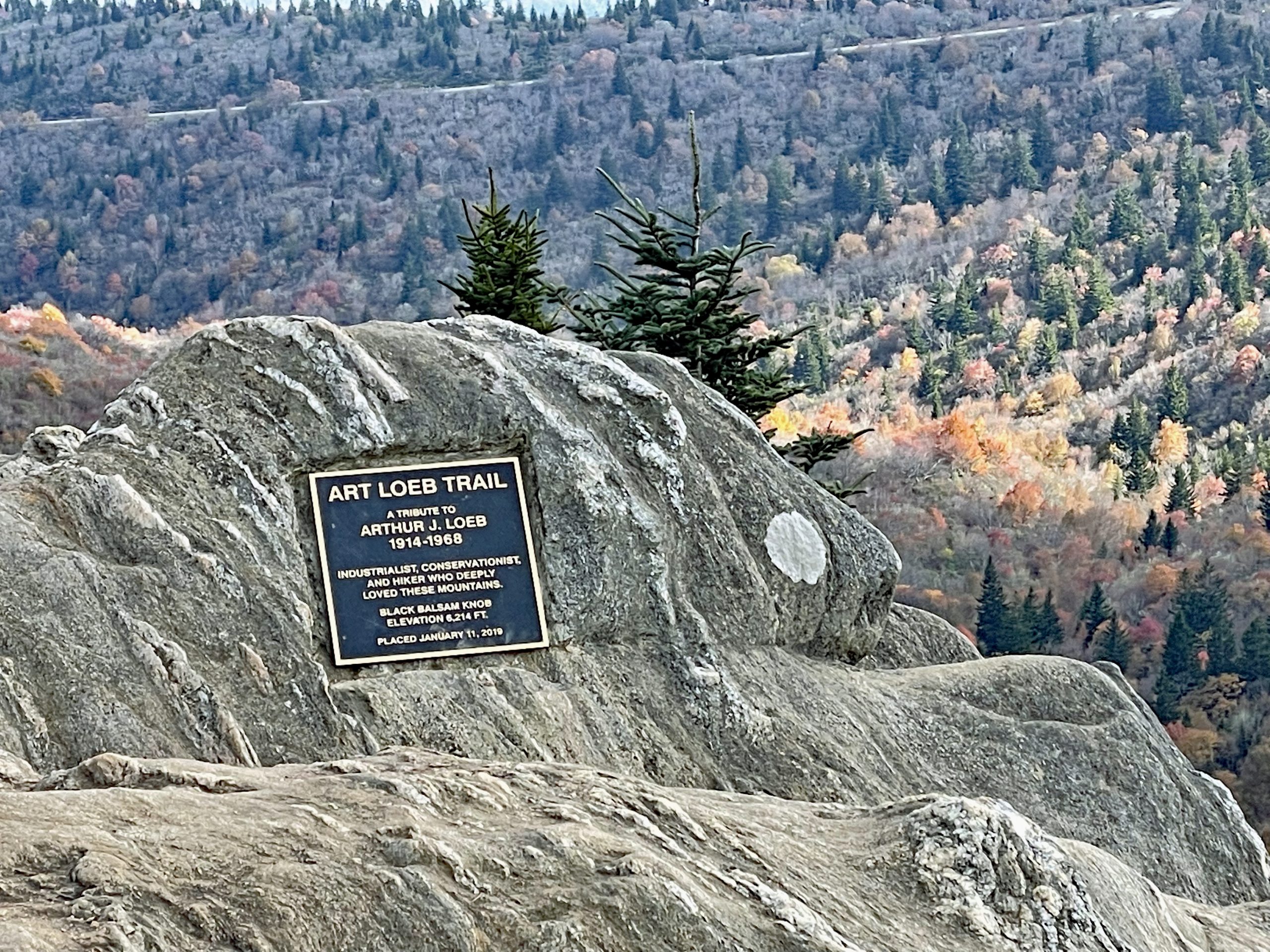
Art Loeb Trail to summit
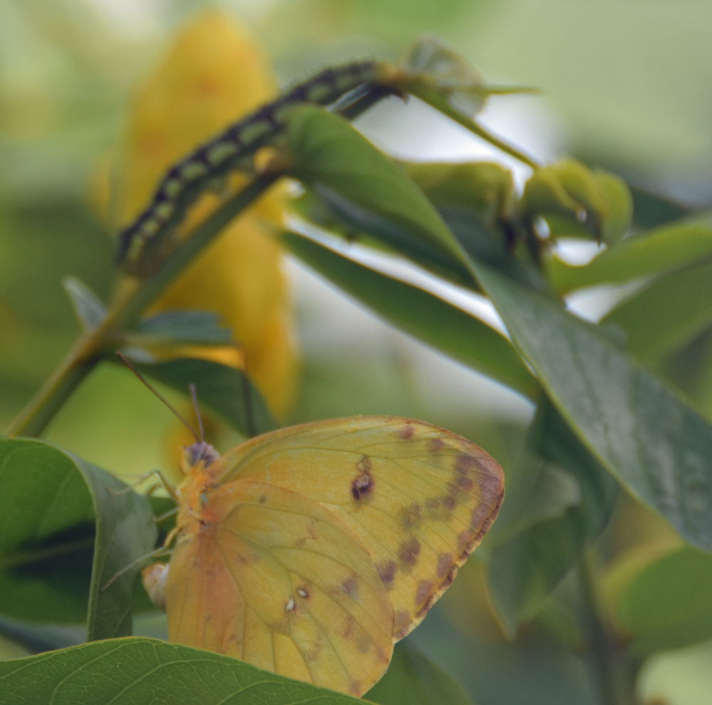
One of the first beautiful butterflies to appear in my garden 5 years ago was a Orange Barred Sulphur. I quickly did a lot of research on butterflies and caterpillars for my location and discovered that sulphurs are common. So, I continued my quest for more information about their species to include their host plants which are Senna or Cassia plants. The Senna plant comes in a variety of species. I started by buying native senna plants and my rewards have been beautiful.
This year the sulphur butterflies have been especially abundant in number. Daily sightings of a multiple sulphur butterflies bring beautiful brightness and childhood wonder in my garden. I have planted a variety of senna plants over the years and even grow them from seed now. My Sulphur butterflies really enjoy Candlestick Senna, Bahama Cassia, and Privet Senna. And the plants have beautiful bright yellow flowers bringing a extra beauty to the garden. I enjoy a the daily dose of observations watching the sulphurs butterflies.
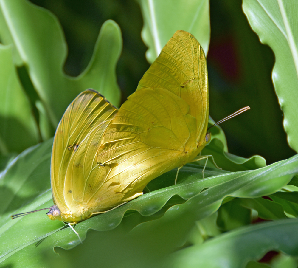
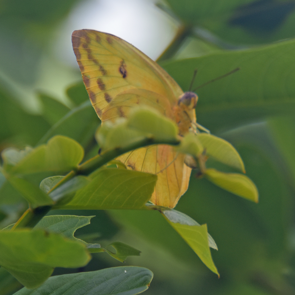
From early morning I observe sulphur butterflies flying low between the plants ever so spirited. They appear to sense every leaf or plant they fly around, in and out like a beautiful angel. Recently I caught a photo of two mating on top of a large leaf of my philodendron plant. And one just sitting peacefully on a leaf of a Senna plant posing at me with her big twinkling eyes and alert antenna watching back at me.
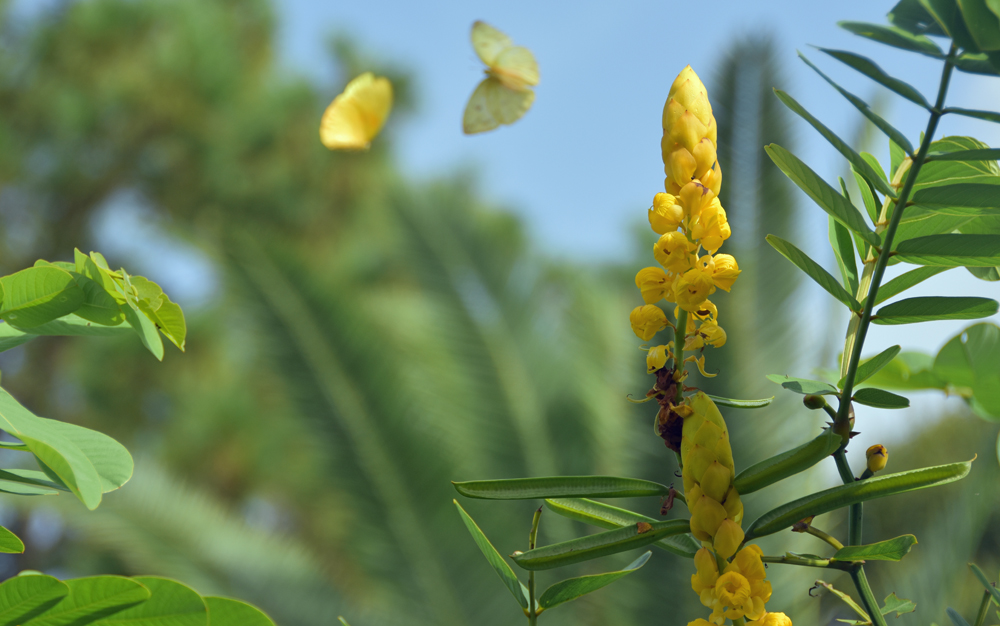
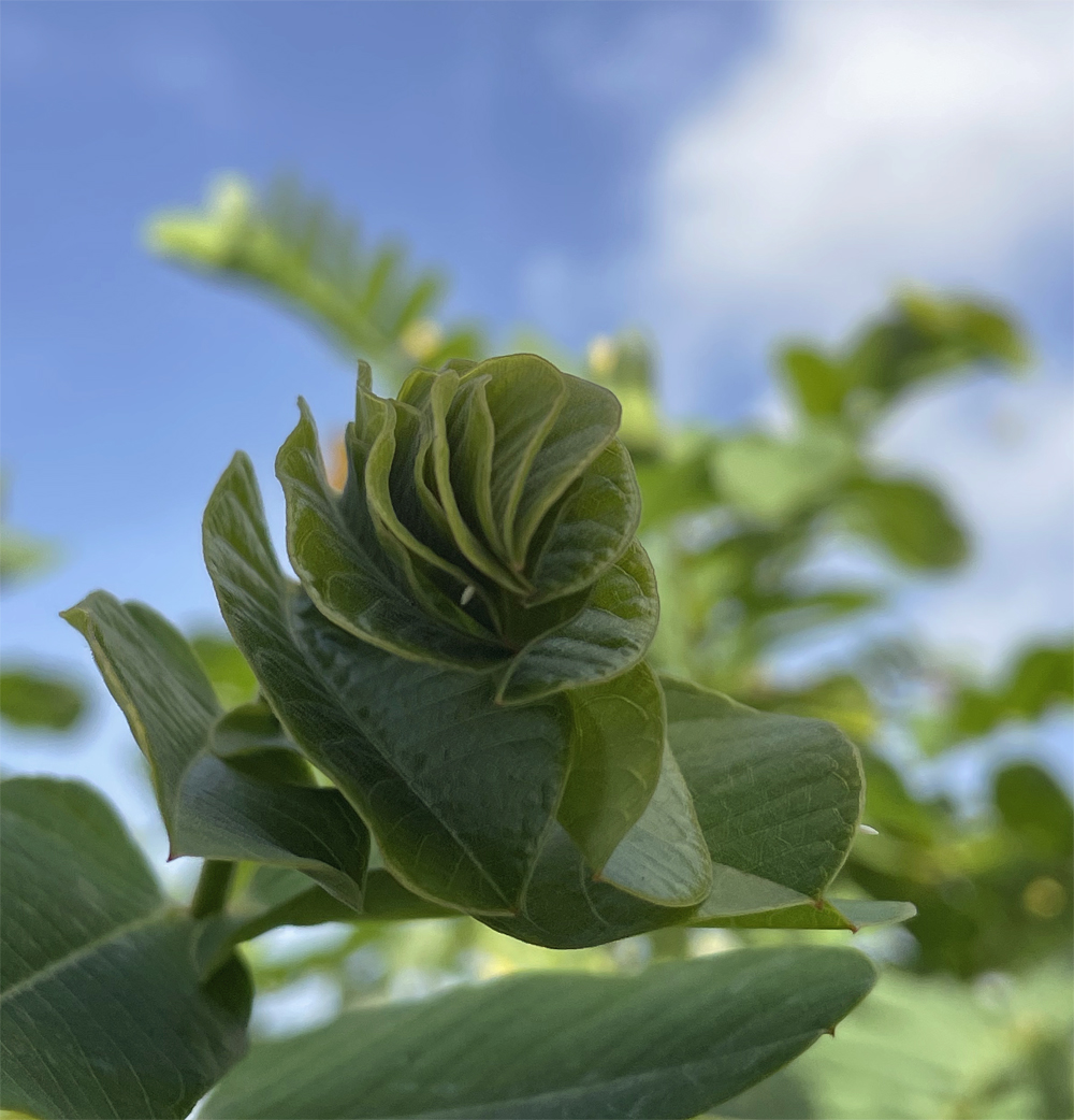
The Candlestick Senna (Senna alata) plant has grown beautifully in my garden. I started with seeds from last years seed pods, transplanted them as 1 gallon plants and now my Candlestick Senna is an 8 foot tree with a tropical appeal. The senna has multiple branches with veined green leaves that unfold like a fan and spread out into a thick branch with an abundance of yellow brightly colored Candlestick spires. There are multiple small yellow flowers filling each spire. This seems to be a favorite plant for sulfur butterflies to use as host plant. The beautiful yellow flowers attract other pollinators who love the nectar as well. But the ants sure do enjoy tracking up and down the Candlestick tree, my research says nectar glands below the leaves attract the ants and unfortunately many sulfur eggs do not survive. Nature has quite a interesting way of balancing itself…..but that’s another blog post.


WOW…the spring and summer of 2022 has been very active season in my garden for butterflies and other pollinators as I expand and expand my plants some more…. everyday in my garden is grounding to the maximum! Nurtures my soul, bring such joy back when life gets filled with daily chaos!
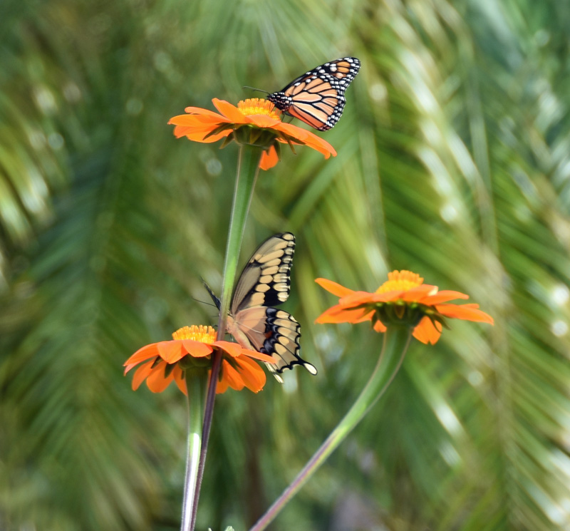
The Spring started out with growing plants from seed and learning about each plant species. I keep a spreadsheet of all plants I grow in my butterfly garden. Adding new plants brings different species of butterflies also. Each butterfly species has host plant preferences to lay their eggs on. They also have nectar plant preferences which I observe in the garden. Believe it or not they each have there own what I call personality. For example the Monarch Butterfly loves milkweed and senses it what seems like miles away. As soon as I plant or start growing milkweed there’s a Monarch who suddenly flies in to check it out.
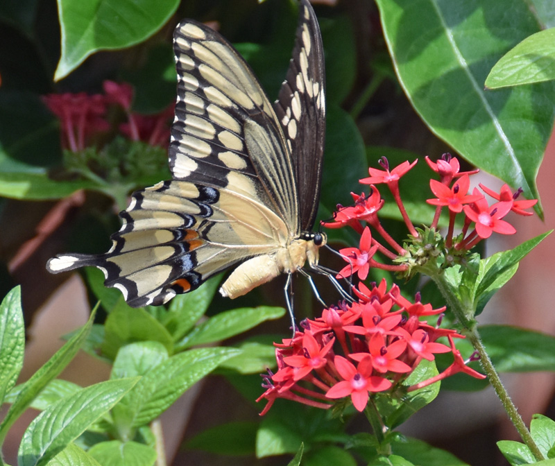
On any given day you can visit my Butterfly Garden and observe 10 different species of Butterflies. Some stay most of the day while others like the Giant Swallowtail Butterfly visits, lays eggs, enjoys nectar then flies away with beauty and grace. But the Black swallowtail swoops in on my fennel, parsley lays eggs, enjoys nectar on my plants and often I don’t observe there presence but find their eggs and cats on my herbs. There is always something to observe in my butterfly garden.

Species that are observed on most days are Monarchs, Orange Barred Sulfurs, Swallowtails, Zebra Longwings, Skippers, Gulf Fritillary, Dusky wings, White Peacocks, Cassius Blues and others less frequently observed (I’m not in the garden 24 hours a day) Red Admirals, Queens and Hairstreaks.

One of the most eloquent butterflies to observe in my garden are the Zebra Longwings. They flt around plants in the garden gracefully with their long narrow wings are black with pale yellow stripes. Butterfly Fun Facts: zebra longwings or zebra heliconian are the State Butterfly of Florida. They like other butterfly species have their favorite nectar plants like Lantana. The females lay eggs on Passiflora or passion vine plants as their host plant. Another fun fact I learned is that zebra longwings can also feed on pollen unlike other butterflies who strictly sip on nectar. They have a specialized ability to dissolve pollen in their mouth parts. I observe them slowly flying in and our of my arbor and garden plants frollicking and playing with each other. You’ll enjoy a morning or afternoon sipping a coffee observing these graceful butterflies.
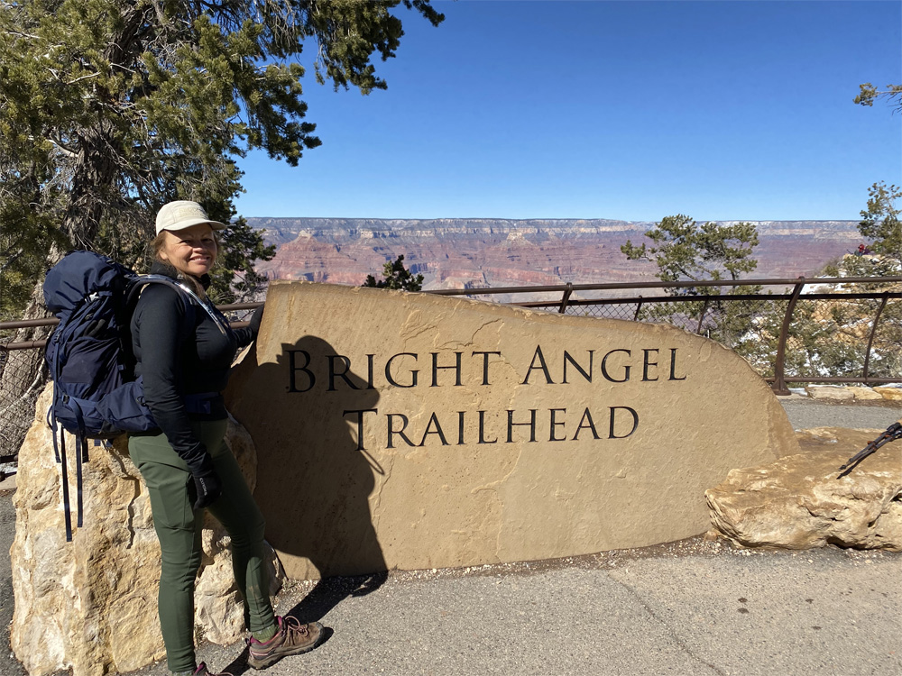
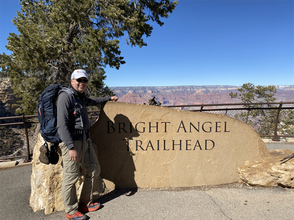
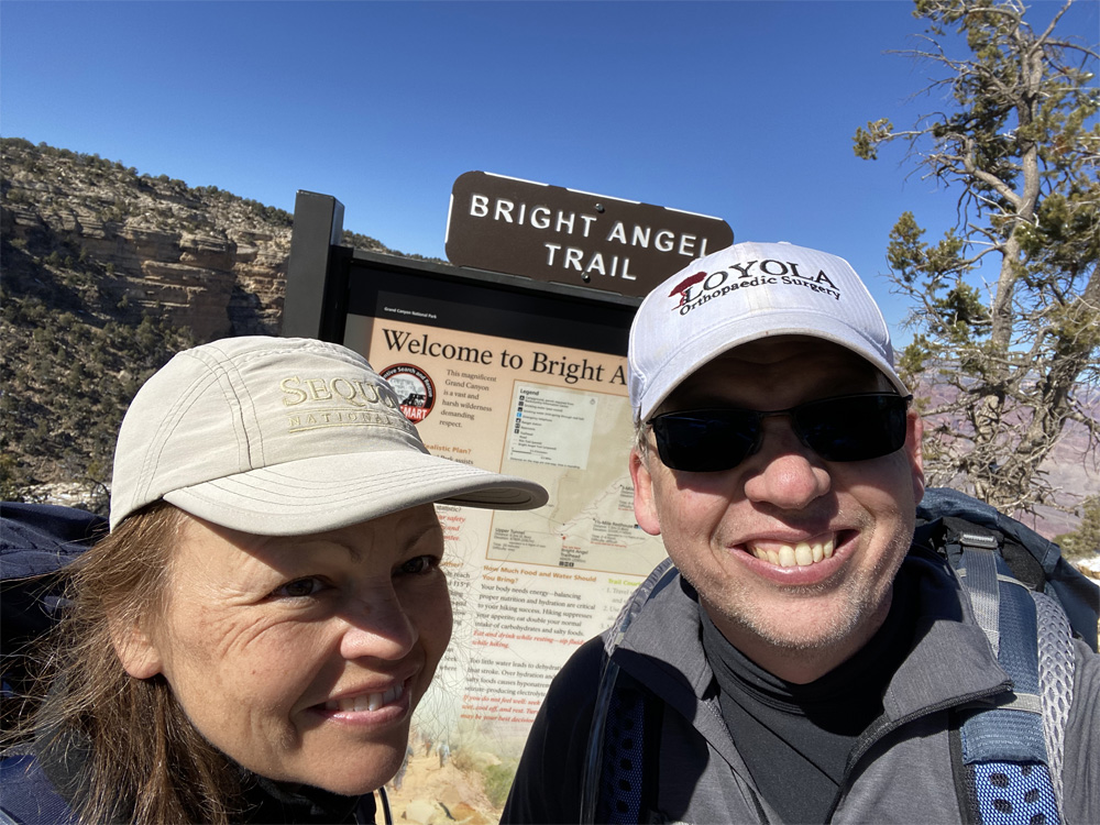
Ascending the BRIGHT ANGEL TRAIL
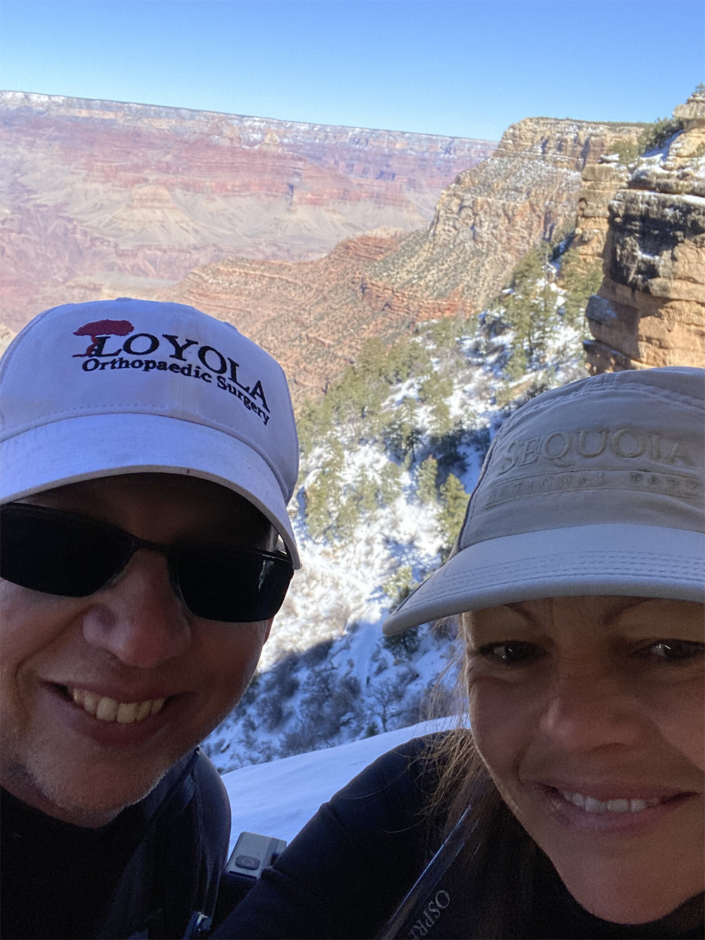
After a restless cold night sleep in our tent, we started to arouse a little after 4:30am (7:30 back home). But with the frigid weather we stayed bundled in our sleeping bags until almost 5am when we unzipped the tent. Our eyes were dazzled by the abundance of stars that filled the skies all around us. Looking up at the 360 degree view of dark clear starry skies was mesmerizing and stimulating. As we gazed at the skies, we walked over to the Canteen for breakfast to prepare us for our journey back up to the South Rim. We sat at a picnic table outside the Canteen and ate an early deliciously warm breakfast of pancakes, scrambled eggs, sausage and hot maple syrup with a hot coffee and tea to warm up from the 32 degree night.

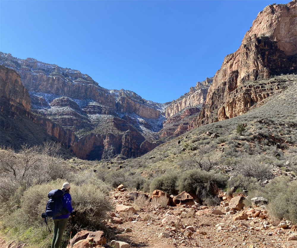
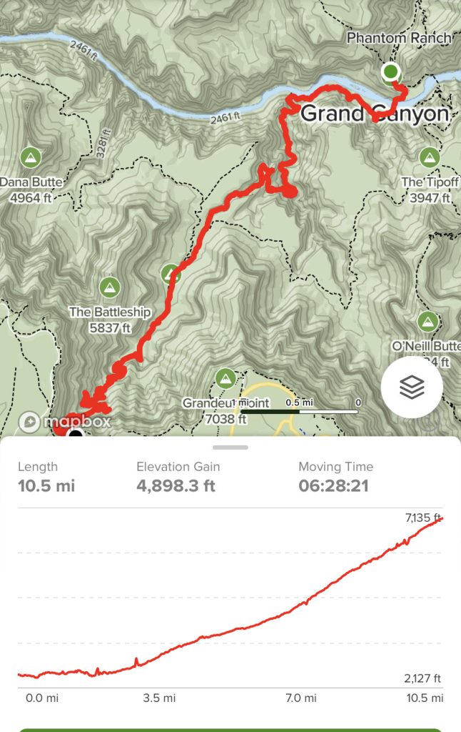
We enjoyed the walk back to campsite with a peaceful awakening of our day. The gentle sound of the creek water flowing, campers waking up, nature stirring with clear blue sunny skies. No sign of a cloud in the sky but 32 degrees is chilly for us southerners. Now was time to take down our campsite and compress our gear back into our backpacks. About 90 minutes later we were packed up, took a few photos of the campground, loaded backpacks on our backs and set out for the Bright Angel Trail, our 10.5 mile ascending hike, a 4,400 feet elevation climb to the top of the South Rim. Our legs and bodies were feeling good after the over 8 mile hike down the canyon from the day before and spending the chilly night in a tent.
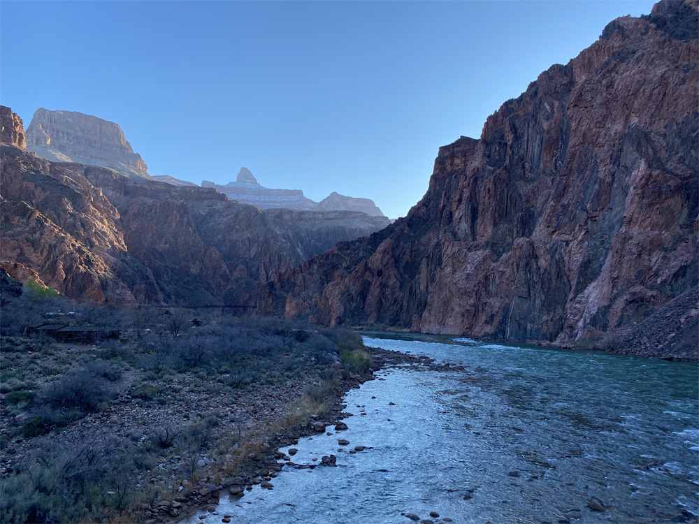
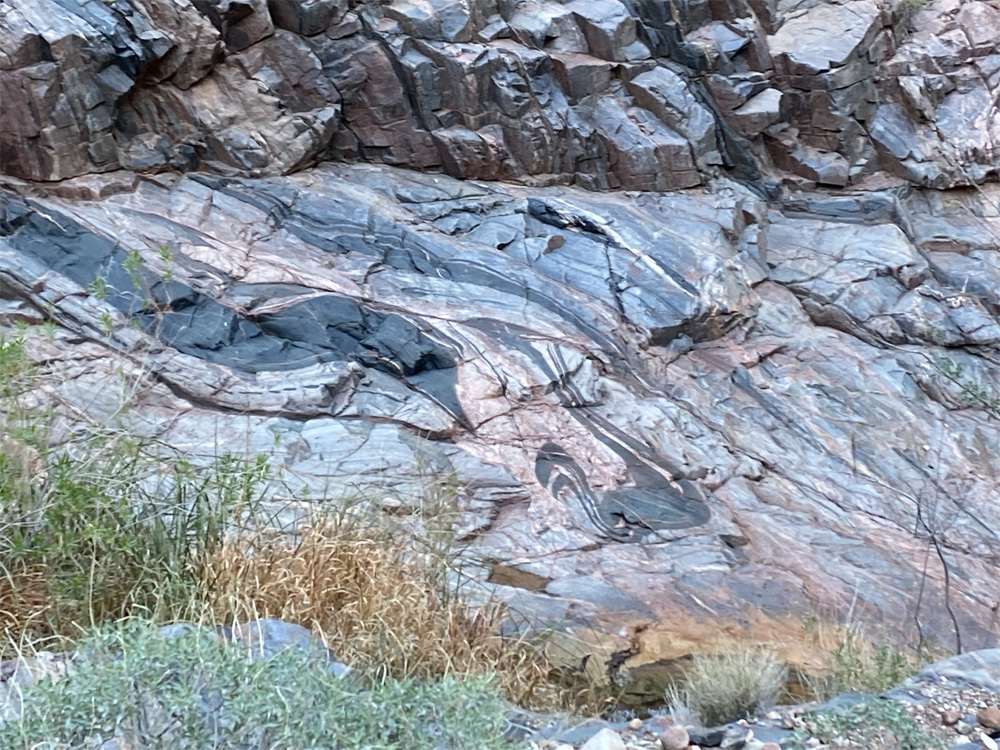
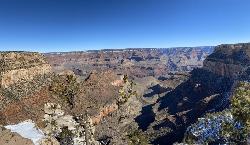
The walk to the Colorado River took about 10 minutes, we were taking in the views of the inner depths of the canyon along the way. The bright blue clear skies were shining on the walls of the canyon creating interesting shadows and colors along the trail. The rock formations, colors and geology of the canyon are really amazing to ponder and research further like John Wesley Powell and his explorers ventured down the Colorado River in 1869. How did they manage to maneuver themselves down this river so long ago? We were reading the book called the “Down the Great Unknown” on this adventure and wow what a journey to think about.

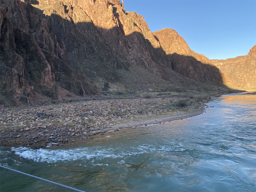
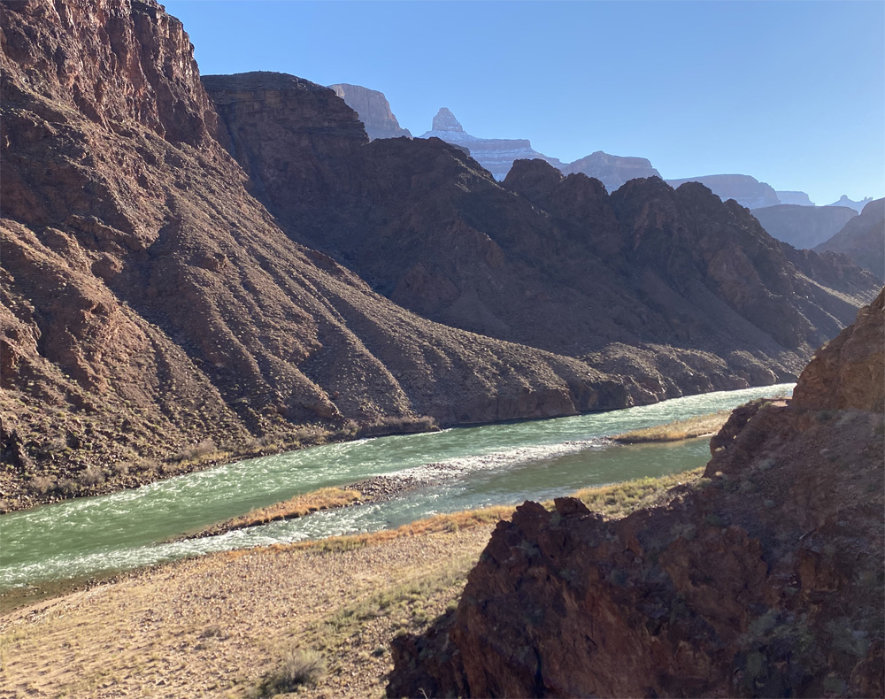
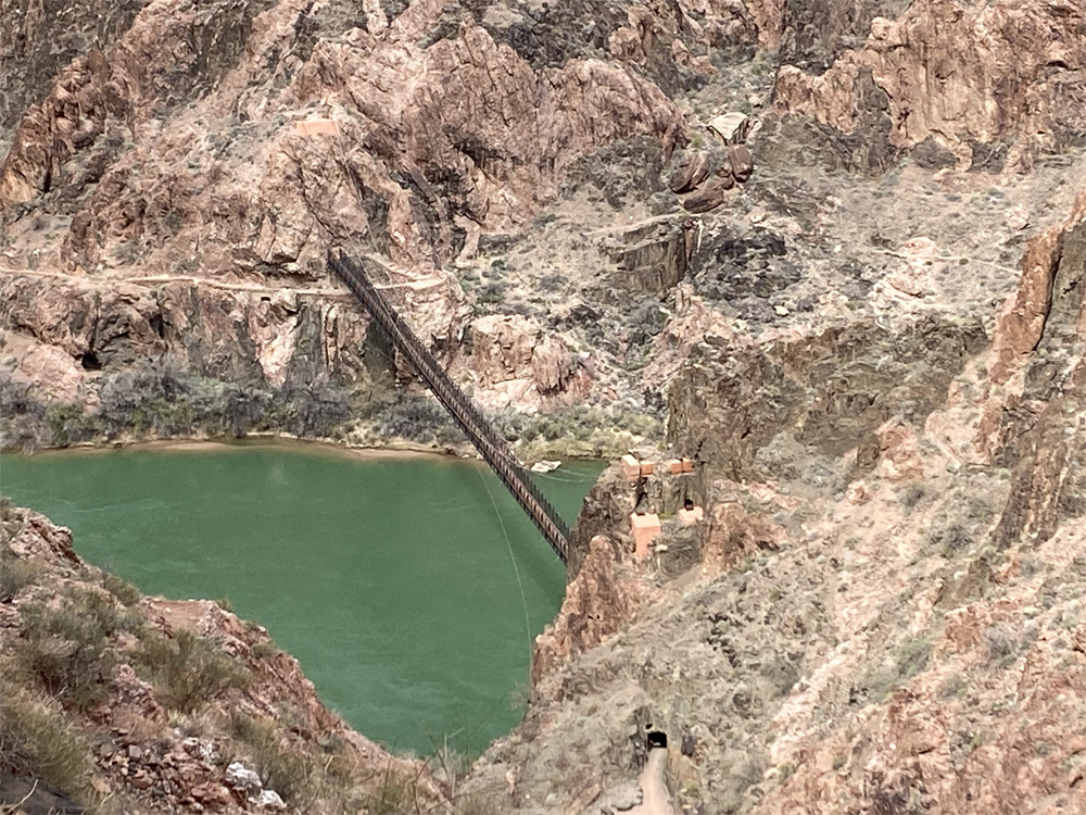
As we approached the Silver Metal Suspension Bridge (at 2,415 feet elevation) I recalled the length is just over 500 feet across with a metal mesh bottom so the river waters are visible thru the openings not like the sturdy Black Suspension bridge made of solid wood just 2,300 feet upstream. We were told the Mules are not fans of walking over this metal bridge, they prefer the wood bridge which blocks the view of the river below. I focused on our views as we got closer to the bridge, we had eye capturing views of the Colorado River which was a glistening emerald green, the water flowing with currents and beautiful ripple lines visible on the surface. The sun really allowed us to capture the rivers essence and beauty. Hearing the river currents flowing made me respect it even more from above…..a body of natural water filled with energy and life. I will let someone else explore the river waters as John Wesley Powell and his team did so long ago.
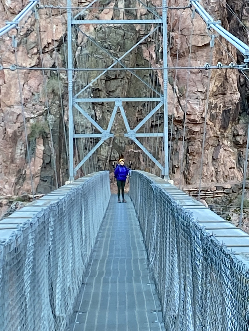
Walking across the bridge I could feel the movement and hear the clanging of the metal and see the water currents flowing below me. As I walked across I could understand the mules hesitation on crossing this bridge but power and energy kept me going. I stopped half way to take in the beauty, sounds and magic of the river and canyon itself. I thought about the name the “Inverted Mountain” and I could barely see in the distance where our 10.5 mile hike will lead us out of the inner canyon and back to south rim.

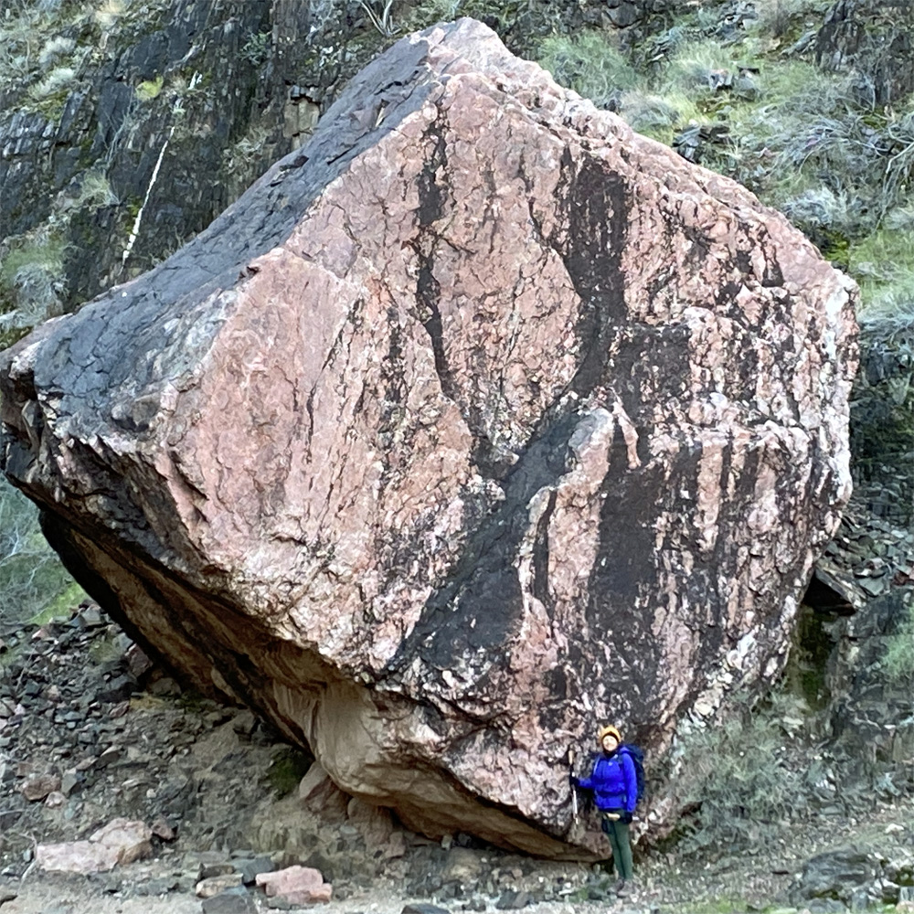
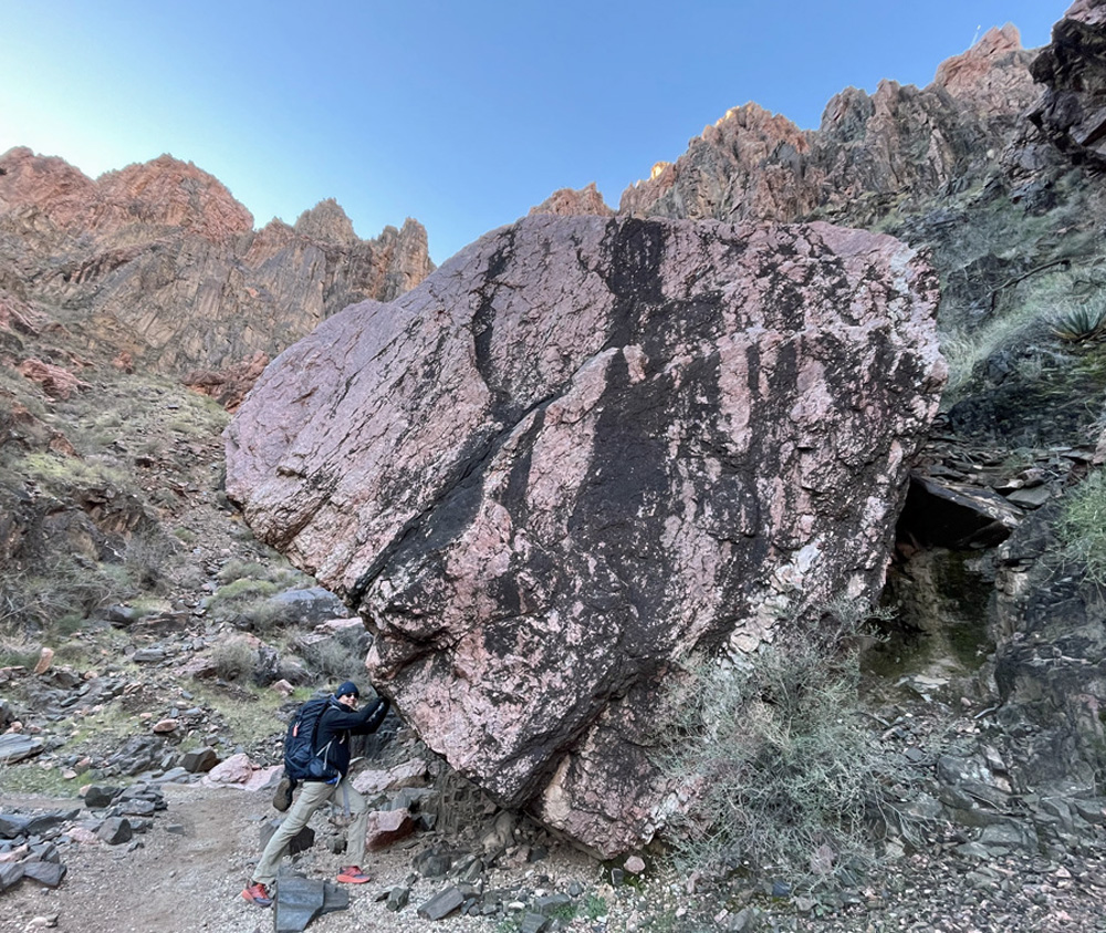
As we reached the south side of the river, the giant rock beach filled with different colors and sizes of polished rocks! I wonder how long ago did the rocks land here and how much tumbling they had sustained. And then I saw the ENORMOUS BOULDER I had seen on the IFIT series, looks even bigger in real life and the colors of the granite were glowing different shades of pink, black and mixed colors, as I stood next to the boulder I appeared to be a miniature person. And the rock formations behind the boulder were also glowing, bright colors and formations just amazing!
Exploring the River Trail along the south river gorge banks the trail gets quite sandy for a distance then turns back into a beautiful reddish dirt trail the along the river. We took in the sites of such an expanse of the canyon walls along the river trail. The beauty is just breathtaking and amazing.
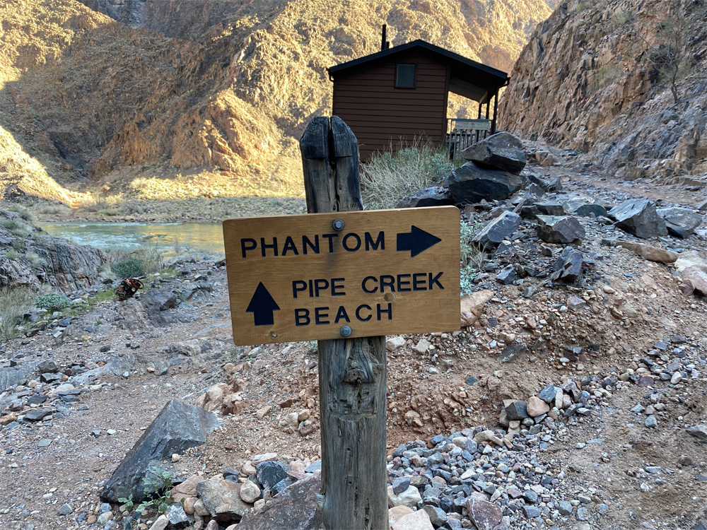
After about mile and a half we reached the mouth of Pipe Creek where is flows into the Colorado River. The elevation had minimal chance at 2,445 feet at this area. There is a sharp left 90 degree turn on the trail to switch to the Bright Angel Trail. To the right is a rocky pipe creek beach area next to the river. You can see the creek flowing gently into the strong river.
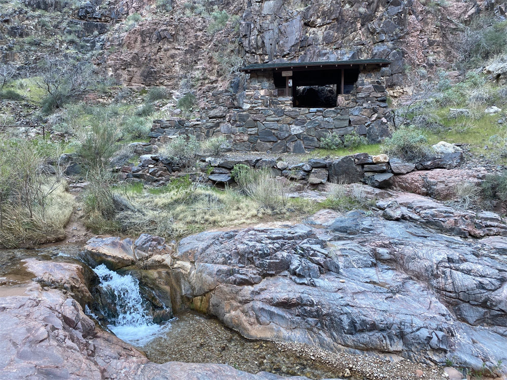
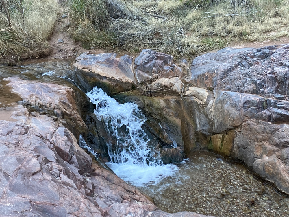
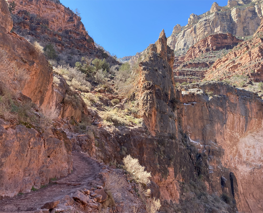
We turn left and and enjoy pipe creek at its best with flowing water and small waterfalls along with the beautifully polished granite brightly glowing. The rain and snow from the previous day had enhanced the sounds and views of our hike along this part of the trail. This is the gentlest part of the trail as the terrain begins to change with more with plant, grasses and vegetation life appearing. We make a couple gentle creek crossings across the rocks and pebbles.
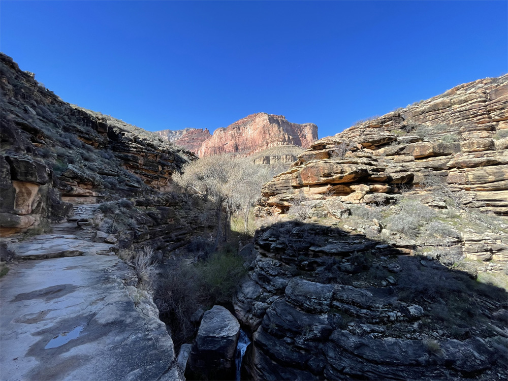
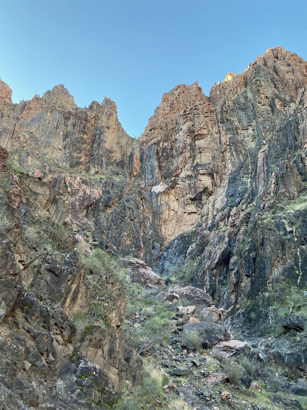
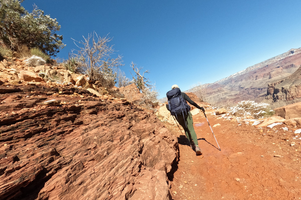
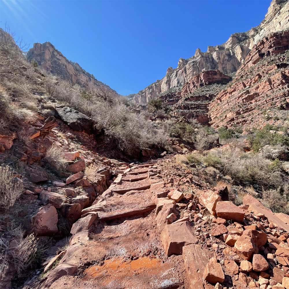
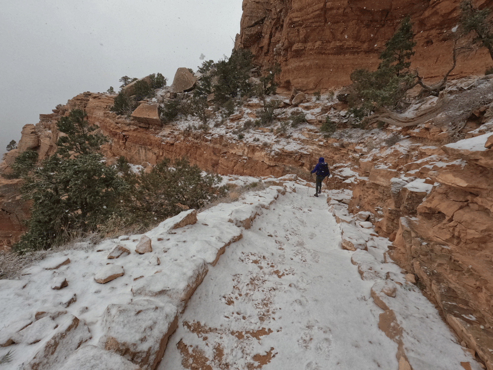
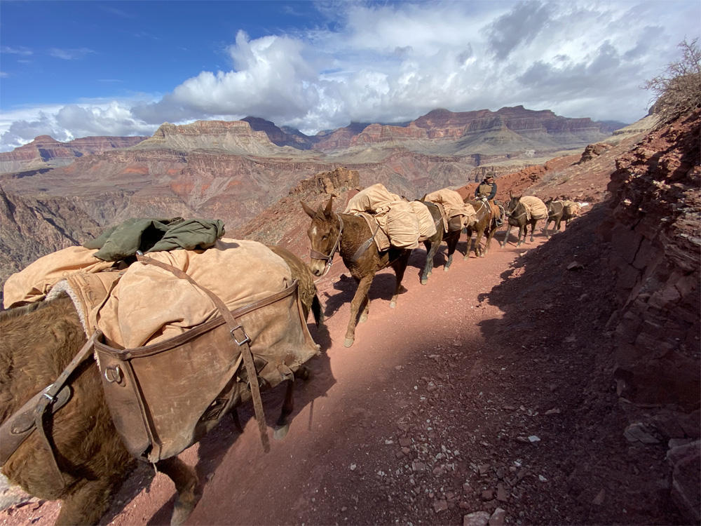
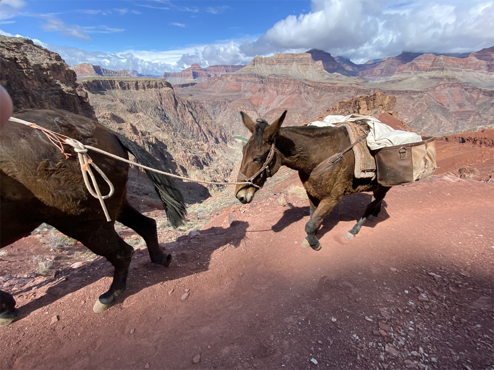
As we leave Pipe Creek we are on Bright Angel Trail, 2,936 feet elevation we hike on about 2 more miles where the trail begins to intensify a bit with switchbacks known as Devil’s Corkscrew. We hike thru changing rock formations from shale, sandstone, limestone. A mule trains comes from behind and passes us, the mules are big and can carry a lot of weight. They appear ever so gentle but move with a fast pace as they pass by. We catch up to them again as they take a stop. The vegetation changes again into plants, thickets, trees and whitish yellow sandstone walls of the canyon are immense.
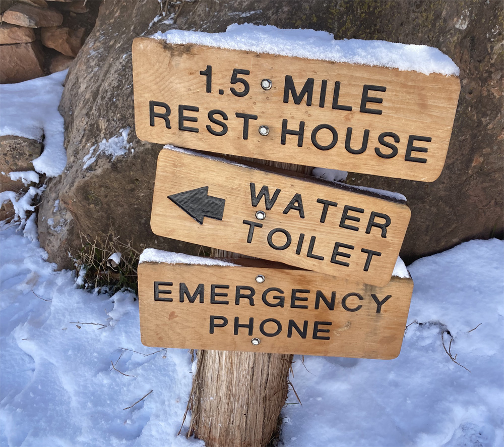
We reach Indian Gardens at 3,820 feet elevation, about 1500 feet of elevation gain and nearly 3000 feet more to go. The mules are drinking and resting under the beautiful tree site. The thermometer reads 40 degrees, sunny blue skies. We take an extended break (a whole 20 minutes) and enjoy the relaxing time with other hikers around, the views and a rock squirrel joins us too! There are benches, the rest house, the water pump house at this area. There is also a campground here for tenting. Temperature has increased 5 degrees since we arrived in Indian Gardens 20 minutes ago.
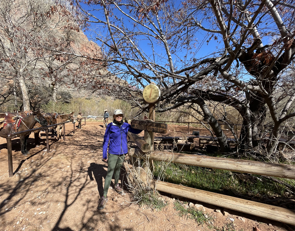
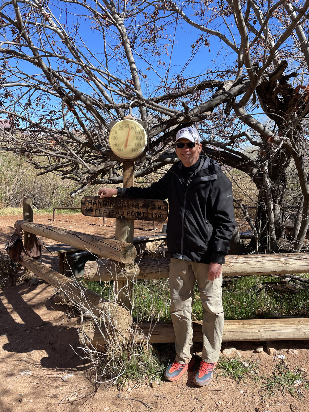
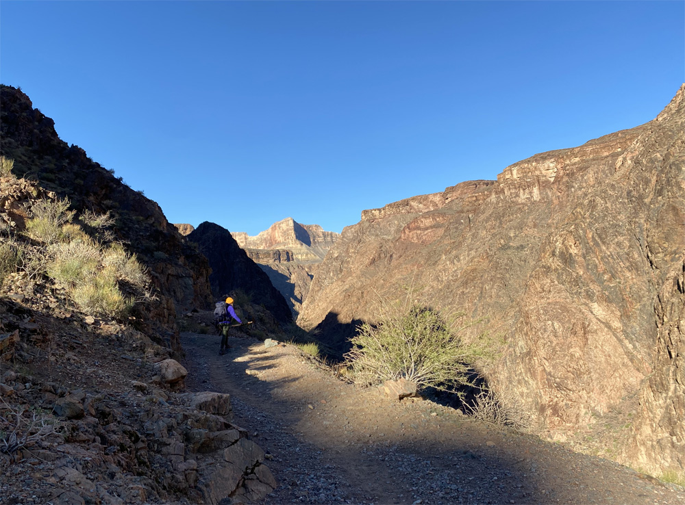
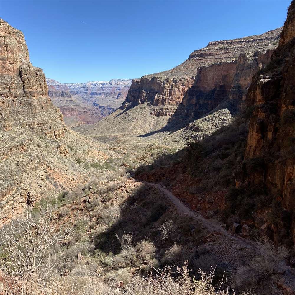
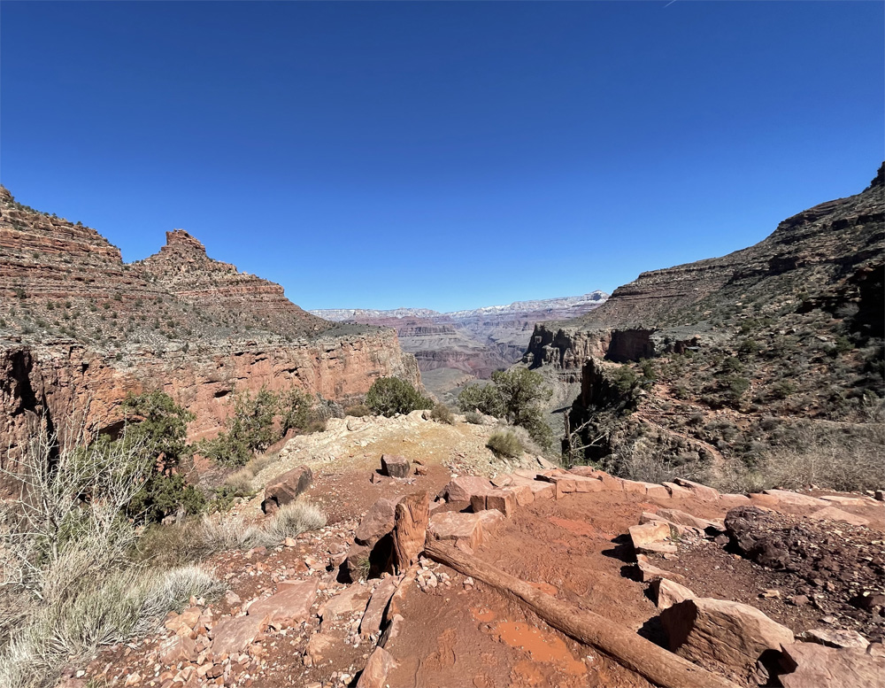
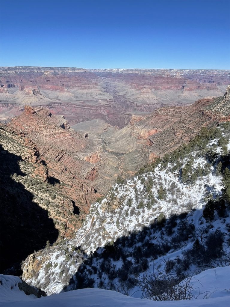
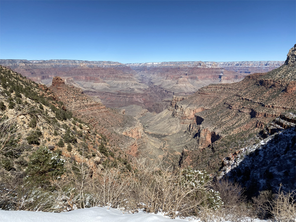
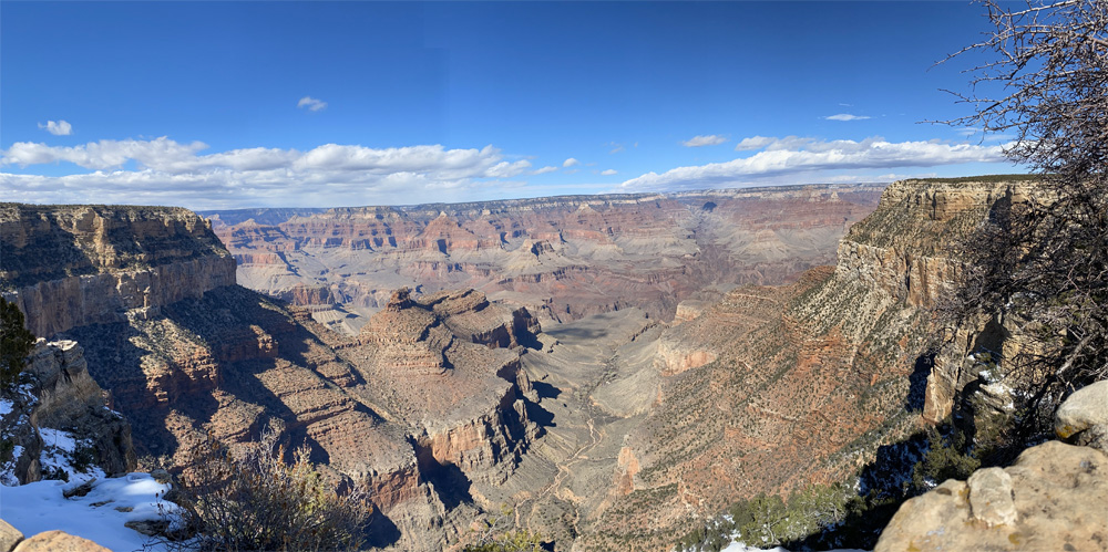
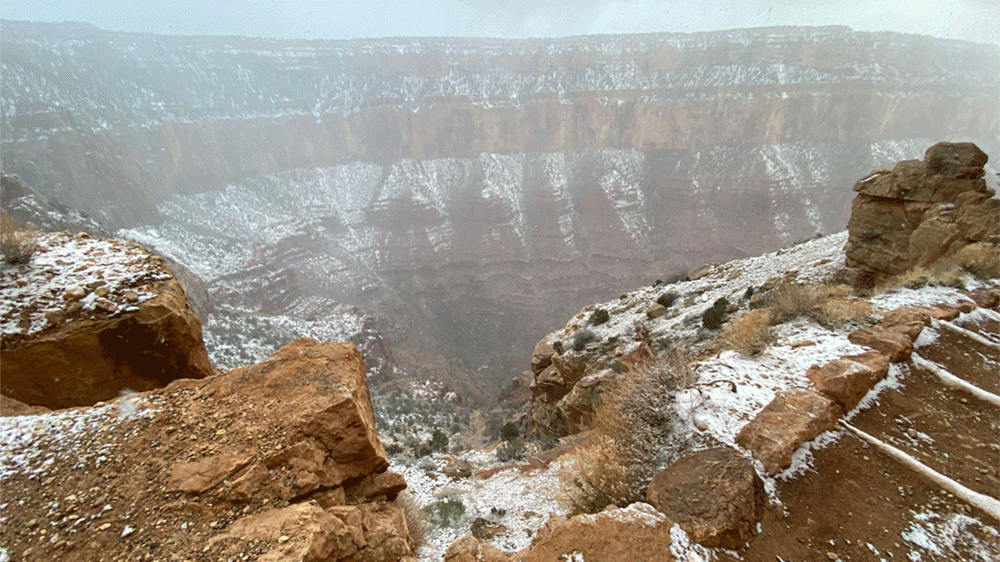
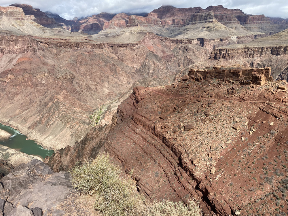
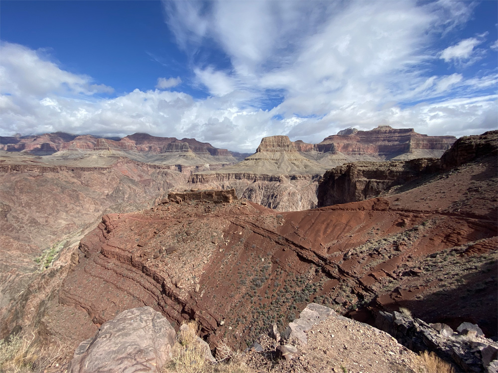
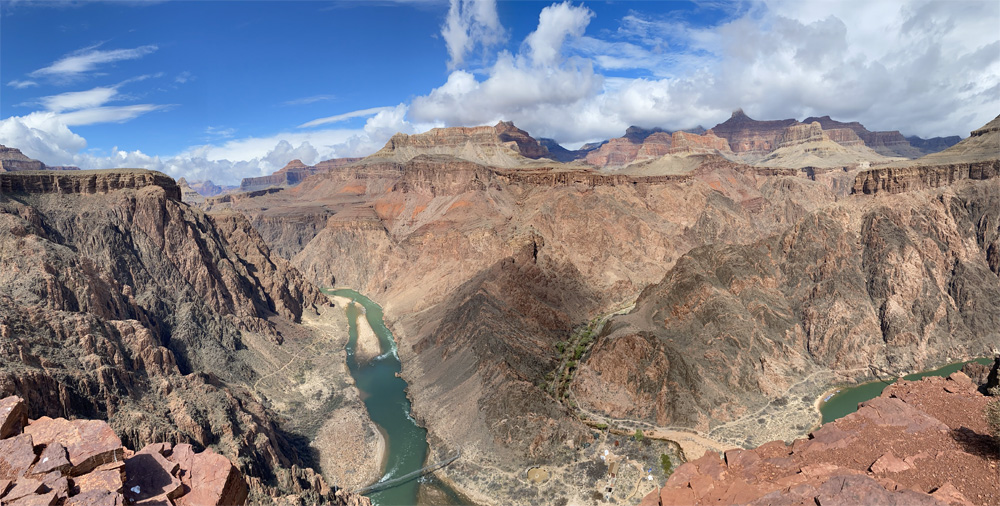
As we hike out of Indian Gardens, we see the sign that says 4.5 miles to go! Don’t let that sign tease you, we have over 3,000 feet of elevation to climb. Soon we will reach the steepest part of the Bright Angel Trail. But for now the 1.5 miles out of Indian Gardens is a gradual climb. We see distant views the top of the South Rim. As can be seen in the photos, our goal is the top of the rim where the left and right walls meet in the middle of the photo.
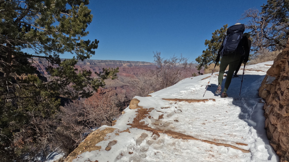
After this gentler part of the trail, we meet the switchbacks with grand views of where we had hiked. Just amazing to reflect on the beauty of the canyon and feel its majesty.
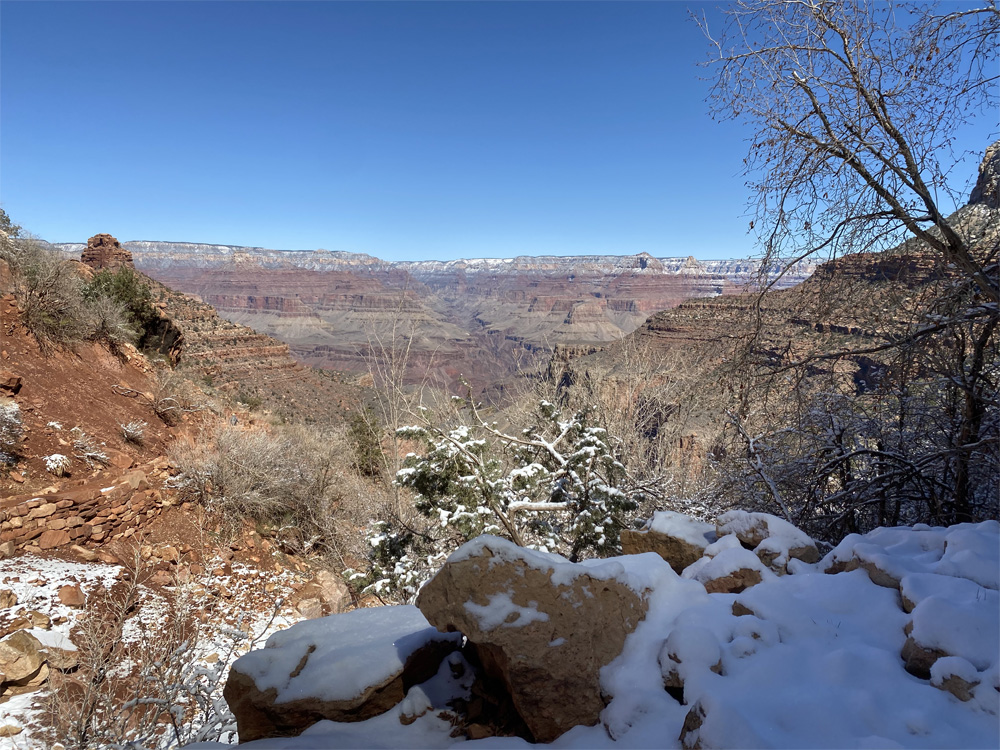
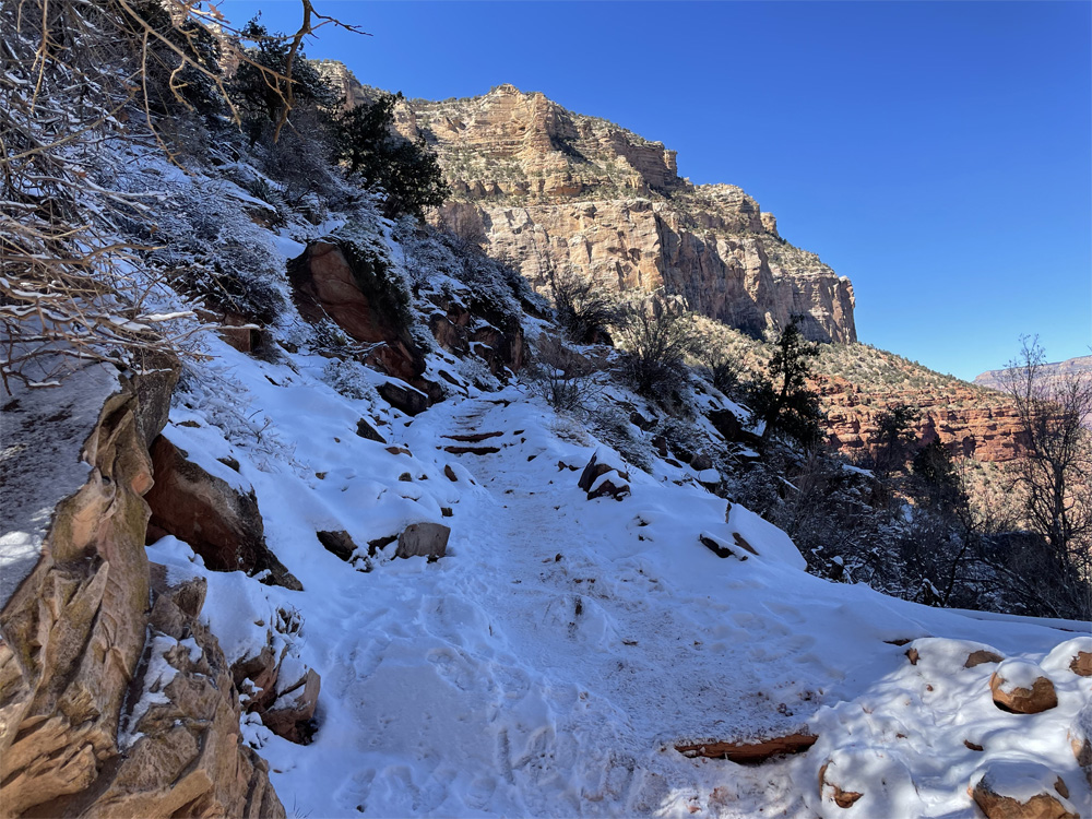
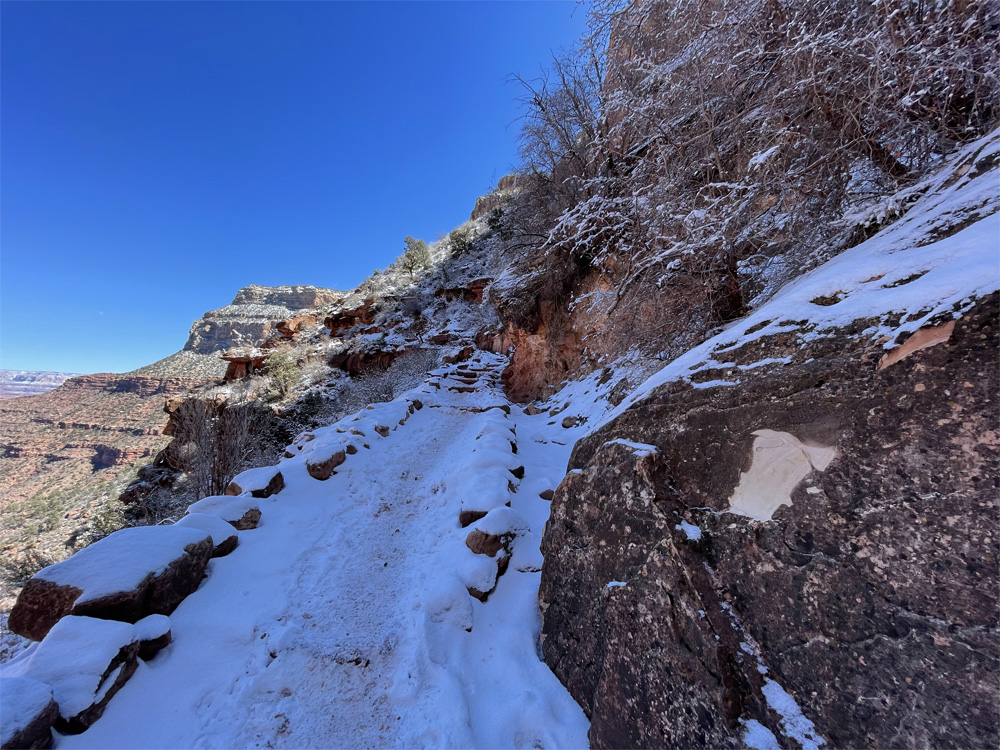
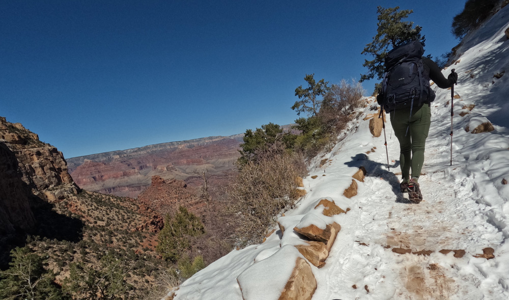
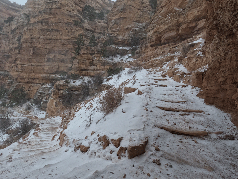
And the trail gets steeper and steeper with muddy switchbacks and puddles covered with ice. We can see the remaining snow covering the upper part of the canyon as we climb further to 3 mile Rest House, 4,732 feet elevation, just over 2,000 feet to climb!
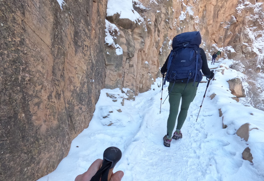
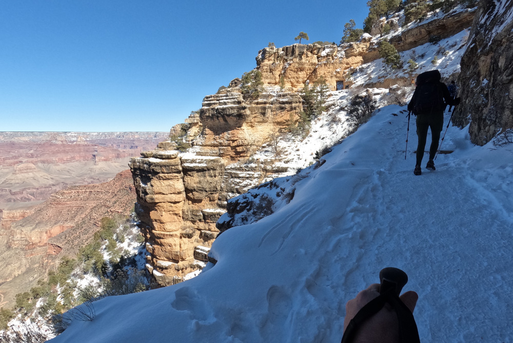
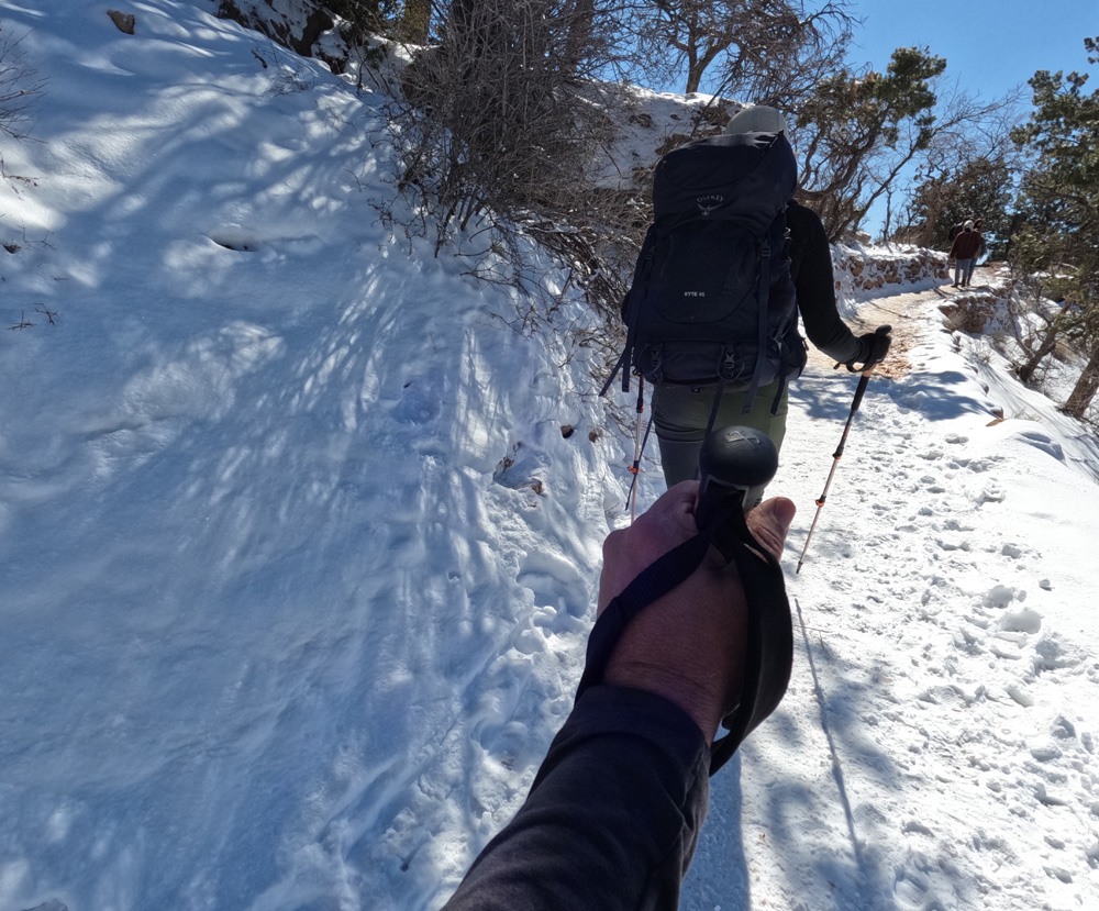
Time to get those micro-cleats on our hiking shoes as the trail turns to snow packed and icy nearing the 1.5 mile rest house at 5,695 feet elevation. Kyle’s happy as that gets rid of 2 pounds out of his backpack. Its a winter wonderland, the trees and ground are covered from yesterdays fresh snow but getting colder and colder as we climb higher. The most intense part of the trail is the last 1.5 miles, steep and elevation gain of 1,246 feet, the micro cleats make the trail safer along with our trekking poles.
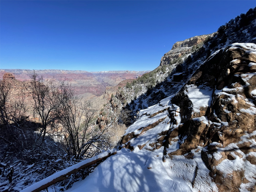
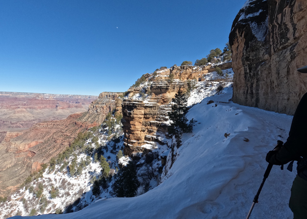
The views of to the North rim and where we have been are stunning. You can see in the photo the trail all the way to Indian Gardens and then the “drop off” that leads to the Colorado River and the Bright Angel Campground. It is amazing that we have traversed this far. We keep climbing keeping our momentum going with our backpacks we hike on. At this point in the trail it was a balance of rest and keeping the body moving as we didn’t want to tighten up or get cold, but it was impossible to not pause and soak in the beauty of the Grand Canyon.
This part of the trail is more congested with tourist hikers not as respectful of other hikers so we keep eyes on the trail. One down hiker slipped on the ice by Kyle’s feet landing flat on his back. Fortunately he didn’t take out Kyle on his fall.
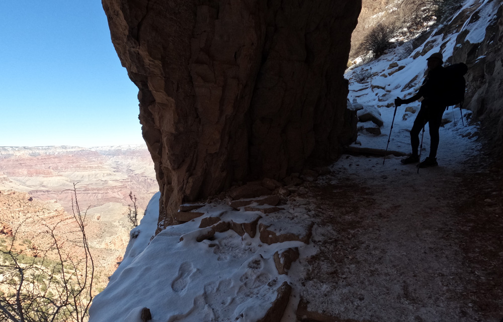
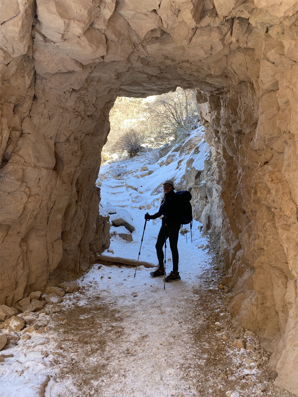
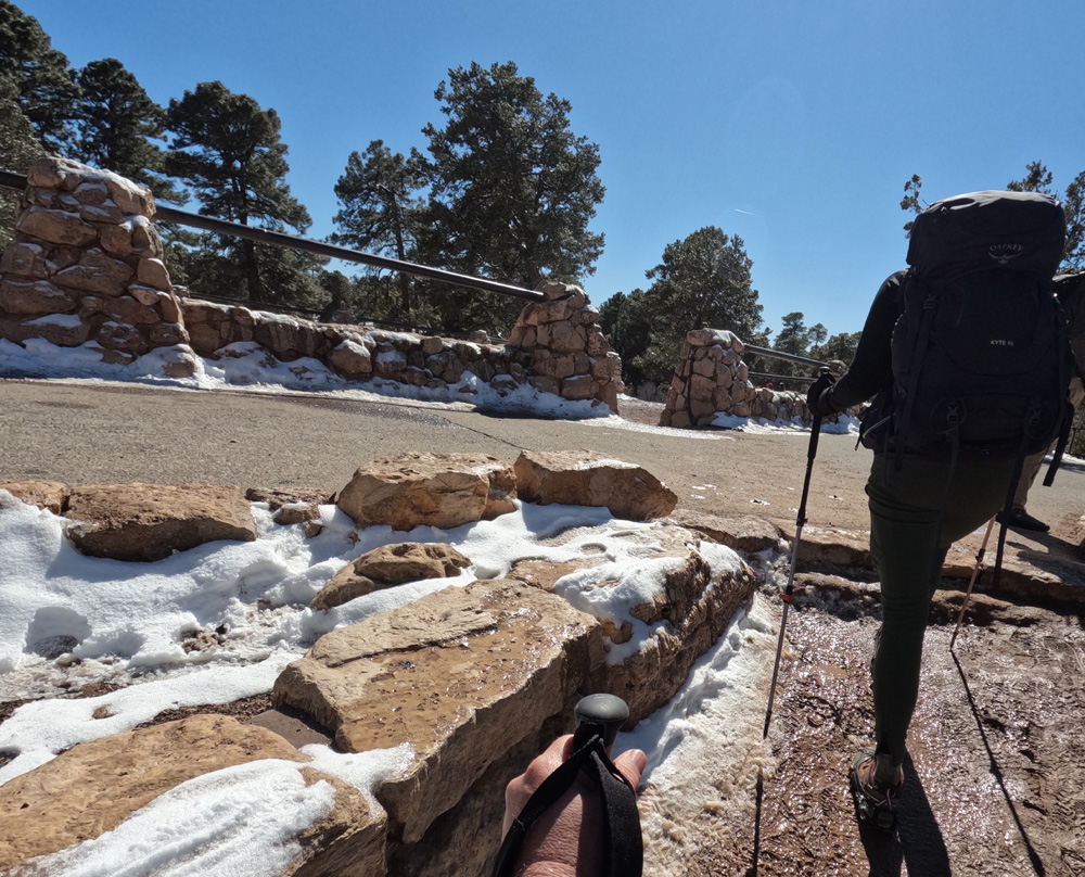
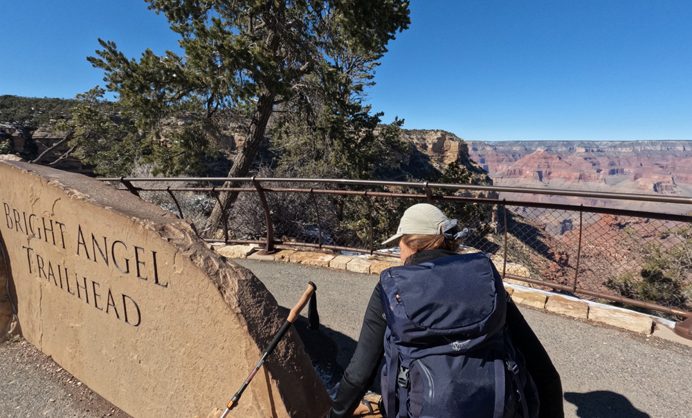
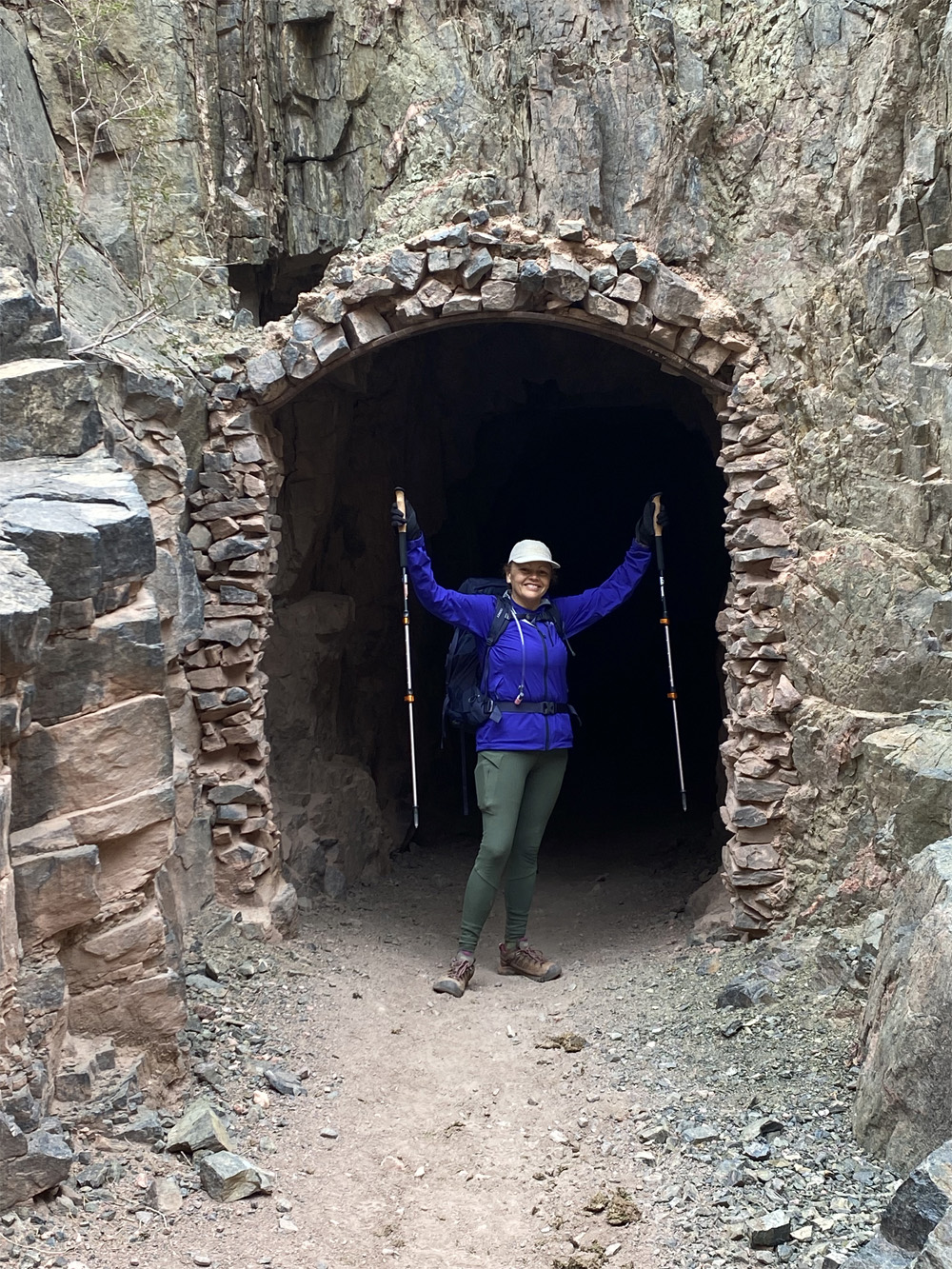
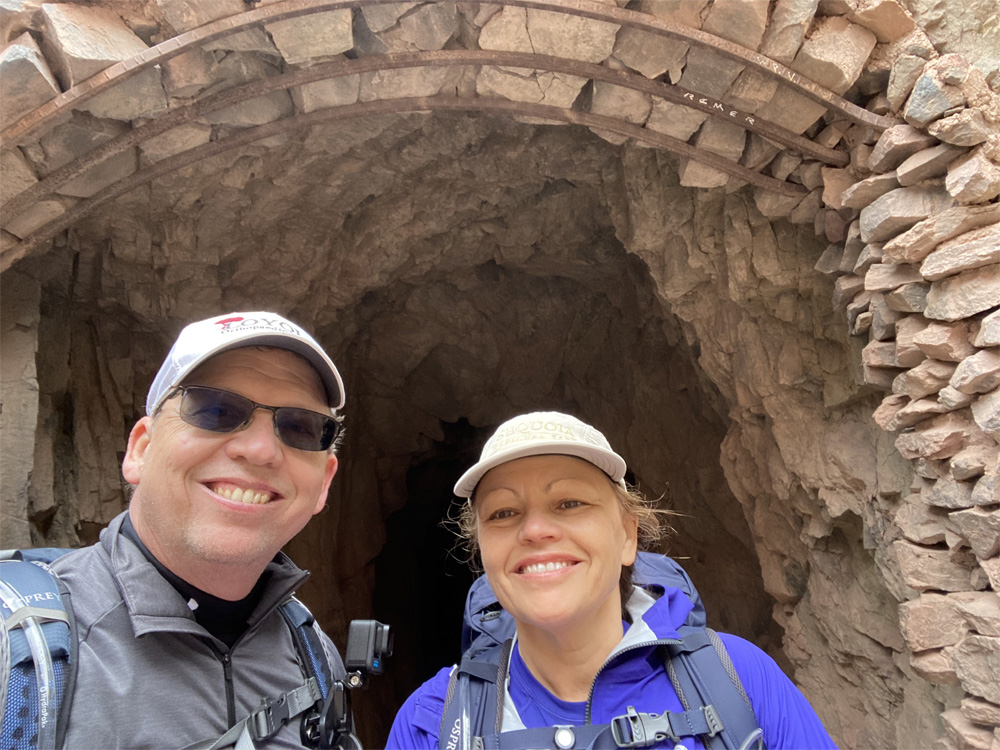
We hike thru the 2 tunnels near the top of the trail and reach the South Rim. We did it. The elevation at the top is 6,841 feet! Over 10 miles of hiking and 4,400 feet of elevation gain.
Other Links:
Video of our climb out the canyon
Video of our climb into the canyon
Blog Posts: Our Decent, Our Equipment, Preparation Part 1, and Preparation Part 2
Kyle’s Google Earth Videos: Decent, Ascent
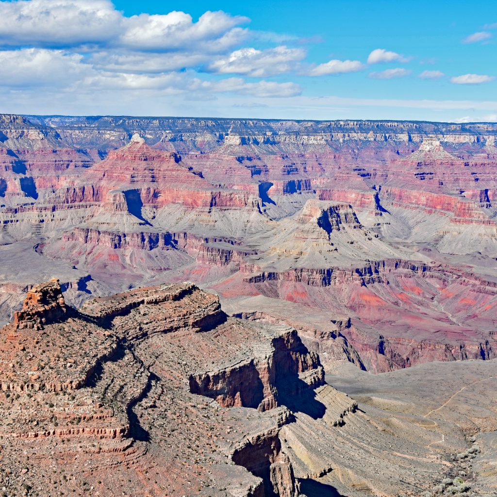
Descending the SOUTH KAIBAB TRAIL
This is a story about myself and my husband Kyle taking our First Backpacking Hike in one of the most amazing natural places on earth. And if you guessed The Grand Canyon, Arizona, USA…Then you were right! The “mountain lying down” defines the canyon as Native Indians gave the name “Kaibab” to the Grand Canyon. I like thinking about the Grand Canyon as an inverted mountain as we hiked with so many layers of different rocks dating back millions of years ago. As you hike further into the depth of the canyon just imagine climbing a vertical mile of depth into the earths core.
After months of planning, research and training we arrived at the Grand Canyon early March for our 3 day stay which included 1 night tenting at Bright Angel Campground down in depths of the Canyon and 2 nights on the South Rim (before and after hiking).
We settled into the El Tovar Hotel for the first night, a wonderfully rustic place filled with history located on the edge of the South Rim within the Grand Canyon National Park. The afternoon temperature was 46 degrees and partly sunny. The next day’s forecast was snow the day for our hike then turning into rain as we descend deeper into the canyon. So we asked ourselves do we go for it, this is not something you can reschedule. A Back Country permit is required to spend the night at Bright Angel Campground which must be applied for 4 months in advance. We received notification in November that we got the permit for March. So we got ready as scheduled and watch the weather in the morning with the understanding of weather changes.
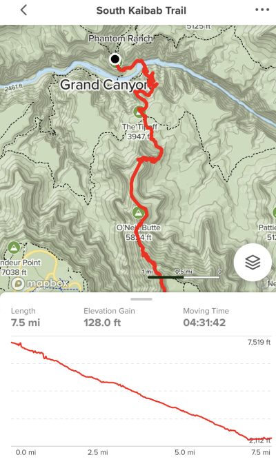
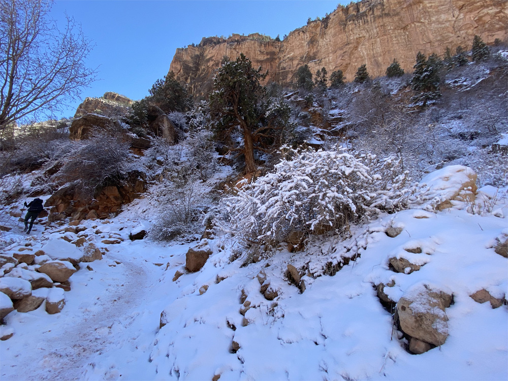
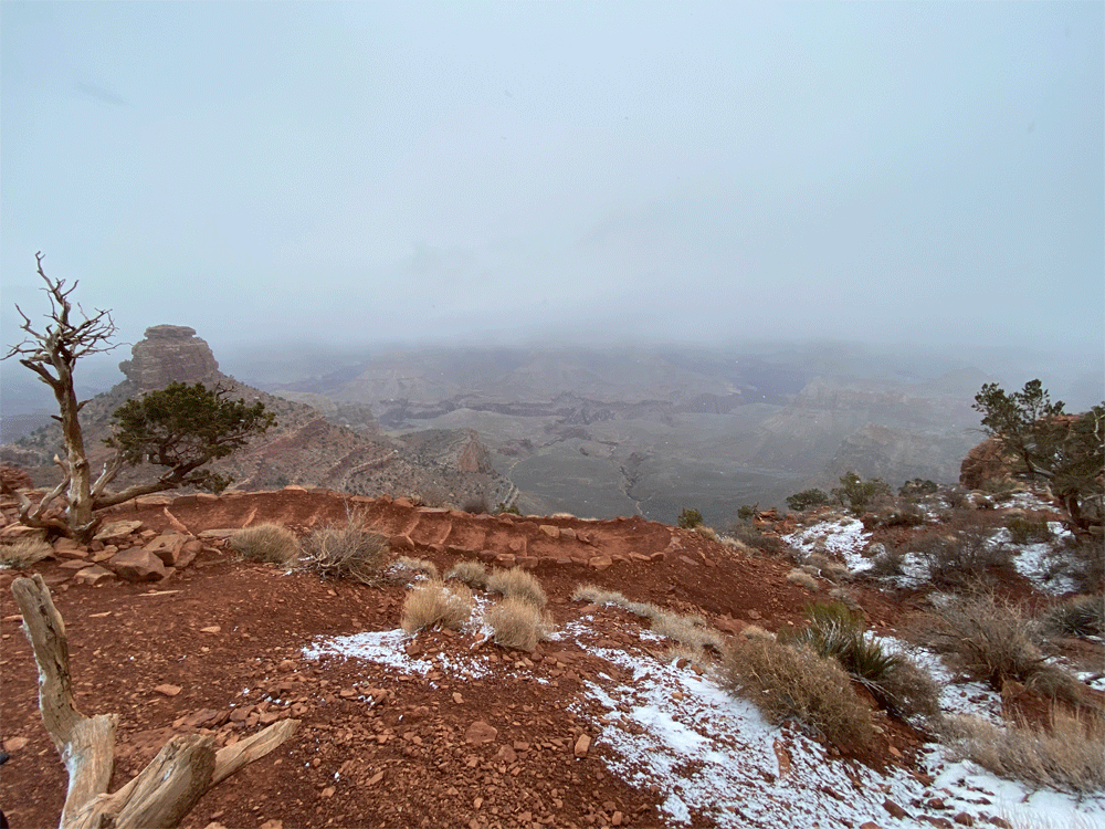
We woke up early the next morning, the temperature is cold but no snow yet, we finished our last minute packing of our Backpacks and headed out to catch the early bus to the South Kaibab Trail. After almost missing the bus, we got on for a 30 minute bus ride to the South Kaibab Trailhead. There were a few other Hikers onboard with us. As we got closer to our starting point, snow flurries started. By the time we reached the South Kaibab Trail Head snow was really falling down with fair visibility of the trail and the inner canyon. Without the glorious views we expected but beautiful snowflakes, we put on our micro spikes causing our hands to feel colder and colder, we grabbed our trekking poles and started down the snowy, icy trail with gusty winds making visibility limited. Our starting elevation was 7,208 feet!
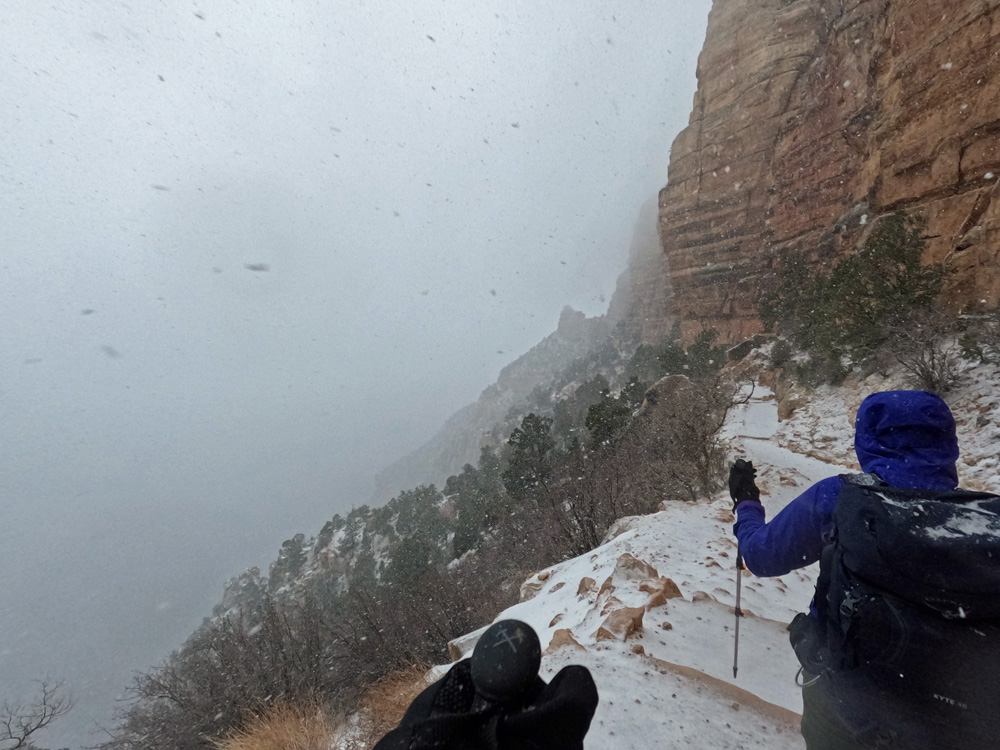
Once we got moving, we warmed up a bit with the challenging trail with switchbacks, natural steps and steep down ward hike with snow and windy conditions. Skies were gray, low clouds which felt very close to us as the snow kept coming down with huge snow flakes …simply beautiful.
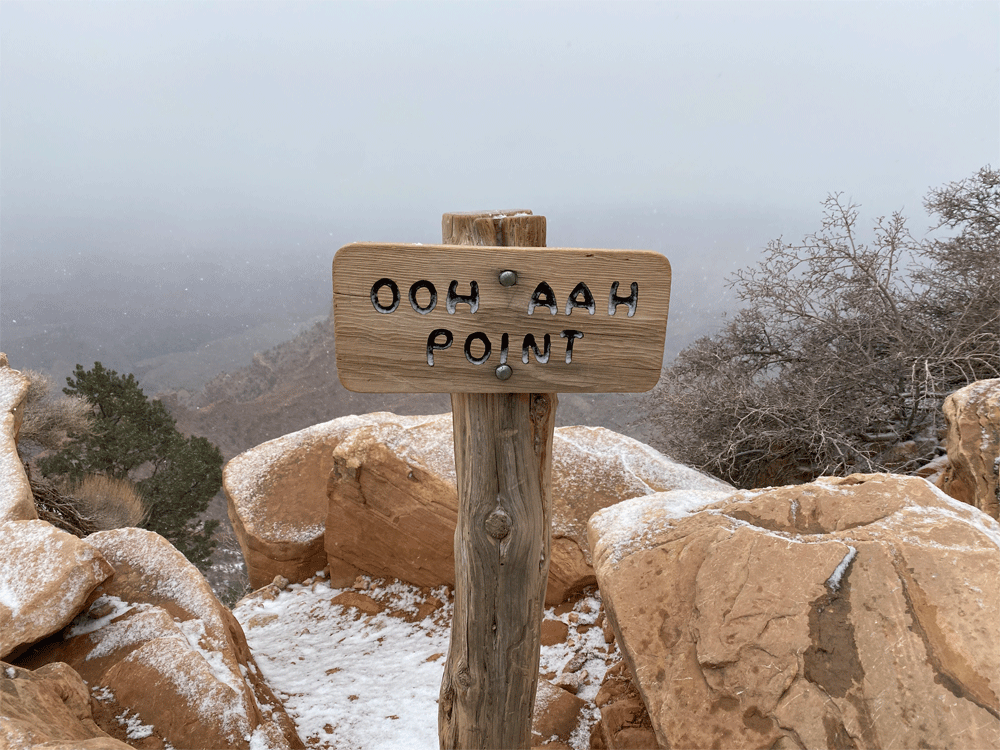
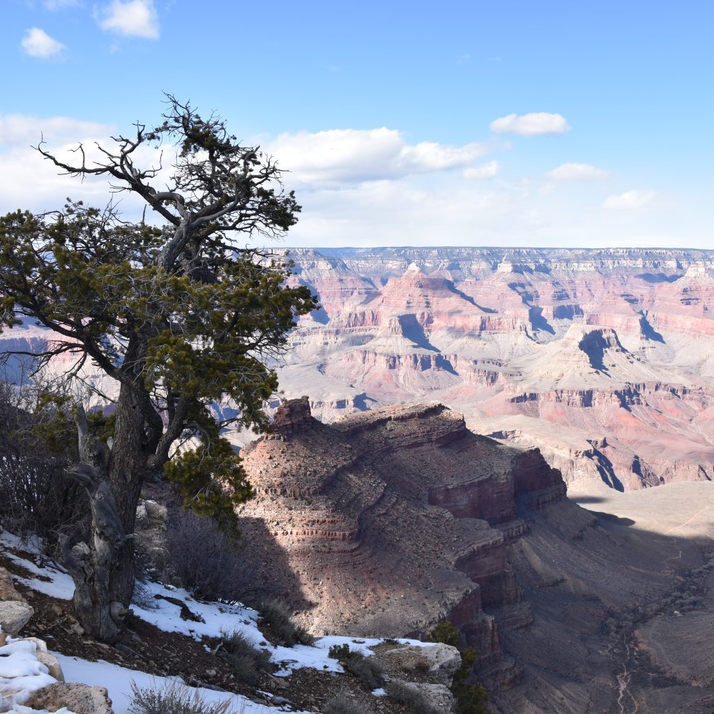
At 1 mile we arrived at Ooh Aah Point, at 6,444 feet elevation, we removed our micro spikes and hiked on as snow falling was slowing with more beautiful views appearing.
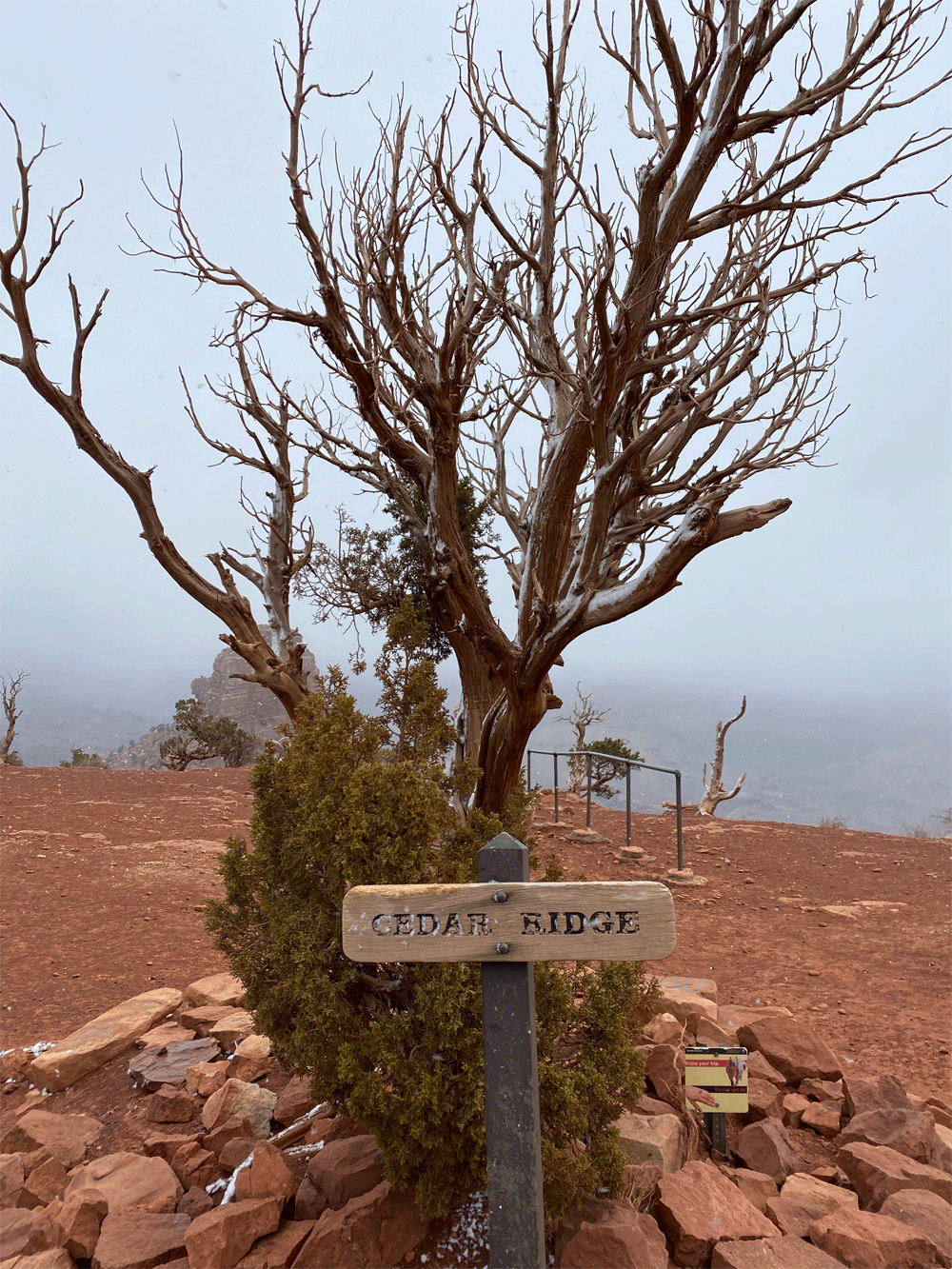
At 1.5 miles we arrived at Cedar Ridge, 6,085 feet elevation, gave the magnificent Cedar tree a hug, feeling exhilarated and energized to keep hiking on.
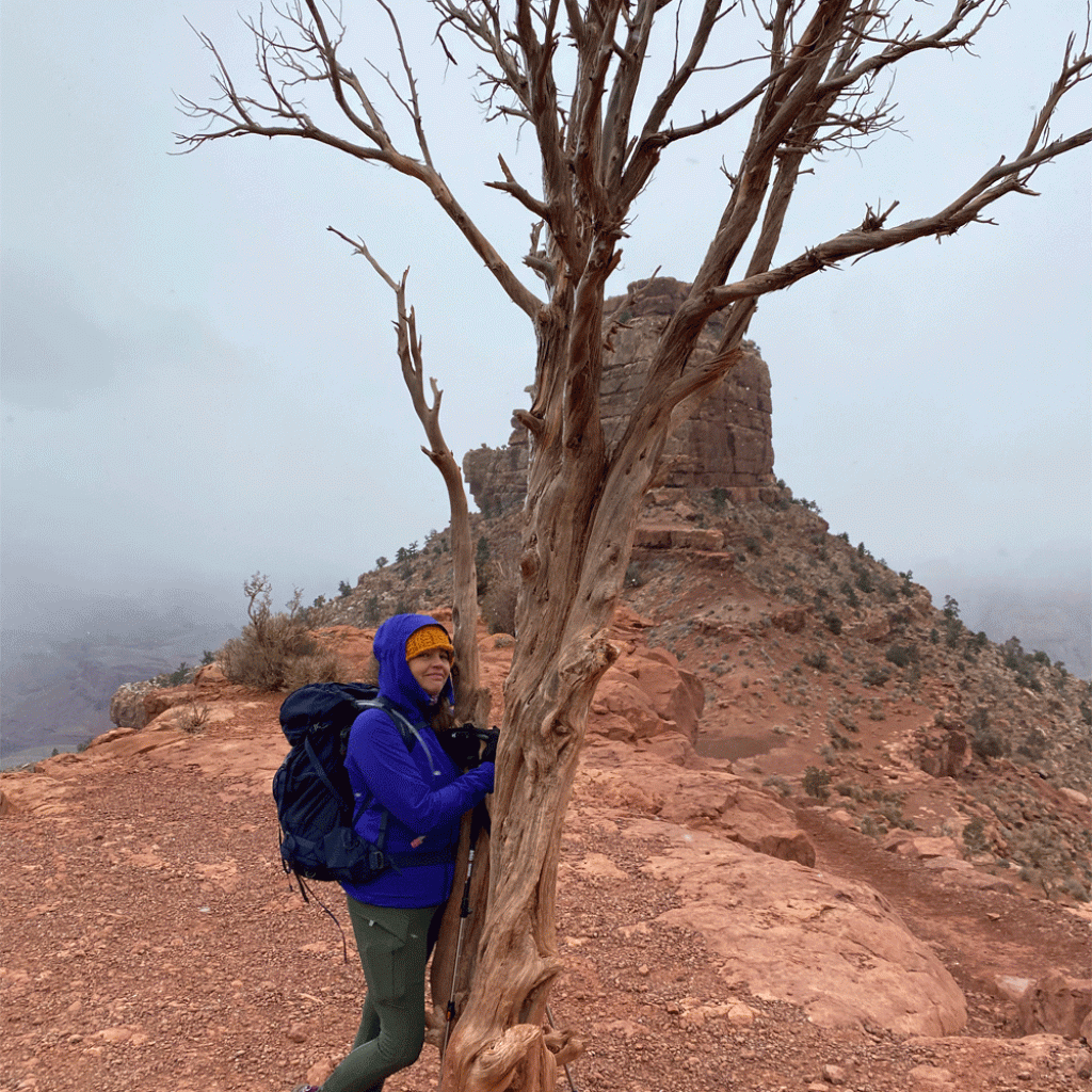
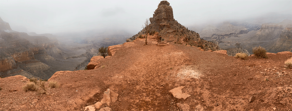
At about 3 miles we had descended more than 2,000 feet in elevation to arrive at Skeleton Point, 5,175 feet elevation and we could see why its called skeleton point.
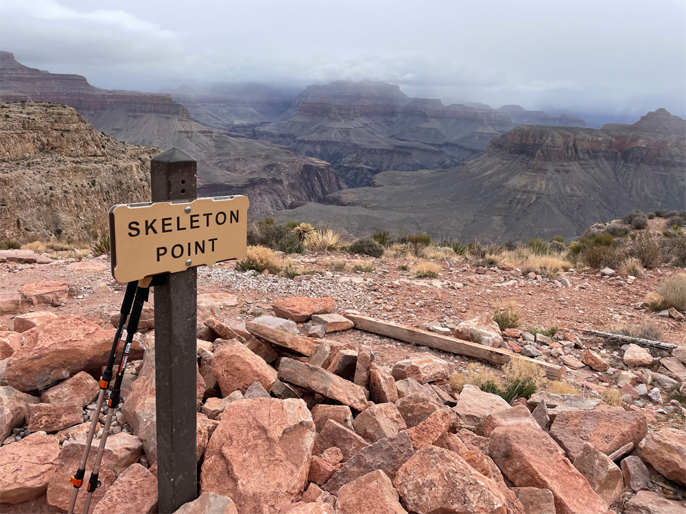
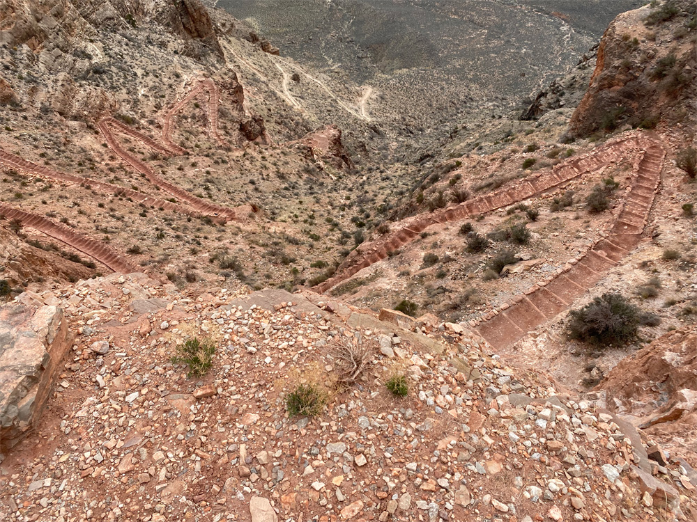
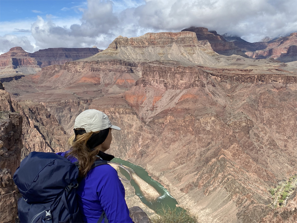
Then our first view of the Colorado River was revealed, we were not disappointed. This is more outstanding than I ever imagined or experienced in my IFIT training which floored me. The Colorado River was so beautifully emerald green, bright sparkling water flowing with a current and I was in aww. The trail is amazingly steep with many switchbacks looking like a skeleton of this bright red limestone rock.
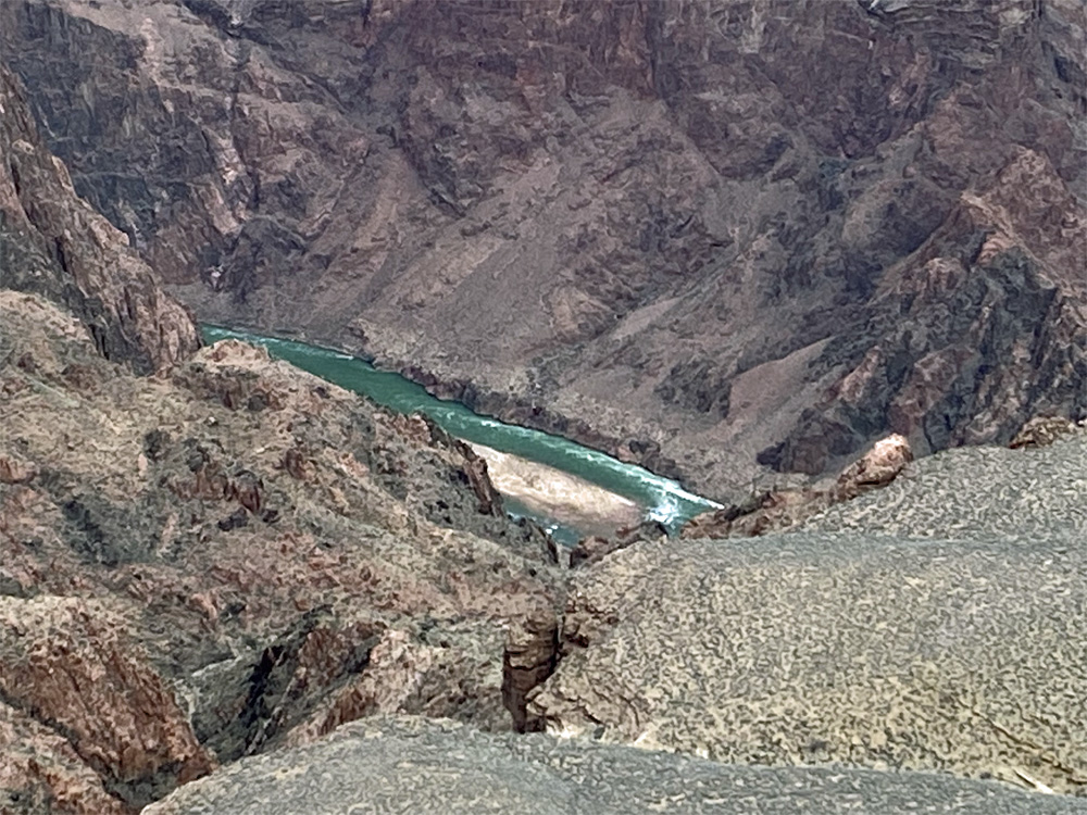
As we continue our descent, the views of plant life along the trail and the canyon walls open up into this iridescent green/blue color and as I looked there was a Squirrel standing there looking at us! I don’t know if I was imagining it but the squirrel appeared to be the same color as the plants. Ok…I’m thinking maybe I need a a drink of water then we should hike on, we have 2,500 more feet of descend! Enjoying the views of the rock layers as they change and became more visible to our eyes.
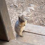
Deeper into the canyon, we arrived at somewhat of a clearing called Tipoff Point, 3,947 feet elevation where the Tonto Trail intersects the Kaibab Trail. There is a Mule stop, an Outhouse and a covered shelter to take a well deserved break. This Rock Squirrel was hoping to have a snack with us but that’s a no-no!
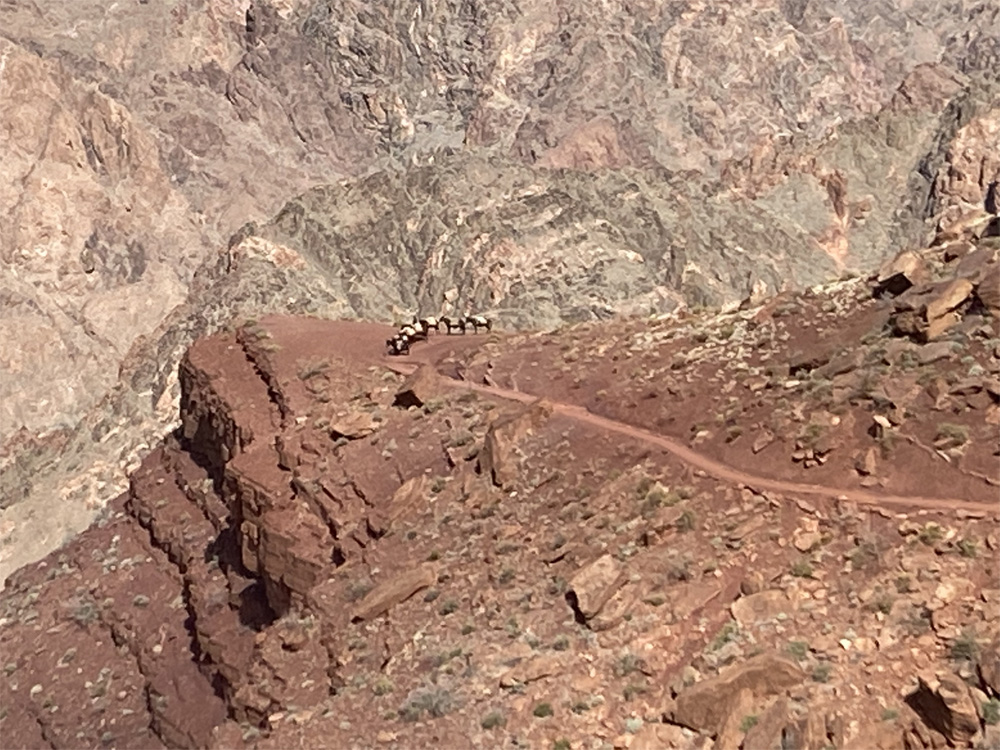
As skies began to clear, we had a wider view of the rock layers, cliffs, and the magnitude of this beautiful place. We left the squirrel for the next hiker and hiked on…next stop Panorama Point, another 0.4 miles of beautiful red limestone views with closer views of the Colorado River and the trail that is upon us. In the distance we saw Panorama point with a Mule train taking a break. We hiked further as the mule train passed us. The mules were grand and followed along one by one carrying what appeared to be heavy loaded packs.
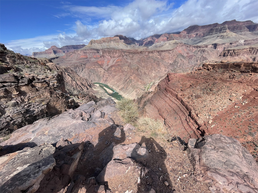
We reached Panorama Point ,3,620 feet elevation, and the panoramic views of the river and the suspension bridges. Still another 1.1 mile hike to descend the canyon. The weather was warming up and time to remove a layer and gloves. Our goal is visible now on the north side of the river check out the photos below.
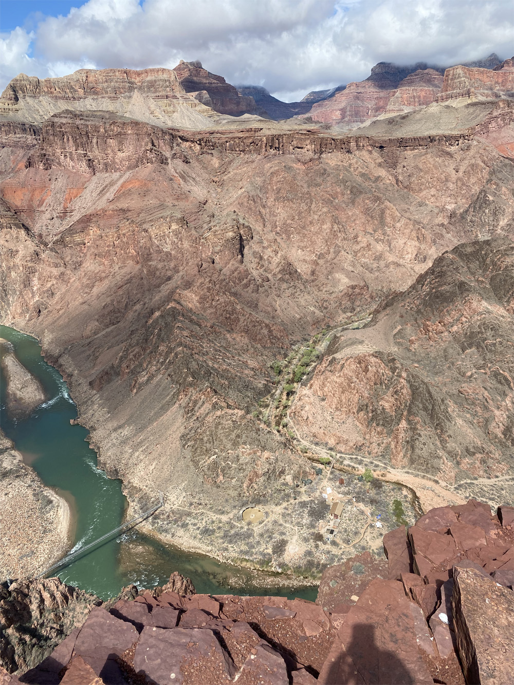
The Trail was winding around and continued a steep descent with ever changing colors of rock layers and looking back we saw how Kaibab trail got its name “the mountain lying down” or inverted mountain to me. Just imagining the rock formations and how this grand canyon was carved out years ago …… the mystery and geology are another post. The views of suspension bridge looked larger than I had imagined. On and on, we finally saw the tunnel which is the connection to the bridge crossing the river to the north side of the canyon.
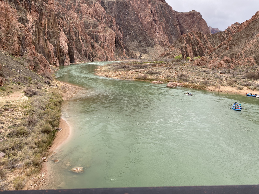
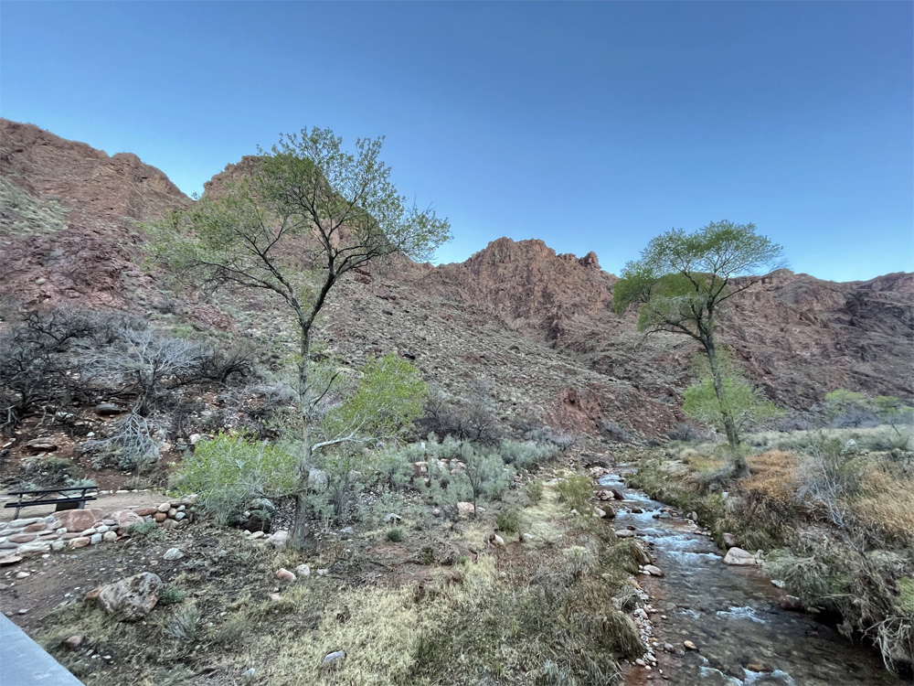
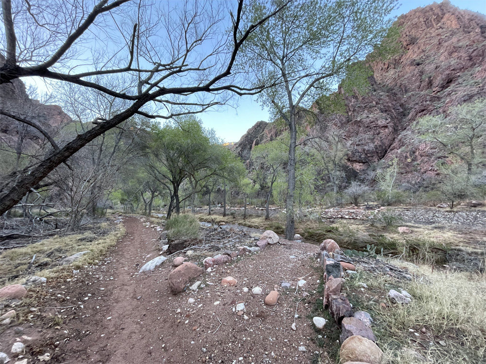
Crossing the suspension bridge at 2,425 feet elevation, which is 440 feet long, felt was very steady to walk across, the bridge is made of wood and suspended above the green Colorado River, brightly sparkling with the sun shining upon the water, rocks of all sizes, currents flowing and river boats parked along the side. Another 0.6 mile of a flat hike to Bright Angel campground 2,489 feet elevation, along the river side, different types of plant life and trees and a snake too. The Trail led us to a beautiful creek along the campground which had such a soft, gentle relaxing sound of calm and peace.
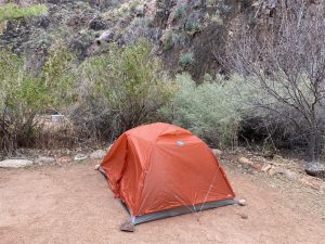
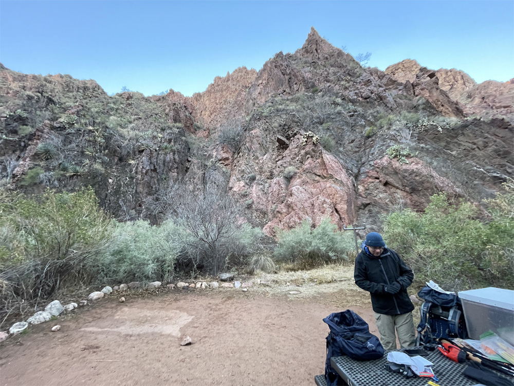
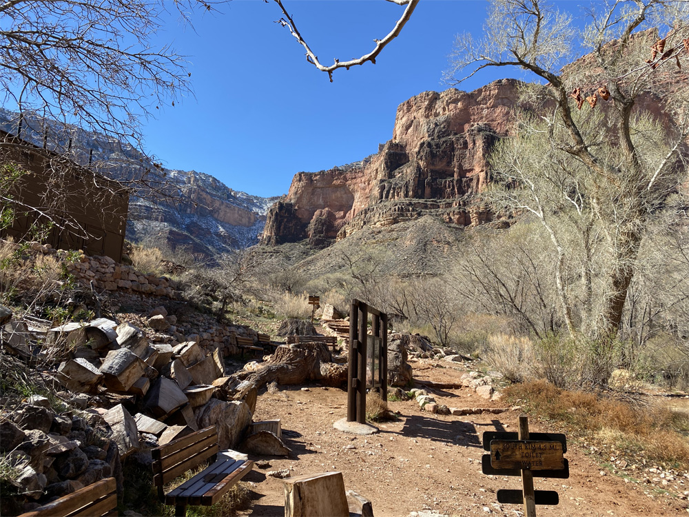
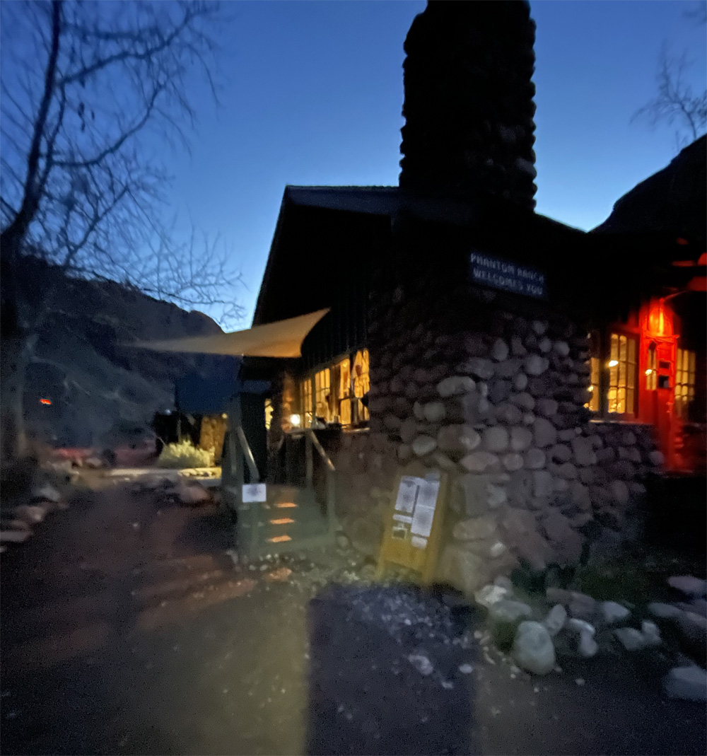
We arrived to an empty campground that was supposedly sold out. Only one site was taken by a group of 4 hikers. The weather was windy and cold. We chose Campsite #16 which was close to the cliff rock side of the campground. We set up camp just in time for the rain to begin. Then walked over to Phantom Ranch Canteen to get a bagel with peanut butter, hot tea and coffee. We walked back to the tent and took a rest after warming up with hot drinks and warm sleeping bags. Finally the afternoon rain stopped just before dinner time. Grateful to get out and stretch our worn out legs. Coming out of our tents we saw almost all sites had campers. Wow when did all the hikers arrive? Guess we were well ahead of everybody.
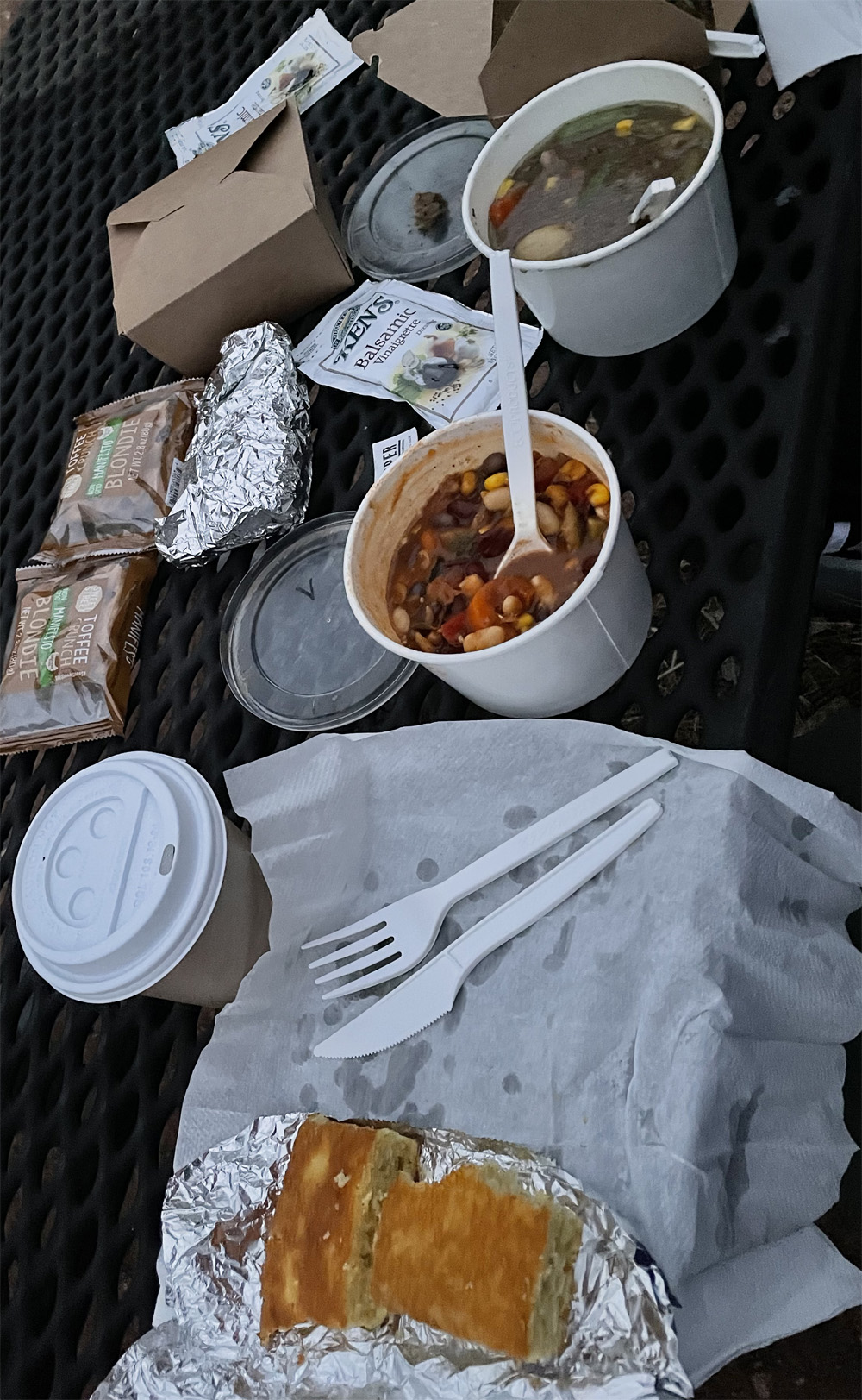

Dinner was take-out only so we grabbed our meals and headed to a picnic table. We sat down next to the the creek making peaceful sounds with the dark night sky settling in. Dinner was delicious and hot, the meal really warmed us up. We grabbed a hot tea, used bathroom and headed to tent for the night. With a record low temperature for March, we had a restless, cold night sleep. I was amazed at the sounds of the airplanes flying over head, you could feel the earth’s vibration. So, I focused on the sounds of the peaceful creek and water flowing ever so soothingly.
Early in the morning we unzipped the tent to discover the most magnificent skies I’ve ever seen. The stargazing took my breath away as much as the cold weather. But the clear dark blue sky was brilliantly filled with bright stars, constellations and just glorious. We enjoyed our breakfast under the stars by the Canteen. Breakfast tasted so delicious pancakes, sausage, scrambled eggs with warm maple syrup and coffee. What a perfect amenity to be sure and order ahead of your hike to lessen the backpack weight. And we really enjoyed the warm meals and drinks too.
We decided to take down our tent and head out for an early hike. The tent had ice crystals on the outside with a mere 32 degree temperature. The skies were waking up with a clear blue bright color without the clouds of yesterday. The sounds of the calm peaceful creek beautified our experience. So, I meandered over to the Canteen to drop off postcards for the Mule Mail. As I am posting this article, the Mule Mail postcards have not arrived yet.
Thankfully, our legs and body felt really pretty good from the 8 mile hike down South Kaibab Trail. Ready for our journey back to the South Rim.
Other Links:
Video of our climb out the canyon
Video of our climb into the canyon
Blog Posts: Our Decent, Our Ascent, Our Equipment, Preparation Part 1, and Preparation Part 2
I wanted to share our Backpack gear list from our Grand Canyon Hike in this post. We hiked down the South Kaibab Trail to Colorado River, spent one night at the Bright Angel Campground. We ascended the Canyon on the Bright Angel Trail back to the South Rim.
The chart includes our estimated Backpack weight. We documented the actual weight of most items in the chart with a few exceptions. We did extensive research with hiker recommendations for the gear we purchased and used. The items posted in blue ink we did not carry in our backpacks but we wore them or carried on our person. Overall we did well carrying this weight for our first backpacking adventure and have learned alot from this experience for future hikes.
There were a few items that were extremely helpful for our hike which were the trekking poles, extreme sleeping bag liner and micro-cleats for hiking boots. We discovered the importance of trekking poles and micro cleats quickly as the trail was icy with low visibility due to snow falling at an inch per hour and gusty winds.
As we watched the weather before our scheduled hike, the forecast a week before included possibility of snow, rain and below freezing temperatures. Our sleepy bags were rated for 30 degrees so we quickly discovered extreme sleeping bag liners, ordered them and received them the day before our hike. The liners added an extra 15 degree warmth to our sleeping bags which were lifesavers for us as the March weather was really cold and wet with a low of 32 temperature. We woke up to ice on our tent.
| Item | Becky | Kyle | Brand | Cost |
|---|---|---|---|---|
| Estimated Weight of Loaded Backpacks | 20.6 | 28.6 | ||
| HIKING GEAR | ||||
| Backpack | 3.4 | Osprey Kyte 46L Womens | 185.00 | |
| 4.2 | Osprey Atmos 50L Mens | 240.00 | ||
| Water Bladder with water | 6.0 | 6.0 | Osprey Hydraulics LT 2.5 Liters of water | 80.00 |
| Tent | 3.5 | Big Agnes Copper Spur HV UL3 | 450.00 | |
| Ground Cover | 0.5 | Big Agnes Copper Spur Footprint | 90.00 | |
| Sleeping Bag | 2.3 | Nemo Disco 30 Womens | 259.95 | |
| 1.9 | Nemo Disco 30 Mens | 279.95 | ||
| Sleeping Pad | 0.8 | Thermarest Neoair Xlite Womens | Gift | |
| 1.0 | Thermarest Neoair Xlite Mens | 229.95 | ||
| Sleeping Bag Liners | 0.9 | 0.9 | Sea to Summit (2) | 140.00 |
| Trekking Poles | 1.2 | 1.2 | REI Traverse Trekking Poles with Rubber Tips(2) | 219.90 |
| Headlamps/Batteries | 0.3 | 0.3 | Petzl Tikka Core Headlamps (2) – Extra Batteries | 99.90 |
| Water Filtration System | 0.4 | Katadyn Gravity BeFree 3Liters | 74.95 | |
| Toilet Wipes | 0.2 | Sea to Summit Wipes, small | 4.95 | |
| Pee Rag | 0.0 | Kula Cloth | 20.00 | |
| First Aid Kit/Toe Kit | 0.6 | Outdoor First Aid Kit plus blister pads/bandaids/tape/wrap…. | – | |
| CLOTHING (Backpack) | Extra Layers (Sometimes Worn) | |||
| Rain Jacket | 0.6 | 1.3 | Mountain Hard / Halti | – |
| Jacket Layer | 0.4 | Mountain Gear Quarter Zip | – | |
| Micro Cleats for Shoes | 1.4 | Kahtoola Microspikes Traction System (2) | 139.90 | |
| Camp Sandals | 1.8 | Keen Whisper Womens | 119.95 | |
| 1.8 | Keen Newport H2 | 129.95 | ||
| Socks | 0.2 | 0.2 | Darn-Tough Socks (Spare in pack) | 30.00 |
| Long Sleeve Shirt | 0.5 | 0.5 | Mountain Equipment Micro Zip T Fleece | 73.73 |
| Gloves | 0.2 | North Face Apex +Etip Gloves | 55.00 | |
| 0.1 | Under Armour Mens Liner 2.0 gloves | 23.95 | ||
| 0.1 | Extremus TouchScreen Liner Gloves | 15.99 | ||
| 0.1 | RBX Fitness Gloves | – | ||
| Compression Leg Sleeves | 0.1 | Zensah Compression Sleeves, calves | 39.95 | |
| Hiking Hats | 0.1 | 0.3 | Smartwool/Canada Bliss | – |
| CLOTHING (Worn) | ||||
| Hiking Boots | 2.1 | Keen Targhee III Waterproof Hiking Shoes W | 164.95 | |
| Hiking Shoes | 1.6 | Hoka One One Speedgoat 4 Mens | 145.00 | |
| Base Layer Pants | 0.4 | UnderArmor Cold Gear Pants | ||
| 0.3 | DEVOPS Base Layer Compression Pants | 20.00 | ||
| Base Layer Shirt | 0.4 | Oneil – Long Sleeve Swimming Shirt | – | |
| 0.5 | UnderArmor Cold Gear | – | ||
| Pants | 0.7 | Calia Leggins | – | |
| 0.6 | Eddie Bauer Leggins | – | ||
| 0.6 | Columbia Convertible Pants | 60.00 | ||
| Shirt | 0.6 | UnderArmor Cold Gear Quarter Zip | ||
| 0.4 | REI Long Sleeve Quarter Zip | 50.00 | ||
| Rain Pants | 0.6 | Adidas Rain Pants | – | |
| Socks | 0.2 | 0.2 | Darn Tough Socks | 30.00 |
| Hiking Hats | 0.4 | Smartwool Merino 250 Beanie | – | |
| ELECTRONICS | ||||
| Phone | 0.5 | 0.5 | iPhone 12 & 11 | – |
| Kindle/Tablet | 0.4 | 1.1 | Kindle Oasis/Samsung S10 | – |
| Camera | 0.3 | GoPro Hero10 | 350.00 | |
| Camera Batteries | 0.2 | GoPro 1720mAh lithium-ion (3) | 60.00 | |
| Battery Charge | 0.1 | Go Pro Dual Battery Charger | 50.00 | |
| GoPro Camera Clip | 0.2 | GoPro Camera Clip | – | |
| Battery Charger | 0.9 | Anker Power Core III 19200 | 110.00 | |
| Cables | 0.4 | Various charging cables | – | |
| OTHER | ||||
| Tooth brush/toothpaste | 0.1 | 0.1 | Hiking toothbrush/toothpaste | – |
| Hand Soap/Sanitizer | 0.1 | 0.1 | Eucalyptis from Bath Store | – |
| Food/Snacks | 0.6 | 0.9 | Stinger Organic Waffles, protein bars, mandarin oranges, jif peanut butter, energy chews, nuts | – |
| Food Storage Bags/Waste Bags | 0.1 | Lopsak odor proof bags(quart and gallon sizes) | 20.00 | |
| Writing Journal/Pen | 0.2 | 0.2 | – | |
| Map Laminated | 0.2 | Trail Map | – | |
| Book | 0.5 | Grand Canyon One Best Hike | – | |
| Clothesline | 0.1 | Sea to Summit Lite Line Clothesline | 13.95 |
Other Links:
Video of our climb out the canyon
Video of our climb into the canyon
Blog Posts: Our Decent, Our Ascent, Our Equipment, Preparation Part 1, and Preparation Part 2
January 2022 to March 2022: Preparation for grand hiking trip continues as time gets closer. Over the last 3 months we have been continuing researching, training and purchasing our remaining backpacking gear to be prepared for our Hike.
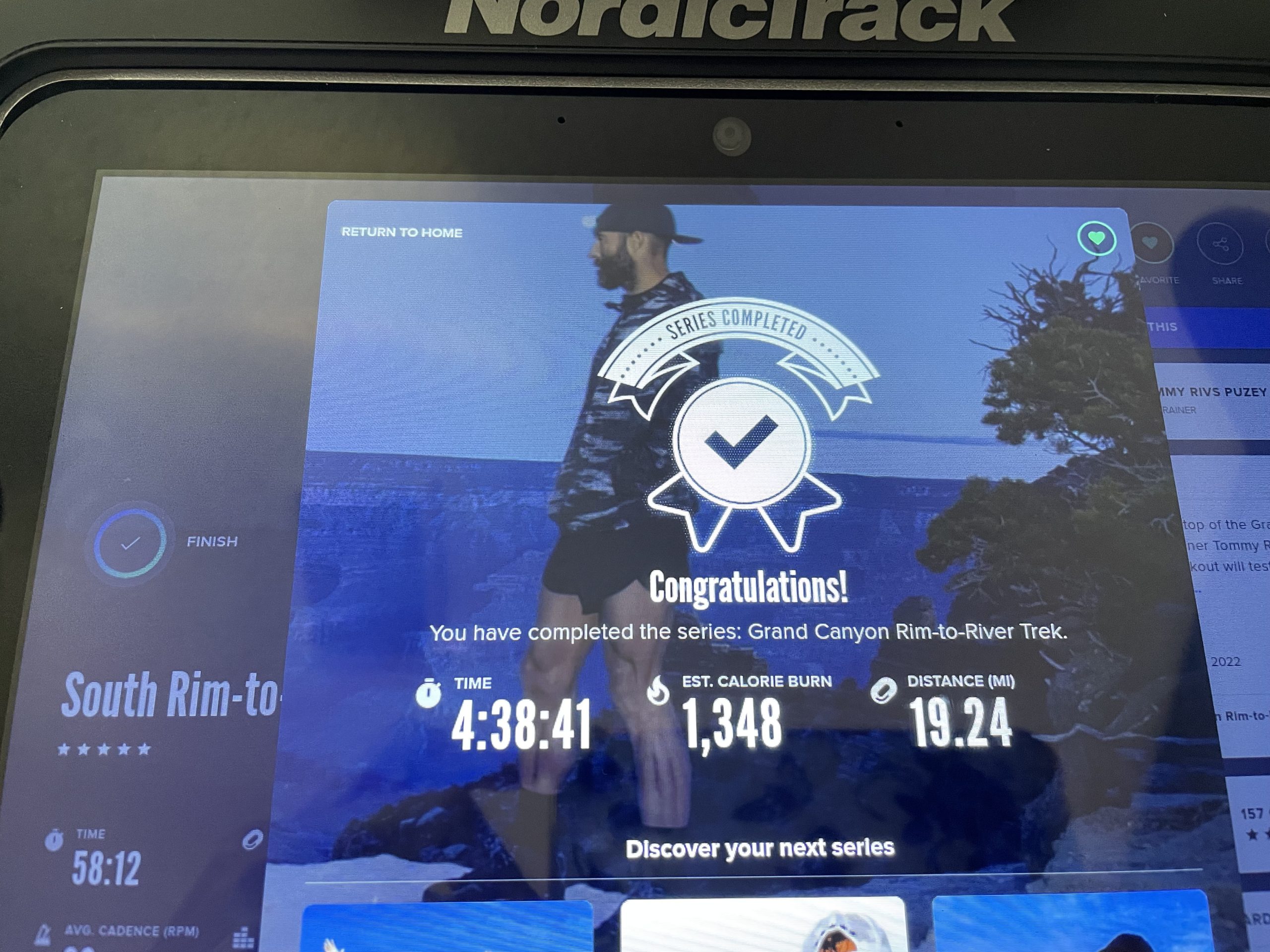
Since I first posted, I have completed the Grand Canyon iFIT training 5 times prior to the REAL Life HIKE! I just could not get enough….I was hoping this would be enough preparation!
The other part I loved about the series (besides the physical workout) was the knowledge about Grand Canyon that was shared. I became so interested in learning about the different rock layers of the grand canyon and the rock formations prior to the real life adventure. Limestone, sandstone, silt stone, shale and combinations of these rocks. The geology is fascinating… dates back at least 2 billion years. As you hike deeper and deeper into the canyon you go back further and further in time. The thought is just incredible to imagine that much time and the beauty of every rock layer.
Now we live in Florida at 20 Feet elevation give or take 10 feet. So no elevation changes here to test us for our 5,124 feet elevation changes on our hike! And weather considerations, average weather for March in Florida are 62 Low to 74 High temperatures. At the Bright Angel Campground within the Grand Canyon 45 Low to 71 High Temp as found on weather-us.com for the month of March. But South Rim Grand Canyon averages are 24 Low to 53 High Temperatures. Weather is a factor for planning your gear list.
We really trusted our elliptical training, my daily 6 mile walks, strength/stretching exercises, yoga and meditations. Long 8 mile beach walks and we found a hill walk near us for fun!
When planning and preparing for backpacking in which neither of us has done before, we took all the research and information seriously the weight of our backpacks too! There are important considerations for backpack base weight being at a comfortable weight then adding other essential consumable items. And does the weight add up fast!
After we finished purchasing our backpacking gear (list below) we planned a wilderness hike an hour north of us to test out our gear! We got lucky… a cool 40 degree morning to take our hike at Jay B. Starkey Wilderness Park, a 7.4 mile Loop. We prepared our backpacks…filled water bladder 1.5L, sleeping bag, air pad, snacks, first aid kit, foot care kit, loaded up to 15 pounds! Kyle’s backpack weighed 20 pounds. Off we went early in morning dressed in hiking clothes, hiking shoes and loaded backpacks.
Once we arrived, we put on our backpacks, trekking poles (for practice) and headed on trail. I’m comfortable with 15 pound weight of backpack on back. We hiked a peaceful trail, sunny and cool while we listened to beautiful birds singing along trail. We took a break for few minutes and had a waffle snack and an mandarin orange…then hiked further along the trail. The trail was dirt but mostly dry and hard with rocks and tree roots. While some of the hike was like a prairie very flat and lots tall grass along the trail. At about 6 miles my toes were feeling the new hiking shoes, they needed more breaking in. But I hiked on to complete 8 miles. We arrived back at our car feeling invigorated and excited about carrying backpacks, drinking from water bladders and understanding the beauty of hiking. A great experience all in all.
We used the hike as a sample of real life backpacking and REI for purchasing backpacking gear, backpack sizing and personal recommendations for basic hiking skills. I found a grand canyon trail guide, a hiking training guide and interesting hiker blogs about their favorite gear. We also took a web class about hiking with an experienced hiker which was very informative which led us to more hiking blogs and information on backpacking the Grand Canyon.
Grand Canyon Backpacking Gear List for our Hike:
*Backpacks: Osprey Kyte 46L for myself, Osprey Atmos 50L for Kyle
*Osprey 2.5L Water bladders
*Big Agnes Tent with ground cover tarp
*Air Mattress Pad: Nemo
*Sleeping Bags: Nemo 30 degree Temp
*Trekking Poles, REI brand
*Hiking Shoes/Boots with orthotics
*Wool socks by Darn Tough Socks
*Hiking clothes; 3 layers tops and hiking leggings, 3 layers tops plus Hiking pants for Kyle
*Rain Jackets
*First Aid Kit; basic
*Foot Kit; blister pads, ointment, bandaids, mole skin…
*Micro Cleats for shoes (in case of snow/ice trails)
*Gloves, Face masks
*Food: Energy Cubes by Clif; Stinger variety Pack of waffles, protein bars, energy cubes; peanut butter; nuts; mandarins
*Electronics: Iphones, Go-Pro camera, Battery power cell, cables, kindle, tablet (installed Book: Down the Great Unknown by Edward Dolnick)
*Headlamps with extra batteries
*Waterproof journals with pen
***A Last week decision based on updated weather report- Sleeping Bag Extreme Liner- GOAL: add 10-15 degrees warmed for night time along with an extra layer of clothing and glove
Other Links:
Video of our climb out the canyon
Video of our climb into the canyon
Blog Posts: Our Decent, Our Ascent, Our Equipment, Preparation Part 1, and Preparation Part 2
As I write today, I am grateful for this day and the challenge in sight for myself and my husband Kyle. The pandemic limited our travels but allowed us to plan for outdoor experiences to see the world. We embraced ourselves for the change happening and cancelled our gym membership. We decided to purchase an Elliptical machine for home use. The machine took 6 months to arrive but included the most amazing training membership called IFIT. I have enjoyed my trainings of over 200 sessions with different Elite Trainers. I have experienced many places around the world that have me craving the travel life again.
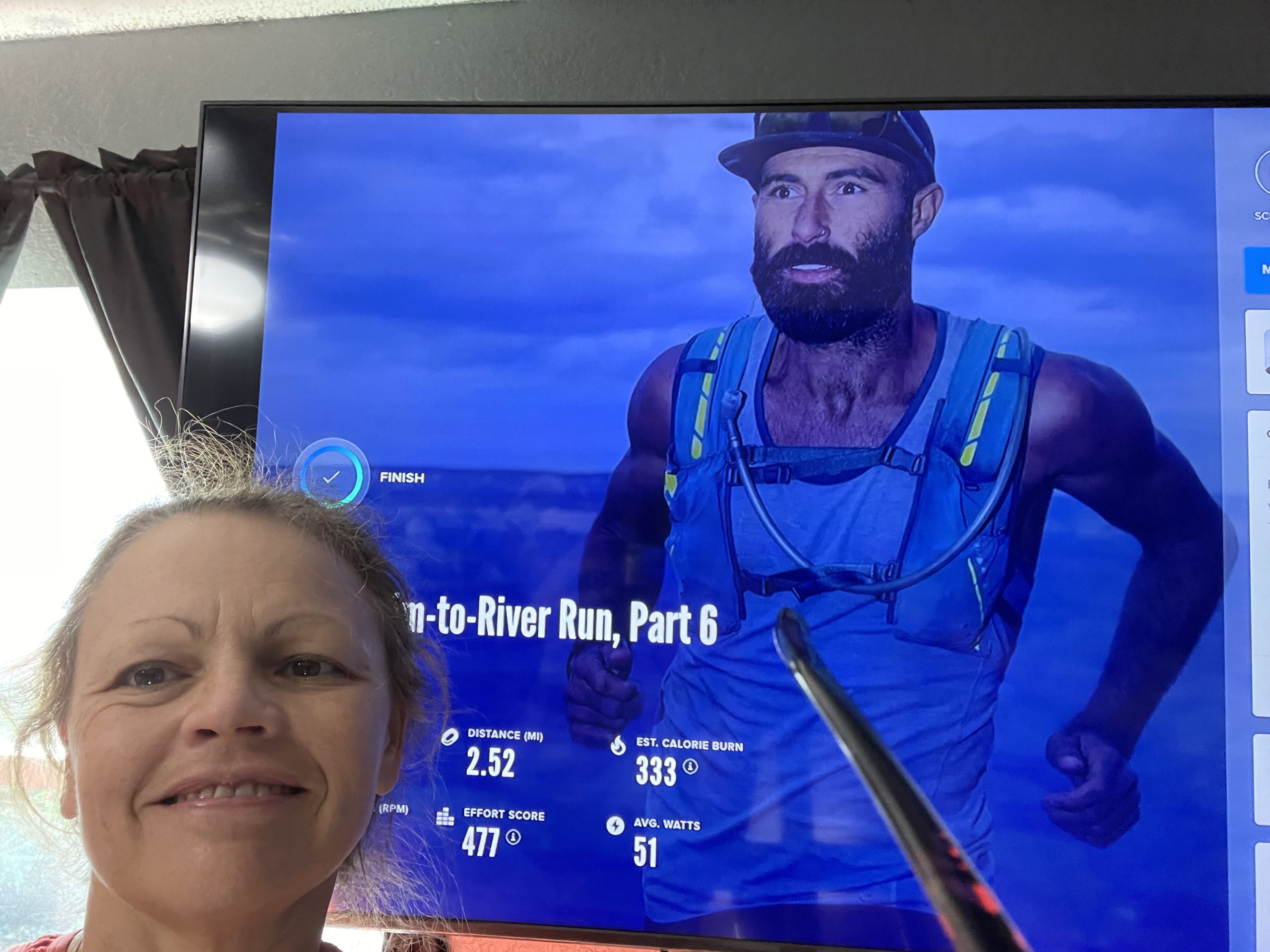
I found a strenuous running series with Tommy Rivs in October 2021, the series ” Grand Canyon South Rim to River to Rim”and that’s where this adventure began! The series was six workouts, 45 – 60 minutes length for each session running in and out of the GRAND CANYON! OMG what an amazing challenge that inspired me to plan a real life hiking trip to the Grand Canyon!!!! I was encouraged by Kyle’s enthusiasm and excitement to join me. This series kicked my butt let me tell you and I loved every aspect of it! The views were incredible and the trainings were very informative,,,I especially love Rivs comment “hydrate or die-drate”, OMG! I finished completing the last two sessions back to back because I just had to complete the series and share this with Kyle. He was very enthusiast yet questioning me about this real life experience! So, he did what he does best …research the possibilities!


Since then, Kyle has completed the Grand Canyon elliptical series and I completed it a second time, not sure how many more times I will complete before our real life hike but the more fit i am the better. For now, We found another Grand Canyon Hike Series that we are embarking on this week to experience the hike style trainings. So far, this has been informative and a fun series!
We began our preparations by applying for a permit to spend the night in the Canyon. We waited for the reply from National Park Services……..and we got the permit! So we got busy planning, preparing, and researching for our adventure. Since this is our first real backpacking adventure our initial gear purchases were a tent, backpacks, trekking poles and hiking shoes.
Off we go…more planning, researching and preparing for this amazing adventure that we can share right here so stay tuned……
Other Links:
Video of our climb out the canyon
Video of our climb into the canyon
Blog Posts: Our Decent, Our Ascent, Our Equipment, Preparation Part 1, and Preparation Part 2
What a month of transformation in my Butterfly Garden……BUTTERFLIES, bees, dragonflies, flowers GALORE!
Giant Swallowtail on Red Penta 
Giant Swallowtail on Red Penta 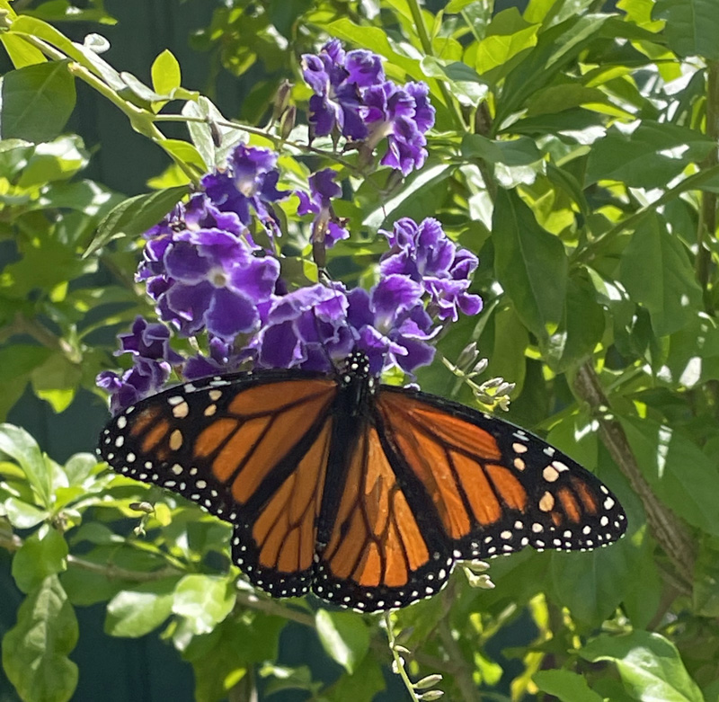
Monarch on Sapphire Showers 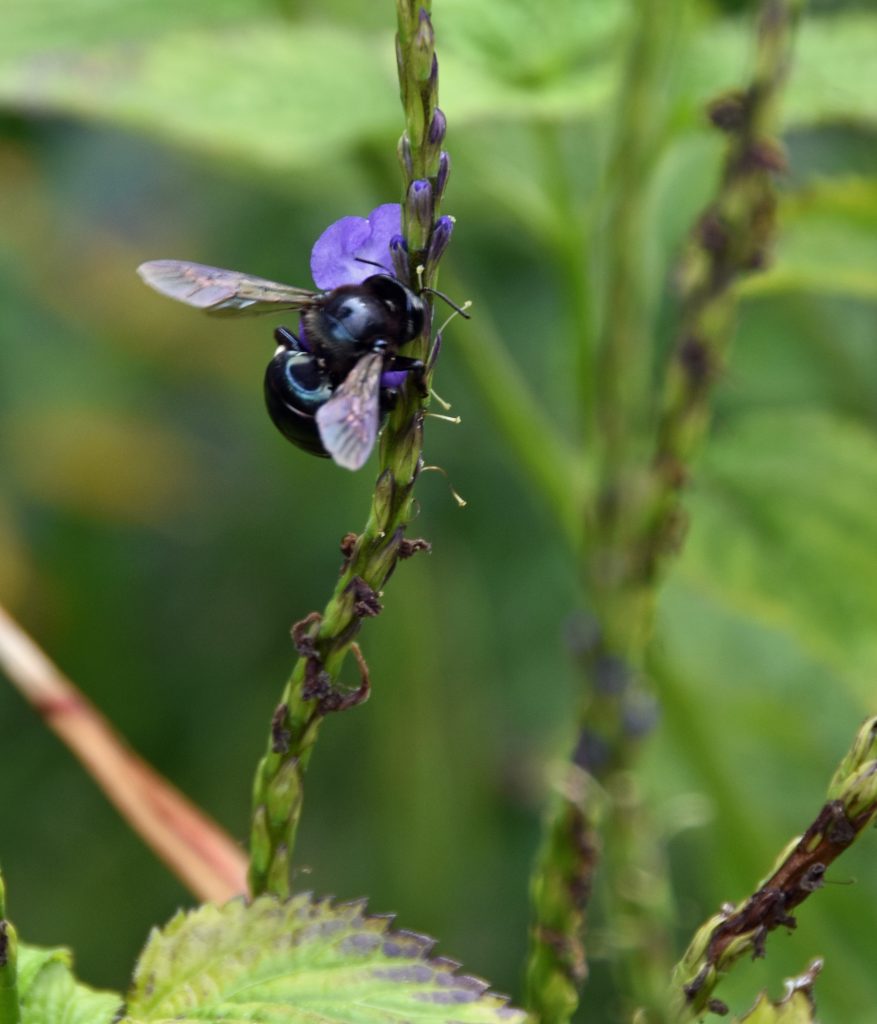
Florida Bee on Porter weed 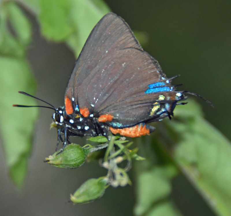
Great Purple Hairstreak 
Gulf Fritillary on Mexican Sunflower
March was full of replanting, new plants and additional garden spaces for the Butterflies, Dragon flies, pollinators….. Watching the plants grow back has been transformational in my Butterfly garden, lots of rain brought beautiful opportunities for my plants. My seedlings grew and grew to beautiful plants. My Mexican Sunflowers bring such brightness and beauty along with butterflies, bees and more!!!
Here’s a few photos to see the changes

New growth from seeds 
Mexican Sunflowers 
Sulfur Butterfly caught on camera 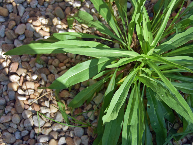
Seasside Goldenrod 
Mex Sunflower Plant 
Mex Sunflower